TopoQuest Logo
Do you find TopoQuest useful?
Help keep TopoQuest running and adding new maps/features by donating!
Bitcoin:  19c7KJd3qBynnjoSw5npx9KScwjBe4ifkT
Litecoin:  LXs6TkuXGGXo1vDsWCkWVdjQX94eUKd6ui
Home View Maps Find Maps Find Places Resources & Links


Mentone, Indiana Topographic Map

USGS Map Title: Mentone, IN
USGS Map MRC: 41086B1
DRG (GeoTIFF) Download: o41086b1.tif


Neighboring USGS Topographic Map Quads:


  Inwood, IN  
41086C2
 

  Bourbon, IN  
41086C1
 

  Atwood, IN  
41085C8
 

  Argos, IN  
41086B2
 

  Mentone, IN  
41086B1
 

  Burket, IN  
41085B8
 

  Rochester, IN  
41086A2
 

  Akron, IN  
41086A1
 

  Silver Lake, IN  
41085A8


Map MRC Location:

N42°
W87°
N42°
W86°
H8 H7 H6 H5 H4 H3 H2 H1
G8 G7 G6 G5 G4 G3 G2 G1
F8 F7 F6 F5 F4 F3 F2 F1
E8 E7 E6 E5 E4 E3 E2 E1
D8 D7 D6 D5 D4 D3 D2 D1
C8 C7 C6 C5 C4 C3 C2 C1
B8 B7 B6 B5 B4 B3 B2 B1
A8 A7 A6 A5 A4 A3 A2 A1
N41°
W87°
N41°
W86°

Mentone, IN USGS 1:24K Topographic Map Preview:
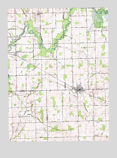
Mentone, IN USGS Topographic Map
Click on map above to begin viewing in our Map Viewer.

This topographic map contains these locations and features:
Feature Name Type Latitude Longitude GNIS ID View Map
Apple FarmsLocaleN41.2469°W86.0758°2709040View Map
Blue DitchCanalN41.1584°W86.0967°431223View Map
Busenburg DitchCanalN41.1537°W86.1008°431888View Map
Clarence Baker DitchCanalN41.2445°W86.1031°432548View Map
Crauder DitchCanalN41.2275°W86.1239°433092View Map
Dorsey DitchCanalN41.2262°W86.0081°433647View Map
East FarmsLocaleN41.1644°W86.0050°2635428View Map
Feldman FarmsLocaleN41.2472°W86.0872°2709046View Map
Four Way Ambulance Emergency Medical ServiceBuildingN41.1732°W86.0379°2719322View Map
Harsh DitchCanalN41.1609°W86.0983°435814View Map
Little Yellow CreekStreamN41.1648°W86.1117°438180View Map
MentonePopulated PlaceN41.1734°W86.0347°439013View Map
Mentone AirportAirportN41.1440°W86.0629°449261View Map
Mentone CemeteryCemeteryN41.1704°W86.0341°436697View Map
Mentone Elementary SchoolSchoolN41.1748°W86.0325°447462View Map
Mentone Town Police DepartmentBuildingN41.1731°W86.0378°2758308View Map
Mentone Volunteer Fire DepartmentBuildingN41.1732°W86.0378°2626170View Map
Meredith CemeteryCemeteryN41.1726°W86.0971°439017View Map
Meredith DitchCanalN41.1512°W86.0258°449605View Map
Miskell Mahoney DitchCanalN41.1400°W86.1128°439284View Map
Moore DitchCanalN41.2370°W86.0697°439398View Map
Old Tip TownPopulated PlaceN41.2237°W86.1153°440605View Map
SevastopolPopulated PlaceN41.1292°W86.0189°443221View Map
Shatto DitchCanalN41.2123°W86.0447°443315View Map
Smith DitchCanalN41.1348°W86.0567°443682View Map
Summit ChapelPopulated PlaceN41.2453°W86.0847°444395View Map
Sycamore CemeteryCemeteryN41.1289°W86.0867°444507View Map
TippecanoePopulated PlaceN41.2089°W86.1150°449738View Map
Tippecanoe CemeteryCemeteryN41.2206°W86.1147°444776View Map
Tippecanoe Fire DepartmentBuildingN41.2113°W86.1155°2625662View Map
Tippecanoe Township Emergency Medical Services First RespondersBuildingN41.2111°W86.1155°2719413View Map
Town of MentoneCivilN41.1741°W86.0382°2396750View Map
Township of TippecanoeCivilN41.2232°W86.1044°453896View Map
Tucker DitchCanalN41.1325°W86.0594°444941View Map
Washam DitchCanalN41.1967°W86.0575°445493View Map
Welch DitchCanalN41.2123°W86.0514°445656View Map
White DitchCanalN41.1284°W86.0583°445935View Map
William Baker DitchCanalN41.1889°W86.0136°446049View Map
Yantiss DitchCanalN41.2031°W86.0881°446367View Map
Yellow Creek CemeteryCemeteryN41.1715°W86.0928°446380View Map

Note: Coordinates in the location and feature list above are referenced to NAD83 datum.


Copyright (C) 2008-2025 Ryan Niemi / Sunset Dynamics ... All Rights Reserved