TopoQuest Logo
Do you find TopoQuest useful?
Help keep TopoQuest running and adding new maps/features by donating!
Bitcoin:  19c7KJd3qBynnjoSw5npx9KScwjBe4ifkT
Litecoin:  LXs6TkuXGGXo1vDsWCkWVdjQX94eUKd6ui
Home View Maps Find Maps Find Places Resources & Links


Elk Creek, Missouri Topographic Map

USGS Map Title: Elk Creek, MO
USGS Map MRC: 37091B8
DRG (GeoTIFF) Download: o37091b8.tif


Neighboring USGS Topographic Map Quads:


  Bucyrus, MO  
37092C1
 

  Houston, MO  
37091C8
 

  Raymondville, MO  
37091C7
 

  Cabool NE, MO  
37092B1
 

  Elk Creek, MO  
37091B8
 

  Eunice, MO  
37091B7
 

  Cabool SE, MO  
37092A1
 

  Willow Springs North, MO  
37091A8
 

  Clear Springs, MO  
37091A7


Map MRC Location:

N38°
W92°
N38°
W91°
H8 H7 H6 H5 H4 H3 H2 H1
G8 G7 G6 G5 G4 G3 G2 G1
F8 F7 F6 F5 F4 F3 F2 F1
E8 E7 E6 E5 E4 E3 E2 E1
D8 D7 D6 D5 D4 D3 D2 D1
C8 C7 C6 C5 C4 C3 C2 C1
B8 B7 B6 B5 B4 B3 B2 B1
A8 A7 A6 A5 A4 A3 A2 A1
N37°
W92°
N37°
W91°

Elk Creek, MO USGS 1:24K Topographic Map Preview:
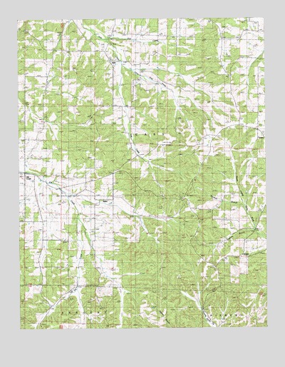
Elk Creek, MO USGS Topographic Map
Click on map above to begin viewing in our Map Viewer.

This topographic map contains these locations and features:
Feature Name Type Latitude Longitude GNIS ID View Map
Antioch Church (historical)ChurchN37.2198°W91.9871°713328View Map
Assembly of God ChurchChurchN37.2270°W91.9854°713453View Map
Bethany ChurchChurchN37.1767°W91.9790°714017View Map
Dog CreekStreamN37.2420°W91.9552°716952View Map
Elk CreekPopulated PlaceN37.1889°W91.9971°717451View Map
French SchoolSchoolN37.1995°W91.9227°718217View Map
Grand View ChurchChurchN37.2237°W91.8915°718679View Map
Grand View SchoolSchoolN37.2342°W91.8824°718681View Map
Greenhill School (historical)SchoolN37.2428°W91.9904°735636View Map
GroganPopulated PlaceN37.1548°W91.8863°740890View Map
Grogan School (historical)SchoolN37.1678°W91.8885°718891View Map
Harmon BranchStreamN37.1751°W91.8860°719103View Map
Lake Gemay DamDamN37.1417°W91.8752°763726View Map
Lebanon SchoolSchoolN37.1776°W91.9568°720875View Map
Little Hog CreekStreamN37.2317°W91.9468°721248View Map
LouisaLocaleN37.1362°W91.9102°740365View Map
Louisa Post OfficePost OfficeN37.1362°W91.9102°760104View Map
New Home CemeteryCemeteryN37.1700°W91.9104°723218View Map
Peabody BranchStreamN37.1648°W91.8804°724134View Map
Pleasant Hill SchoolSchoolN37.2359°W91.9260°724544View Map
SoloPopulated PlaceN37.2334°W91.9532°755485View Map
Steely ChapelChurchN37.1842°W91.9971°727054View Map
StultzLocaleN37.1767°W91.9571°735992View Map
Township of CassCivilN37.2047°W91.9730°767464View Map
TyronePopulated PlaceN37.2034°W91.8765°727945View Map

Note: Coordinates in the location and feature list above are referenced to NAD83 datum.


Copyright (C) 2008-2025 Ryan Niemi / Sunset Dynamics ... All Rights Reserved