TopoQuest Logo
Do you find TopoQuest useful?
Help keep TopoQuest running and adding new maps/features by donating!
Bitcoin:  19c7KJd3qBynnjoSw5npx9KScwjBe4ifkT
Litecoin:  LXs6TkuXGGXo1vDsWCkWVdjQX94eUKd6ui
Home View Maps Find Maps Find Places Resources & Links


Cabool SE, Missouri Topographic Map

USGS Map Title: Cabool SE, MO
USGS Map MRC: 37092A1
DRG (GeoTIFF) Download: o37092a1.tif


Neighboring USGS Topographic Map Quads:


  Cabool NW, MO  
37092B2
 

  Cabool NE, MO  
37092B1
 

  Elk Creek, MO  
37091B8
 

  Cabool SW, MO  
37092A2
 

  Cabool SE, MO  
37092A1
 

  Willow Springs North, MO  
37091A8
 

  Nichols Knob, MO  
36092H2
 

  Dyestone Mountain, MO  
36092H1
 

  Willow Springs South, MO  
36091H8


Map MRC Location:

N38°
W93°
N38°
W92°
H8 H7 H6 H5 H4 H3 H2 H1
G8 G7 G6 G5 G4 G3 G2 G1
F8 F7 F6 F5 F4 F3 F2 F1
E8 E7 E6 E5 E4 E3 E2 E1
D8 D7 D6 D5 D4 D3 D2 D1
C8 C7 C6 C5 C4 C3 C2 C1
B8 B7 B6 B5 B4 B3 B2 B1
A8 A7 A6 A5 A4 A3 A2 A1
N37°
W93°
N37°
W92°

Cabool SE, MO USGS 1:24K Topographic Map Preview:
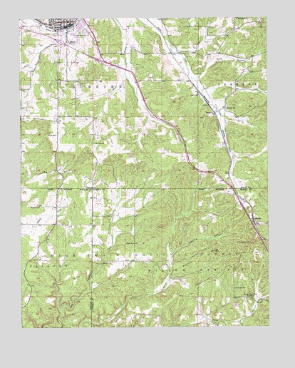
Cabool SE, MO USGS Topographic Map
Click on map above to begin viewing in our Map Viewer.

This topographic map contains these locations and features:
Feature Name Type Latitude Longitude GNIS ID View Map
CaboolPopulated PlaceN37.1239°W92.1013°749152View Map
Cabool CemeteryCemeteryN37.1134°W92.1064°2703076View Map
Cabool Fire DepartmentBuildingN37.1228°W92.1004°2621413View Map
Cabool Police DepartmentBuildingN37.1226°W92.1004°2752523View Map
Cabool Post OfficePost OfficeN37.1231°W92.1012°2782820View Map
Cedar BluffPopulated PlaceN37.1195°W92.0924°735337View Map
Cedar Bluff Baptist Church (historical)ChurchN37.1189°W92.0940°735338View Map
Cedar Bluff CemeteryCemeteryN37.1186°W92.0927°749276View Map
Forest Flower SchoolSchoolN37.0114°W92.0086°749957View Map
John Foster DamDamN37.0117°W92.0552°764761View Map
Jones CemeteryCemeteryN37.0450°W92.0807°750541View Map
KUKU-FM (Willow Springs)TowerN37.0637°W92.0277°754239View Map
Mount Pisgah ChurchChurchN37.1245°W92.0149°751190View Map
New Hope School (historical)SchoolN37.0420°W92.0982°733868View Map
Ozark SchoolSchoolN37.0339°W92.0685°751467View Map
Pea Ridge ChurchChurchN37.0745°W92.0882°751522View Map
Pea Ridge School (historical)SchoolN37.0737°W92.0727°751524View Map
Perkins RidgeRidgeN37.0281°W92.0352°751549View Map
Pine Flat ChurchChurchN37.0487°W92.1160°751604View Map
Pine Flat Community BuildingBuildingN37.0334°W92.1168°754369View Map
Riley HollowValleyN37.1014°W92.0357°751880View Map
SargentPopulated PlaceN37.0867°W92.0271°752034View Map
Sargent CemeteryCemeteryN37.0938°W92.0347°752035View Map
Sargent SchoolSchoolN37.0884°W92.0210°752036View Map
Spring Valley CemeteryCemeteryN37.0156°W92.0176°752323View Map
SterlingPopulated PlaceN37.0439°W92.0082°752356View Map
Sterling HollowValleyN37.0298°W92.0488°752357View Map
Sterling Lookout TowerTowerN37.0339°W92.0093°755416View Map
Sterling SchoolSchoolN37.0437°W92.0093°735072View Map
Tick HollowValleyN37.0256°W92.0499°752544View Map
Township of BurdineCivilN37.1219°W92.0882°767462View Map
Union SchoolSchoolN37.0778°W92.1074°752666View Map

Note: Coordinates in the location and feature list above are referenced to NAD83 datum.


Copyright (C) 2008-2025 Ryan Niemi / Sunset Dynamics ... All Rights Reserved