TopoQuest Logo
Do you find TopoQuest useful?
Help keep TopoQuest running and adding new maps/features by donating!
Bitcoin:  19c7KJd3qBynnjoSw5npx9KScwjBe4ifkT
Litecoin:  LXs6TkuXGGXo1vDsWCkWVdjQX94eUKd6ui
Home View Maps Find Maps Find Places Resources & Links


Cabool NE, Missouri Topographic Map

USGS Map Title: Cabool NE, MO
USGS Map MRC: 37092B1
DRG (GeoTIFF) Download: o37092b1.tif


Neighboring USGS Topographic Map Quads:


  Huggins, MO  
37092C2
 

  Bucyrus, MO  
37092C1
 

  Houston, MO  
37091C8
 

  Cabool NW, MO  
37092B2
 

  Cabool NE, MO  
37092B1
 

  Elk Creek, MO  
37091B8
 

  Cabool SW, MO  
37092A2
 

  Cabool SE, MO  
37092A1
 

  Willow Springs North, MO  
37091A8


Map MRC Location:

N38°
W93°
N38°
W92°
H8 H7 H6 H5 H4 H3 H2 H1
G8 G7 G6 G5 G4 G3 G2 G1
F8 F7 F6 F5 F4 F3 F2 F1
E8 E7 E6 E5 E4 E3 E2 E1
D8 D7 D6 D5 D4 D3 D2 D1
C8 C7 C6 C5 C4 C3 C2 C1
B8 B7 B6 B5 B4 B3 B2 B1
A8 A7 A6 A5 A4 A3 A2 A1
N37°
W93°
N37°
W92°

Cabool NE, MO USGS 1:24K Topographic Map Preview:
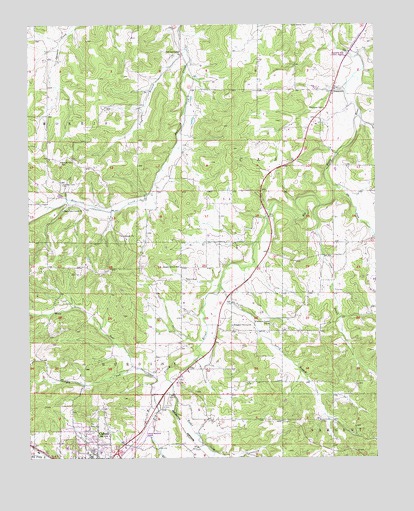
Cabool NE, MO USGS Topographic Map
Click on map above to begin viewing in our Map Viewer.

This topographic map contains these locations and features:
Feature Name Type Latitude Longitude GNIS ID View Map
Altis CemeteryCemeteryN37.1781°W92.1065°713251View Map
Bear CreekStreamN37.1487°W92.0763°713793View Map
Beeler BranchStreamN37.1320°W92.0813°748768View Map
Berry BranchStreamN37.1748°W92.0560°713991View Map
Cabool Memorial AirportAirportN37.1300°W92.0867°758613View Map
Camp BranchStreamN37.1981°W92.0199°715246View Map
City of CaboolCivilN37.1262°W92.1032°2393489View Map
Crag BranchStreamN37.2431°W92.0679°716453View Map
David (historical)LocaleN37.1717°W92.0321°740312View Map
David Post OfficePost OfficeN37.1717°W92.0321°760099View Map
Dry ForkStreamN37.1509°W92.0857°717103View Map
Elk CreekStreamN37.2031°W92.0146°749812View Map
Freely Give SchoolSchoolN37.2106°W92.1132°718205View Map
Hamilton CemeteryCemeteryN37.1396°W92.0767°719029View Map
Hamilton Creek CemeteryCemeteryN37.2042°W92.1132°719038View Map
Hamilton Creek ChurchChurchN37.1964°W92.1127°719039View Map
HurstPopulated PlaceN37.2367°W92.0868°740139View Map
Oak Grove SchoolSchoolN37.2414°W92.0699°723593View Map
Pleasant Grove ChurchChurchN37.1631°W92.0518°724490View Map
Pleasant Grove SchoolSchoolN37.1637°W92.0385°724502View Map
Potter CreekStreamN37.1481°W92.0765°751732View Map
Providence ChurchChurchN37.1884°W92.0899°724969View Map
Shady Grove SchoolSchoolN37.1803°W92.0704°726245View Map
SimmonsPopulated PlaceN37.2306°W92.0154°726463View Map
Simmons Ford Public AccessLocaleN37.2417°W92.0099°742765View Map
Simmons SchoolSchoolN37.2259°W92.0185°726468View Map

Note: Coordinates in the location and feature list above are referenced to NAD83 datum.


Copyright (C) 2008-2025 Ryan Niemi / Sunset Dynamics ... All Rights Reserved