TopoQuest Logo
Do you find TopoQuest useful?
Help keep TopoQuest running and adding new maps/features by donating!
Bitcoin:  19c7KJd3qBynnjoSw5npx9KScwjBe4ifkT
Litecoin:  LXs6TkuXGGXo1vDsWCkWVdjQX94eUKd6ui
Home View Maps Find Maps Find Places Resources & Links


Clear Springs, Missouri Topographic Map

USGS Map Title: Clear Springs, MO
USGS Map MRC: 37091A7
DRG (GeoTIFF) Download: o37091a7.tif


Neighboring USGS Topographic Map Quads:


  Elk Creek, MO  
37091B8
 

  Eunice, MO  
37091B7
 

  Summersville, MO  
37091B6
 

  Willow Springs North, MO  
37091A8
 

  Clear Springs, MO  
37091A7
 

  Pine Crest, MO  
37091A6
 

  Willow Springs South, MO  
36091H8
 

  Trask, MO  
36091H7
 

  Mountain View, MO  
36091H6


Map MRC Location:

N38°
W92°
N38°
W91°
H8 H7 H6 H5 H4 H3 H2 H1
G8 G7 G6 G5 G4 G3 G2 G1
F8 F7 F6 F5 F4 F3 F2 F1
E8 E7 E6 E5 E4 E3 E2 E1
D8 D7 D6 D5 D4 D3 D2 D1
C8 C7 C6 C5 C4 C3 C2 C1
B8 B7 B6 B5 B4 B3 B2 B1
A8 A7 A6 A5 A4 A3 A2 A1
N37°
W92°
N37°
W91°

Clear Springs, MO USGS 1:24K Topographic Map Preview:
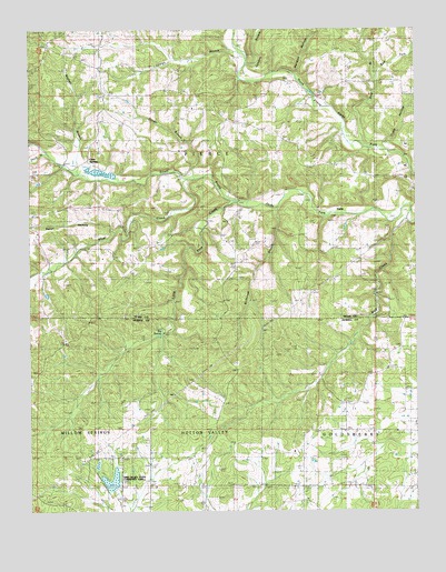
Clear Springs, MO USGS Topographic Map
Click on map above to begin viewing in our Map Viewer.

This topographic map contains these locations and features:
Feature Name Type Latitude Longitude GNIS ID View Map
Big SpringSpringN37.0459°W91.8321°714218View Map
Big Spring CreekStreamN37.0462°W91.8324°735078View Map
Clear SpringsPopulated PlaceN37.1084°W91.8504°740748View Map
Clear Springs Rural Fire Protection AssociationBuildingN37.1078°W91.8505°2620668View Map
Clear Springs SchoolSchoolN37.1078°W91.8501°715955View Map
East Fork Pine BranchStreamN37.1112°W91.7618°717298View Map
Flinger BranchStreamN37.0864°W91.8207°718022View Map
Gill CemeteryCemeteryN37.0225°W91.7501°718444View Map
Grace Church (historical)ChurchN37.0064°W91.7868°718642View Map
GuildPopulated PlaceN37.0701°W91.8018°735339View Map
Harmon HollowValleyN37.1142°W91.7874°719106View Map
HattiePopulated PlaceN37.0798°W91.7735°740913View Map
Hattie Post Office (historical)Post OfficeN37.0848°W91.7793°760181View Map
Houston SchoolSchoolN37.1123°W91.7918°735657View Map
Little Pine CreekStreamN37.0803°W91.8085°721294View Map
Mayhan BranchStreamN37.0876°W91.8588°722013View Map
Mount Olive Church (historical)ChurchN37.0717°W91.7899°735340View Map
Mount Olive SchoolSchoolN37.0720°W91.7893°722827View Map
New Salem CemeteryCemeteryN37.0280°W91.7727°723298View Map
New Salem Church (historical)ChurchN37.0278°W91.7721°735076View Map
Oak Ridge School (historical)SchoolN37.0648°W91.8451°723644View Map
Pine BranchStreamN37.0956°W91.7671°724367View Map
Pine CreekStreamN37.0866°W91.8255°751600View Map
Rebel HollowValleyN37.0720°W91.8476°751824View Map
Rocky Mountain RanchLocaleN37.0164°W91.7871°725522View Map
Sanders BranchStreamN37.1164°W91.8043°726026View Map
Scales ValleyValleyN37.0048°W91.8379°735075View Map
Shuld BranchStreamN37.0948°W91.8707°752144View Map
Sims Valley Community Lake DamDamN37.0067°W91.8485°763643View Map
Sims Valley State Community LakeReservoirN37.0081°W91.8489°763644View Map
Solid Rock ChurchChurchN37.0720°W91.8726°726687View Map
Spargo BranchStreamN37.1181°W91.8040°726826View Map
Stillhouse BranchStreamN37.0795°W91.7943°727103View Map
Township of PierceCivilN37.0943°W91.8448°767472View Map
Tracy HollowValleyN37.0945°W91.7607°727753View Map
Vaughn School (historical)SchoolN37.0059°W91.7776°728157View Map
Wofford School (historical)SchoolN37.1076°W91.7529°729025View Map
Wolf CreekStreamN37.0756°W91.7526°729037View Map

Note: Coordinates in the location and feature list above are referenced to NAD83 datum.


Copyright (C) 2008-2025 Ryan Niemi / Sunset Dynamics ... All Rights Reserved