TopoQuest Logo
Do you find TopoQuest useful?
Help keep TopoQuest running and adding new maps/features by donating!
Bitcoin:  19c7KJd3qBynnjoSw5npx9KScwjBe4ifkT
Litecoin:  LXs6TkuXGGXo1vDsWCkWVdjQX94eUKd6ui
Home View Maps Find Maps Find Places Resources & Links


Argyle, Wisconsin Topographic Map

USGS Map Title: Argyle, WI
USGS Map MRC: 42089F7
DRG (GeoTIFF) Download: o42089f7.tif


Neighboring USGS Topographic Map Quads:


  Yellowstone Lake, WI  
42089G8
 

  Blanchardville, WI  
42089G7
 

  New Glarus, WI  
42089G6
 

  Wiota, WI  
42089F8
 

  Argyle, WI  
42089F7
 

  Monroe NW, WI  
42089F6
 

  South Wayne, WI  
42089E8
 

  Browntown, WI  
42089E7
 

  Monroe, WI  
42089E6


Map MRC Location:

N43°
W90°
N43°
W89°
H8 H7 H6 H5 H4 H3 H2 H1
G8 G7 G6 G5 G4 G3 G2 G1
F8 F7 F6 F5 F4 F3 F2 F1
E8 E7 E6 E5 E4 E3 E2 E1
D8 D7 D6 D5 D4 D3 D2 D1
C8 C7 C6 C5 C4 C3 C2 C1
B8 B7 B6 B5 B4 B3 B2 B1
A8 A7 A6 A5 A4 A3 A2 A1
N42°
W90°
N42°
W89°

Argyle, WI USGS 1:24K Topographic Map Preview:
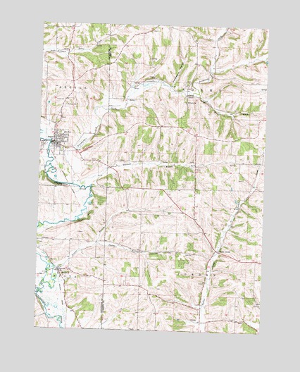
Argyle, WI USGS Topographic Map
Click on map above to begin viewing in our Map Viewer.

This topographic map contains these locations and features:
Feature Name Type Latitude Longitude GNIS ID View Map
Alea Argyle Land Ethic AcademySchoolN42.7073°W89.8682°2715726View Map
ArgylePopulated PlaceN42.7011°W89.8671°1560933View Map
Argyle Adams Community Fire DepartmentBuildingN42.7021°W89.8657°2698181View Map
Argyle Elementary SchoolSchoolN42.7072°W89.8682°2715699View Map
Argyle Emergency Medical ServicesBuildingN42.7019°W89.8662°2698291View Map
Argyle High SchoolSchoolN42.7073°W89.8682°1851601View Map
Argyle Police DepartmentBuildingN42.7015°W89.8657°2759600View Map
Argyle Wastewater Treatment FacilityLocaleN42.6992°W89.8694°2709283View Map
Big Valley FarmLocaleN42.7247°W89.7925°2709976View Map
Braezels BranchStreamN42.6831°W89.8493°1562136View Map
Calvary CemeteryCemeteryN42.7189°W89.8621°1562529View Map
Cherry BranchStreamN42.6450°W89.8704°1562986View Map
Dougherty CreekStreamN42.6842°W89.8560°1564079View Map
Jockey HollowValleyN42.6608°W89.8417°1567187View Map
Jordan CenterLocaleN42.6578°W89.7748°1567283View Map
Lewis CemeteryCemeteryN42.6564°W89.7884°1567998View Map
Prairie BrookStreamN42.7225°W89.7879°1571869View Map
Puddledock HollowValleyN42.7250°W89.8027°1571959View Map
Saint Francis ChurchChurchN42.7186°W89.7946°1572934View Map
Saint Joseph Catholic ChurchChurchN42.7039°W89.8637°1989675View Map
Town of AdamsCivilN42.7268°W89.7789°1582655View Map
Town of JordanCivilN42.6397°W89.7786°1583459View Map
Trotter BranchStreamN42.6494°W89.8648°1575658View Map
Village of ArgyleCivilN42.7015°W89.8657°1582710View Map
Willet (historical)Populated PlaceN42.7234°W89.7941°2760451View Map
WoodfordPopulated PlaceN42.6486°W89.8626°1576987View Map
Woodford Census Designated PlaceCensusN42.6477°W89.8600°2586576View Map
Woodford Volunteer Fire DepartmentBuildingN42.6486°W89.8629°2698166View Map
Woodlawn CemeteryCemeteryN42.7167°W89.8612°1576995View Map

Note: Coordinates in the location and feature list above are referenced to NAD83 datum.


Copyright (C) 2008-2025 Ryan Niemi / Sunset Dynamics ... All Rights Reserved