TopoQuest Logo
Do you find TopoQuest useful?
Help keep TopoQuest running and adding new maps/features by donating!
Bitcoin:  19c7KJd3qBynnjoSw5npx9KScwjBe4ifkT
Litecoin:  LXs6TkuXGGXo1vDsWCkWVdjQX94eUKd6ui
Home View Maps Find Maps Find Places Resources & Links


New Glarus, Wisconsin Topographic Map

USGS Map Title: New Glarus, WI
USGS Map MRC: 42089G6
DRG (GeoTIFF) Download: o42089g6.tif


Neighboring USGS Topographic Map Quads:


  Daleyville, WI  
42089H7
 

  Mount Vernon, WI  
42089H6
 

  Verona, WI  
42089H5
 

  Blanchardville, WI  
42089G7
 

  New Glarus, WI  
42089G6
 

  Belleville, WI  
42089G5
 

  Argyle, WI  
42089F7
 

  Monroe NW, WI  
42089F6
 

  Monticello, WI  
42089F5


Map MRC Location:

N43°
W90°
N43°
W89°
H8 H7 H6 H5 H4 H3 H2 H1
G8 G7 G6 G5 G4 G3 G2 G1
F8 F7 F6 F5 F4 F3 F2 F1
E8 E7 E6 E5 E4 E3 E2 E1
D8 D7 D6 D5 D4 D3 D2 D1
C8 C7 C6 C5 C4 C3 C2 C1
B8 B7 B6 B5 B4 B3 B2 B1
A8 A7 A6 A5 A4 A3 A2 A1
N42°
W90°
N42°
W89°

New Glarus, WI USGS 1:24K Topographic Map Preview:
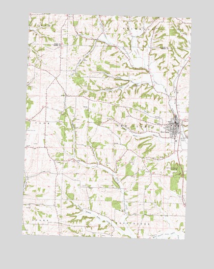
New Glarus, WI USGS Topographic Map
Click on map above to begin viewing in our Map Viewer.

This topographic map contains these locations and features:
Feature Name Type Latitude Longitude GNIS ID View Map
Country Hills FarmLocaleN42.7903°W89.7086°2723821View Map
Durest ValleyValleyN42.8168°W89.6345°1564197View Map
Evangelical United Brethren CemeteryCemeteryN42.8147°W89.6468°1564716View Map
Farmers Grove (historical)Populated PlaceN42.7850°W89.7241°2760449View Map
Greens Prairie CemeteryCemeteryN42.8089°W89.7490°1565853View Map
Hustad ValleyValleyN42.8612°W89.6977°1566832View Map
Kadence FarmLocaleN42.8025°W89.7131°2723820View Map
Karlen Dairy FarmLocaleN42.7569°W89.7319°2723737View Map
Krieg ValleyValleyN42.8393°W89.6687°1567647View Map
Legler School BranchStreamN42.8031°W89.6301°1567949View Map
New GlarusPopulated PlaceN42.8144°W89.6351°1570216View Map
New Glarus Christian SchoolSchoolN42.8175°W89.6405°2716877View Map
New Glarus City HallBuildingN42.8167°W89.6354°1838291View Map
New Glarus DairyLocaleN42.7881°W89.6450°2723823View Map
New Glarus Elementary SchoolSchoolN42.8054°W89.6341°2716193View Map
New Glarus Emergency Ambulance ServiceBuildingN42.8160°W89.6366°2698285View Map
New Glarus Middle / High SchoolSchoolN42.8023°W89.6361°1838292View Map
New Glarus Police DepartmentBuildingN42.8165°W89.6355°2759787View Map
New Glarus Post OfficePost OfficeN42.8158°W89.6354°1838293View Map
New Glarus Volunteer Fire DepartmentBuildingN42.8166°W89.6362°2697971View Map
New Glarus Wastewater Treatment PlantLocaleN42.8067°W89.6300°2709424View Map
New Glarus Woods State ParkParkN42.7872°W89.6298°1570217View Map
Nixiebabes Dairy FarmLocaleN42.8589°W89.6264°2723824View Map
Pioneer ValleyValleyN42.8403°W89.6556°1571548View Map
Pisgah Evangelical United Brethren Church (historical)ChurchN42.8144°W89.6357°1838294View Map
Postville CemeteryCemeteryN42.7994°W89.7490°1571822View Map
Prairie Ridge FarmLocaleN42.7681°W89.7247°2723745View Map
Rainbow Fleece FarmLocaleN42.8425°W89.7144°2723822View Map
Southside Mobile Home ParkPopulated PlaceN42.8064°W89.6392°2630566View Map
Spring Valley CreekStreamN42.8186°W89.6335°1577250View Map
Spring Valley CreekStreamN42.8189°W89.6337°1574707View Map
Swiss Reformed CemeteryCemeteryN42.8132°W89.6418°1575195View Map
Swiss United Church of ChristChurchN42.8158°W89.6340°1838301View Map
Town of New GlarusCivilN42.8141°W89.6628°1583806View Map
Village of New GlarusCivilN42.8130°W89.6337°1583805View Map

Note: Coordinates in the location and feature list above are referenced to NAD83 datum.


Copyright (C) 2008-2024 Ryan Niemi / Sunset Dynamics ... All Rights Reserved