TopoQuest Logo
Do you find TopoQuest useful?
Help keep TopoQuest running and adding new maps/features by donating!
Bitcoin:  19c7KJd3qBynnjoSw5npx9KScwjBe4ifkT
Litecoin:  LXs6TkuXGGXo1vDsWCkWVdjQX94eUKd6ui
Home View Maps Find Maps Find Places Resources & Links


Blanchardville, Wisconsin Topographic Map

USGS Map Title: Blanchardville, WI
USGS Map MRC: 42089G7
DRG (GeoTIFF) Download: o42089g7.tif


Neighboring USGS Topographic Map Quads:


  Hollandale, WI  
42089H8
 

  Daleyville, WI  
42089H7
 

  Mount Vernon, WI  
42089H6
 

  Yellowstone Lake, WI  
42089G8
 

  Blanchardville, WI  
42089G7
 

  New Glarus, WI  
42089G6
 

  Wiota, WI  
42089F8
 

  Argyle, WI  
42089F7
 

  Monroe NW, WI  
42089F6


Map MRC Location:

N43°
W90°
N43°
W89°
H8 H7 H6 H5 H4 H3 H2 H1
G8 G7 G6 G5 G4 G3 G2 G1
F8 F7 F6 F5 F4 F3 F2 F1
E8 E7 E6 E5 E4 E3 E2 E1
D8 D7 D6 D5 D4 D3 D2 D1
C8 C7 C6 C5 C4 C3 C2 C1
B8 B7 B6 B5 B4 B3 B2 B1
A8 A7 A6 A5 A4 A3 A2 A1
N42°
W90°
N42°
W89°

Blanchardville, WI USGS 1:24K Topographic Map Preview:
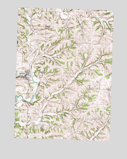
Blanchardville, WI USGS Topographic Map
Click on map above to begin viewing in our Map Viewer.

This topographic map contains these locations and features:
Feature Name Type Latitude Longitude GNIS ID View Map
0.47 ReservoirReservoirN42.8517°W89.8668°1793182View Map
Adams ChurchChurchN42.7653°W89.7729°1560683View Map
Bakers Field (historical)AirportN42.8253°W89.8701°1581891View Map
BlanchardvillePopulated PlaceN42.8103°W89.8621°1561917View Map
Blanchardville Fire DepartmentBuildingN42.8100°W89.8610°2697500View Map
Blanchardville Lutheran ChurchChurchN42.8131°W89.8587°1851606View Map
Blanchardville Police DepartmentBuildingN42.8100°W89.8609°2759687View Map
Blanchardville Post OfficePost OfficeN42.8081°W89.8629°1851607View Map
Blanchardville Village HallBuildingN42.8100°W89.8626°1851608View Map
Blanchardville Wastewater Treatment FacilityLocaleN42.8061°W89.8558°2709285View Map
Brager BranchStreamN42.8208°W89.8562°1577357View Map
Einerson SchoolSchoolN42.7706°W89.8576°1564477View Map
Erickson CreekStreamN42.7714°W89.8398°1564686View Map
Gordon CreekStreamN42.8097°W89.8557°1561947View Map
Hay HollowValleyN42.8170°W89.7878°1566198View Map
Immaculate Conception Catholic ChurchChurchN42.8075°W89.8607°1851610View Map
Jeglum ValleyValleyN42.8707°W89.8054°1567138View Map
Kittleson Valley CreekStreamN42.8606°W89.8587°1577259View Map
Lee ValleyValleyN42.8728°W89.7772°1567931View Map
Loyalty SchoolSchoolN42.7892°W89.8140°1568774View Map
McCoy G 9648 DamDamN42.8517°W89.8668°1793181View Map
McKellar ParkParkN42.8094°W89.8590°1851611View Map
McPeace ValleyValleyN42.8214°W89.8561°1569271View Map
McPeace Valley CreekStreamN42.8292°W89.8385°1577299View Map
Meadowview SchoolSchoolN42.8647°W89.8085°1569299View Map
MoscowPopulated PlaceN42.8333°W89.8551°1577735View Map
Pecatonica Christian PreschoolSchoolN42.8131°W89.8587°1851612View Map
Pecatonica High SchoolSchoolN42.8063°W89.8599°1851613View Map
PostvillePopulated PlaceN42.7992°W89.7529°1571821View Map
Sawmill CreekStreamN42.7631°W89.8743°1573749View Map
Step ValleyValleyN42.8654°W89.8112°1574861View Map
Syftestad CreekStreamN42.8722°W89.8157°1575200View Map
Town of YorkCivilN42.8139°W89.7792°1584494View Map
Trinity Lutheran ChurchChurchN42.8072°W89.8612°1989674View Map
Ula CemeteryCemeteryN42.8142°W89.8062°1575847View Map
Village of BlanchardvilleCivilN42.8096°W89.8607°1582828View Map
Yankee HollowValleyN42.7728°W89.8398°1577077View Map
York ChurchChurchN42.8467°W89.8035°1577108View Map
York Memorial ChurchChurchN42.8469°W89.8079°1577110View Map
York Prairie State Natural AreaParkN42.8397°W89.7912°1989641View Map

Note: Coordinates in the location and feature list above are referenced to NAD83 datum.


Copyright (C) 2008-2025 Ryan Niemi / Sunset Dynamics ... All Rights Reserved