TopoQuest Logo
Do you find TopoQuest useful?
Help keep TopoQuest running and adding new maps/features by donating!
Bitcoin:  19c7KJd3qBynnjoSw5npx9KScwjBe4ifkT
Litecoin:  LXs6TkuXGGXo1vDsWCkWVdjQX94eUKd6ui
Home View Maps Find Maps Find Places Resources & Links


Elkton, Florida Topographic Map

USGS Map Title: Elkton, FL
USGS Map MRC: 29081G4
DRG (GeoTIFF) Download: o29081g4.tif


Neighboring USGS Topographic Map Quads:


  Picolata, FL  
29081H5
 

  Bakersville, FL  
29081H4
 

  Saint Augustine, FL  
29081H3
 

  Riverdale, FL  
29081G5
 

  Elkton, FL  
29081G4
 

  Saint Augustine Beach, FL  
29081G3
 

  Hastings, FL  
29081F5
 

  Spuds, FL  
29081F4
 

  Dinner Island NE, FL  
29081F3


Map MRC Location:

N30°
W82°
N30°
W81°
H8 H7 H6 H5 H4 H3 H2 H1
G8 G7 G6 G5 G4 G3 G2 G1
F8 F7 F6 F5 F4 F3 F2 F1
E8 E7 E6 E5 E4 E3 E2 E1
D8 D7 D6 D5 D4 D3 D2 D1
C8 C7 C6 C5 C4 C3 C2 C1
B8 B7 B6 B5 B4 B3 B2 B1
A8 A7 A6 A5 A4 A3 A2 A1
N29°
W82°
N29°
W81°

Elkton, FL USGS 1:24K Topographic Map Preview:
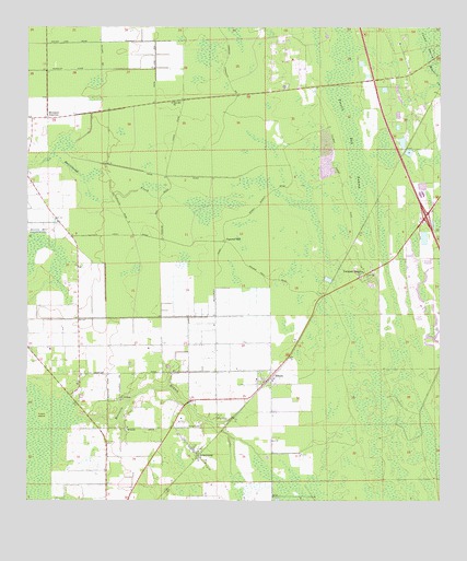
Elkton, FL USGS Topographic Map
Click on map above to begin viewing in our Map Viewer.

This topographic map contains these locations and features:
Feature Name Type Latitude Longitude GNIS ID View Map
ArmstrongPopulated PlaceN29.7622°W81.4479°307876View Map
Bartram Farms Air ParkAirportN29.8215°W81.4965°2717000View Map
Byrd Air FieldAirportN29.8015°W81.4914°309385View Map
Coquina Crossing Mobile Home ParkPopulated PlaceN29.8062°W81.3869°2448828View Map
Cypress Woods Golf and Country ClubLocaleN29.8027°W81.3788°2448827View Map
ElktonPopulated PlaceN29.7830°W81.4259°307946View Map
Elkton Post OfficePost OfficeN29.7850°W81.4263°2767990View Map
Fotch IslandLocaleN29.7725°W81.4954°307967View Map
Moccasin BranchStreamN29.7711°W81.4820°308035View Map
Molasses JunctionPopulated PlaceN29.8511°W81.4937°308037View Map
Revels Strip (historical)AirportN29.8214°W81.4709°309478View Map
Saint Ambrose ChurchChurchN29.7764°W81.4715°308100View Map
Squirrel HillSummitN29.8186°W81.4401°308137View Map
Trestle Bay SwampSwampN29.8443°W81.4003°308152View Map
Vermont HeightsPopulated PlaceN29.8102°W81.3970°308162View Map
Zion Hill ChurchChurchN29.8552°W81.4565°307861View Map

Note: Coordinates in the location and feature list above are referenced to NAD83 datum.


Copyright (C) 2008-2025 Ryan Niemi / Sunset Dynamics ... All Rights Reserved