TopoQuest Logo
Do you find TopoQuest useful?
Help keep TopoQuest running and adding new maps/features by donating!
Bitcoin:  19c7KJd3qBynnjoSw5npx9KScwjBe4ifkT
Litecoin:  LXs6TkuXGGXo1vDsWCkWVdjQX94eUKd6ui
Home View Maps Find Maps Find Places Resources & Links


Riverdale, Florida Topographic Map

USGS Map Title: Riverdale, FL
USGS Map MRC: 29081G5
DRG (GeoTIFF) Download: o29081g5.tif


Neighboring USGS Topographic Map Quads:


  Green Cove Springs, FL  
29081H6
 

  Picolata, FL  
29081H5
 

  Bakersville, FL  
29081H4
 

  Bostwick, FL  
29081G6
 

  Riverdale, FL  
29081G5
 

  Elkton, FL  
29081G4
 

  Palatka, FL  
29081F6
 

  Hastings, FL  
29081F5
 

  Spuds, FL  
29081F4


Map MRC Location:

N30°
W82°
N30°
W81°
H8 H7 H6 H5 H4 H3 H2 H1
G8 G7 G6 G5 G4 G3 G2 G1
F8 F7 F6 F5 F4 F3 F2 F1
E8 E7 E6 E5 E4 E3 E2 E1
D8 D7 D6 D5 D4 D3 D2 D1
C8 C7 C6 C5 C4 C3 C2 C1
B8 B7 B6 B5 B4 B3 B2 B1
A8 A7 A6 A5 A4 A3 A2 A1
N29°
W82°
N29°
W81°

Riverdale, FL USGS 1:24K Topographic Map Preview:
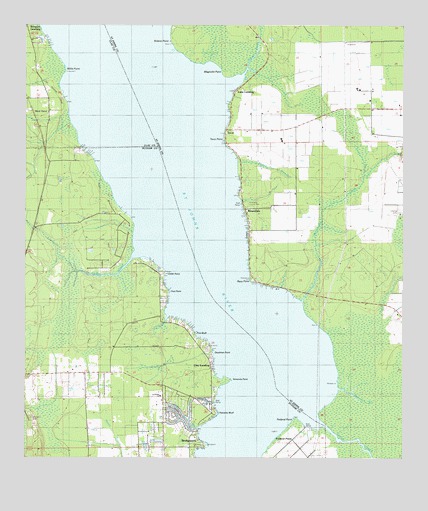
Riverdale, FL USGS Topographic Map
Click on map above to begin viewing in our Map Viewer.

This topographic map contains these locations and features:
Feature Name Type Latitude Longitude GNIS ID View Map
Bluff BranchStreamN29.7589°W81.5670°279085View Map
Brewers LandingPopulated PlaceN29.8733°W81.6206°295148View Map
BridgeportPopulated PlaceN29.7533°W81.5701°279389View Map
Cedar CreekStreamN29.8077°W81.5895°280185View Map
Cedar PointCapeN29.8033°W81.5781°280218View Map
Clay LandingPopulated PlaceN29.7747°W81.5617°295199View Map
Dancey PointCapeN29.7836°W81.5498°308201View Map
Deadman PointCapeN29.7800°W81.5623°281397View Map
Deep CreekStreamN29.7600°W81.5265°307933View Map
Elbow BranchStreamN29.7908°W81.5776°282140View Map
Federal PointCapeN29.7611°W81.5359°282403View Map
Flint PointCapeN29.7983°W81.5770°294015View Map
Fort Peyton (historical)MilitaryN29.7667°W81.5500°307421View Map
Lane LandingPopulated PlaceN29.8575°W81.5529°308008View Map
Magnolia PointCapeN29.8611°W81.5598°308016View Map
McCullough CreekStreamN29.7950°W81.5331°308023View Map
Moccasin BranchStreamN29.7700°W81.5220°308034View Map
Ninemile PointCapeN29.7727°W81.5570°294100View Map
Paines BranchStreamN29.8358°W81.5545°308065View Map
Palmetto BluffCliffN29.7630°W81.5609°288430View Map
Pine BluffCliffN29.7861°W81.5681°288824View Map
Racy PointCapeN29.8011°W81.5504°308092View Map
Racy Point Post Light (historical)BuildingN29.8017°W81.5503°2652544View Map
RiverdalePopulated PlaceN29.8216°W81.5517°308097View Map
Saint Johns County Fire Rescue Station 13 RiverdaleBuildingN29.8228°W81.5521°2644318View Map
San Nicolas Tolentino (historical)Populated PlaceN29.8502°W81.5498°308379View Map
Solano PointCapeN29.8722°W81.5770°308123View Map
TocoiPopulated PlaceN29.8450°W81.5579°308147View Map
Tocoi CreekStreamN29.8608°W81.5523°308148View Map
Tocoi PointCapeN29.8427°W81.5587°308149View Map
West TocoiPopulated PlaceN29.8502°W81.6173°295705View Map
Willis PointCapeN29.8616°W81.6115°293347View Map

Note: Coordinates in the location and feature list above are referenced to NAD83 datum.


Copyright (C) 2008-2025 Ryan Niemi / Sunset Dynamics ... All Rights Reserved