TopoQuest Logo
Do you find TopoQuest useful?
Help keep TopoQuest running and adding new maps/features by donating!
Bitcoin:  19c7KJd3qBynnjoSw5npx9KScwjBe4ifkT
Litecoin:  LXs6TkuXGGXo1vDsWCkWVdjQX94eUKd6ui
Home View Maps Find Maps Find Places Resources & Links


Ellicottville, New York Topographic Map

USGS Map Title: Ellicottville, NY
USGS Map MRC: 42078C6
DRG (GeoTIFF) Download: o42078c6.tif


Neighboring USGS Topographic Map Quads:


  Collins Center, NY  
42078D7
 

  Ashford Hollow, NY  
42078D6
 

  West Valley, NY  
42078D5
 

  Cattaraugus, NY  
42078C7
 

  Ellicottville, NY  
42078C6
 

  Ashford, NY  
42078C5
 

  Little Valley, NY  
42078B7
 

  Salamanca, NY  
42078B6
 

  Humphrey, NY  
42078B5


Map MRC Location:

N43°
W79°
N43°
W78°
H8 H7 H6 H5 H4 H3 H2 H1
G8 G7 G6 G5 G4 G3 G2 G1
F8 F7 F6 F5 F4 F3 F2 F1
E8 E7 E6 E5 E4 E3 E2 E1
D8 D7 D6 D5 D4 D3 D2 D1
C8 C7 C6 C5 C4 C3 C2 C1
B8 B7 B6 B5 B4 B3 B2 B1
A8 A7 A6 A5 A4 A3 A2 A1
N42°
W79°
N42°
W78°

Ellicottville, NY USGS 1:24K Topographic Map Preview:
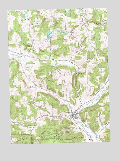
Ellicottville, NY USGS Topographic Map
Click on map above to begin viewing in our Map Viewer.

This topographic map contains these locations and features:
Feature Name Type Latitude Longitude GNIS ID View Map
Armstrong HillSummitN42.3742°W78.7367°942570View Map
Bailey HillSummitN42.3612°W78.7131°942780View Map
Bartlett HillSummitN42.2765°W78.6581°943097View Map
Bowen CemeteryCemeteryN42.3083°W78.7177°944506View Map
Crumb HillSummitN42.3609°W78.7192°947870View Map
Elk CreekStreamN42.2748°W78.6698°949489View Map
EllicottvillePopulated PlaceN42.2751°W78.6728°949515View Map
Ellicottville / Great Valley Ambulance ServiceBuildingN42.2830°W78.6706°2719175View Map
Ellicottville Elementary SchoolSchoolN42.2530°W78.6514°2597374View Map
Ellicottville Fire DepartmentBuildingN42.2830°W78.6707°2701223View Map
Ellicottville Memorial LibraryBuildingN42.2828°W78.6748°2598254View Map
Ellicottville Middle High SchoolSchoolN42.2530°W78.6514°2597385View Map
Ellicottville Police DepartmentBuildingN42.2754°W78.6733°2780686View Map
Ellicottville Post OfficePost OfficeN42.2754°W78.6733°2598451View Map
Ellicottville School (historical)SchoolN42.2744°W78.6719°2562362View Map
Ellicottville Town HallBuildingN42.2753°W78.6733°2386378View Map
First Methodist Episcopal Church (historical)ChurchN42.2753°W78.6739°2386377View Map
Fish HillSummitN42.2751°W78.7223°950140View Map
Goodell CreekStreamN42.3331°W78.7311°951322View Map
Hinman ValleyValleyN42.3312°W78.7234°952887View Map
Holiday Valley Ski ClubLocaleN42.2620°W78.6798°974409View Map
Holimont Ski ClubLocaleN42.2726°W78.6886°974410View Map
Holy Cross CemeteryCemeteryN42.2845°W78.6588°2554905View Map
Holy Name of Mary Roman Catholic ChurchChurchN42.2744°W78.6719°2388700View Map
Irish HillSummitN42.3367°W78.6381°953763View Map
Jackman HillSummitN42.3434°W78.6745°953872View Map
Jefferson Street CemeteryCemeteryN42.2705°W78.6688°2554904View Map
Mansfield Volunteer Fire CompanyBuildingN42.3333°W78.7352°2734675View Map
MaplesPopulated PlaceN42.3340°W78.7350°956461View Map
Maples CemeteryCemeteryN42.3354°W78.7348°2554903View Map
McCarty HillSummitN42.2542°W78.6942°956733View Map
McMurray CreekStreamN42.3101°W78.6261°956839View Map
Murder HillSummitN42.2531°W78.7275°958174View Map
New York State Police Troop A Zone 4 Ellicottville StationBuildingN42.2753°W78.6733°2780754View Map
Niles CemeteryCemeteryN42.2745°W78.6943°958588View Map
OrlandoPopulated PlaceN42.3045°W78.7161°972898View Map
PlatoPopulated PlaceN42.3515°W78.6711°960676View Map
Plum CreekStreamN42.2703°W78.6678°960761View Map
Poverty HillSummitN42.3090°W78.6984°961068View Map
Poverty Hill Ski ClubLocaleN42.3156°W78.6956°974826View Map
Rainbow LakeReservoirN42.3540°W78.6931°962146View Map
Saint John's Episcopal ChurchChurchN42.2747°W78.6728°2386379View Map
Saint Paul's Lutheran ChurchChurchN42.2838°W78.6622°2386376View Map
Saint Pauls Lutheran CemeteryCemeteryN42.3642°W78.6540°960677View Map
Sommerville ValleyValleyN42.2573°W78.6424°965637View Map
Stoney Pitcher FallsFallsN42.3403°W78.7225°970665View Map
Sunset Hill CemeteryCemeteryN42.2752°W78.6804°966839View Map
Timber LakeReservoirN42.3529°W78.6790°967532View Map
Town of EllicottvilleCivilN42.3166°W78.6372°978934View Map
Union Public School (historical)SchoolN42.2747°W78.6722°2387499View Map
United Church of EllicottvilleChurchN42.2769°W78.6733°2389023View Map
Village of EllicottvilleCivilN42.2746°W78.6722°2391662View Map
Watson HillSummitN42.2915°W78.7348°968926View Map
Zion Evangelical ChurchChurchN42.2731°W78.6736°2386647View Map

Note: Coordinates in the location and feature list above are referenced to NAD83 datum.


Copyright (C) 2008-2024 Ryan Niemi / Sunset Dynamics ... All Rights Reserved