TopoQuest Logo
Do you find TopoQuest useful?
Help keep TopoQuest running and adding new maps/features by donating!
Bitcoin:  19c7KJd3qBynnjoSw5npx9KScwjBe4ifkT
Litecoin:  LXs6TkuXGGXo1vDsWCkWVdjQX94eUKd6ui
Home View Maps Find Maps Find Places Resources & Links


Collins Center, New York Topographic Map

USGS Map Title: Collins Center, NY
USGS Map MRC: 42078D7
DRG (GeoTIFF) Download: o42078d7.tif


Neighboring USGS Topographic Map Quads:


  North Collins, NY  
42078E8
 

  Langford, NY  
42078E7
 

  Springville, NY  
42078E6
 

  Gowanda, NY  
42078D8
 

  Collins Center, NY  
42078D7
 

  Ashford Hollow, NY  
42078D6
 

  New Albion, NY  
42078C8
 

  Cattaraugus, NY  
42078C7
 

  Ellicottville, NY  
42078C6


Map MRC Location:

N43°
W79°
N43°
W78°
H8 H7 H6 H5 H4 H3 H2 H1
G8 G7 G6 G5 G4 G3 G2 G1
F8 F7 F6 F5 F4 F3 F2 F1
E8 E7 E6 E5 E4 E3 E2 E1
D8 D7 D6 D5 D4 D3 D2 D1
C8 C7 C6 C5 C4 C3 C2 C1
B8 B7 B6 B5 B4 B3 B2 B1
A8 A7 A6 A5 A4 A3 A2 A1
N42°
W79°
N42°
W78°

Collins Center, NY USGS 1:24K Topographic Map Preview:
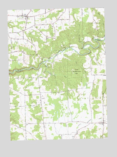
Collins Center, NY USGS Topographic Map
Click on map above to begin viewing in our Map Viewer.

This topographic map contains these locations and features:
Feature Name Type Latitude Longitude GNIS ID View Map
Ballard School (historical)SchoolN42.3908°W78.8315°2491143View Map
Barber CemeteryCemeteryN42.3907°W78.8546°942979View Map
Beverly School (historical)SchoolN42.4189°W78.8572°2491104View Map
Brooklyn CemeteryCemeteryN42.4360°W78.7517°2089787View Map
Brooklyn School (historical)SchoolN42.4356°W78.7522°2491138View Map
Collins CenterPopulated PlaceN42.4937°W78.8514°947157View Map
Collins Center Fire CompanyBuildingN42.4944°W78.8554°2701221View Map
Coon BrookStreamN42.4581°W78.7861°947373View Map
Dake School (historical)SchoolN42.3848°W78.8547°2491142View Map
East OttoPopulated PlaceN42.3898°W78.7548°949195View Map
East Otto CemeteryCemeteryN42.3902°W78.7590°2554876View Map
East Otto CreekStreamN42.3940°W78.7578°949196View Map
East Otto Fire DistrictBuildingN42.3895°W78.7548°2735035View Map
East Otto Post OfficePost OfficeN42.3895°W78.7552°2598449View Map
North Otto CemeteryCemeteryN42.4148°W78.8338°958867View Map
North Otto School (historical)SchoolN42.4264°W78.8381°2491117View Map
Poverty Hill School (historical)SchoolN42.4606°W78.8625°2491059View Map
Red School (historical)SchoolN42.4725°W78.8572°2491060View Map
Saint Frances Cabrini Roman Catholic ChurchChurchN42.4967°W78.8477°2714178View Map
School Number 10 (historical)SchoolN42.4994°W78.7653°2491097View Map
School Number 4 (historical)SchoolN42.4628°W78.8000°2491061View Map
Scrabble Hill CemeteryCemeteryN42.4963°W78.8022°954775View Map
Scrabble Hill School (historical)SchoolN42.4889°W78.8111°2491077View Map
Swamp School (historical)SchoolN42.3921°W78.7950°2491144View Map
Town of CollinsCivilN42.4908°W78.8623°978852View Map
Town of OttoCivilN42.3972°W78.8393°979331View Map
Utley BrookStreamN42.4584°W78.8061°968328View Map
Utley School (historical)SchoolN42.4278°W78.7683°2491137View Map
Waterman BrookStreamN42.4487°W78.8309°968901View Map
ZoarPopulated PlaceN42.4567°W78.8392°973309View Map
Zoar BridgeBridgeN42.4556°W78.8133°2491119View Map
Zoar School (historical)SchoolN42.4522°W78.8094°2491118View Map

Note: Coordinates in the location and feature list above are referenced to NAD83 datum.


Copyright (C) 2008-2024 Ryan Niemi / Sunset Dynamics ... All Rights Reserved