TopoQuest Logo
Do you find TopoQuest useful?
Help keep TopoQuest running and adding new maps/features by donating!
Bitcoin:  19c7KJd3qBynnjoSw5npx9KScwjBe4ifkT
Litecoin:  LXs6TkuXGGXo1vDsWCkWVdjQX94eUKd6ui
Home View Maps Find Maps Find Places Resources & Links


Ellington, Connecticut Topographic Map

USGS Map Title: Ellington, CT
USGS Map MRC: 41072H4
DRG (GeoTIFF) Download: o41072h4.tif


Neighboring USGS Topographic Map Quads:


  Springfield South, MA  
42072A5
 

  Hampden, MA  
42072A4
 

  Monson, MA  
42072A3
 

  Broad Brook, CT  
41072H5
 

  Ellington, CT  
41072H4
 

  Stafford Springs, CT  
41072H3
 

  Manchester, CT  
41072G5
 

  Rockville, CT  
41072G4
 

  Coventry, CT  
41072G3


Map MRC Location:

N42°
W73°
N42°
W72°
H8 H7 H6 H5 H4 H3 H2 H1
G8 G7 G6 G5 G4 G3 G2 G1
F8 F7 F6 F5 F4 F3 F2 F1
E8 E7 E6 E5 E4 E3 E2 E1
D8 D7 D6 D5 D4 D3 D2 D1
C8 C7 C6 C5 C4 C3 C2 C1
B8 B7 B6 B5 B4 B3 B2 B1
A8 A7 A6 A5 A4 A3 A2 A1
N41°
W73°
N41°
W72°

Ellington, CT USGS 1:24K Topographic Map Preview:
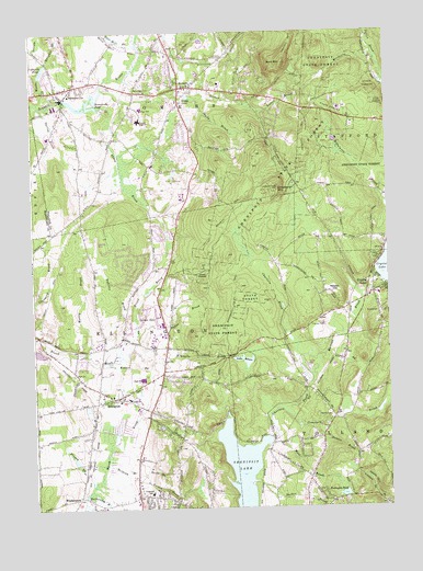
Ellington, CT USGS Topographic Map
Click on map above to begin viewing in our Map Viewer.

This topographic map contains these locations and features:
Feature Name Type Latitude Longitude GNIS ID View Map
Abbey BrookStreamN41.9807°W72.4748°205029View Map
Bahlers BrookStreamN41.9162°W72.4690°205193View Map
Bald MountainSummitN41.9918°W72.4098°205220View Map
Belding BrookStreamN41.8862°W72.4745°205431View Map
Browns BrookStreamN41.8962°W72.4031°205771View Map
Cemetery BrookStreamN41.9001°W72.4115°206120View Map
Center Elementary SchoolSchoolN41.9037°W72.4662°206144View Map
Charter CemeteryCemeteryN41.9230°W72.3982°206196View Map
Charters BrookStreamN41.8929°W72.4162°206200View Map
Charters PondReservoirN41.9279°W72.4120°212326View Map
Chestnut MountainSummitN41.9793°W72.3856°212327View Map
Crystal LakePopulated PlaceN41.9318°W72.3784°206549View Map
Crystal Lake CemeteryCemeteryN41.9455°W72.3753°1943278View Map
Crystal Lake CemeteryCemeteryN41.9307°W72.3817°1943279View Map
Crystal Lake Census Designated PlaceCensusN41.9343°W72.3755°2377812View Map
Crystal Lake Elementary SchoolSchoolN41.9309°W72.4109°212367View Map
Crystal Lake Volunteer Fire DepartmentBuildingN41.9298°W72.3822°2420018View Map
Davis BrookStreamN41.8840°W72.4618°206609View Map
EllingtonPopulated PlaceN41.9040°W72.4698°206928View Map
Ellington AirportAirportN41.9235°W72.4558°213041View Map
Ellington Fire Marshal's OfficeBuildingN41.9039°W72.4676°2420088View Map
Ellington Police DeptBuildingN41.9025°W72.4637°2754684View Map
Ellington Volunteer Ambulance CorpsBuildingN41.9086°W72.4632°2660870View Map
Ellington Volunteer Fire DepartmentBuildingN41.9027°W72.4636°2420033View Map
Grants BrookStreamN41.9137°W72.3995°207404View Map
Gulf StreamStreamN41.9854°W72.4737°207568View Map
Hall Hill BrookStreamN41.9962°W72.4606°207609View Map
Hydes BrookStreamN41.9232°W72.4631°208053View Map
Johnson Memorial HospitalHospitalN41.9796°W72.3911°2660308View Map
Kibbes BrookStreamN41.9134°W72.4734°208285View Map
Kimballs BrookStreamN41.9170°W72.4673°208297View Map
Lafayette PondLakeN41.9904°W72.4956°208350View Map
Lake BonairReservoirN41.9138°W72.4255°1771383View Map
Lake BonairLakeN41.9145°W72.4259°205634View Map
Lake Bonair DamDamN41.9151°W72.4295°1771382View Map
Lievre BrookStreamN41.9793°W72.4187°208460View Map
Longview Junior High SchoolSchoolN41.8787°W72.4593°208591View Map
Marsh BrookStreamN41.8798°W72.4806°208731View Map
Martins BrookStreamN41.9093°W72.4012°208741View Map
Maybelle B Avery Elementary SchoolSchoolN41.9798°W72.4598°212393View Map
Mitchells BrookStreamN41.9920°W72.3779°208977View Map
Muddy BrookStreamN41.9154°W72.4820°209121View Map
New West CemeteryCemeteryN41.9845°W72.4598°209258View Map
Newell HillSummitN41.9304°W72.3920°209261View Map
North CemeteryCemeteryN41.8987°W72.3951°209340View Map
North CemeteryCemeteryN41.9951°W72.4501°209341View Map
Paulk HillSummitN41.8809°W72.3862°212340View Map
Pease BrookStreamN41.9645°W72.4687°212341View Map
Pinney BrookStreamN41.8815°W72.4790°209814View Map
Poehnerts PondReservoirN41.8785°W72.3909°209873View Map
Pomercy DamDamN41.9601°W72.3795°1771116View Map
Pomeroy DamDamN41.9604°W72.3804°209893View Map
Pomeroy ReservoirReservoirN41.9601°W72.3795°1771117View Map
Shady BrookStreamN41.9826°W72.4401°210769View Map
Shady LakeLakeN41.9831°W72.4445°210771View Map
Shenipsit LakeReservoirN41.8847°W72.4273°210804View Map
Shenipsit State ForestForestN41.9612°W72.4123°210805View Map
Soapstone MountainSummitN41.9590°W72.4126°210943View Map
SomersPopulated PlaceN41.9854°W72.4462°210950View Map
Somers Census Designated PlaceCensusN41.9911°W72.4429°2378343View Map
Somers Fire TowerTowerN41.9590°W72.4126°212347View Map
Somers High SchoolSchoolN41.9768°W72.4606°210951View Map
Somers Volunteer Fire and Ambulance Station 46BuildingN41.9841°W72.4645°2420070View Map
SomersvillePopulated PlaceN41.9829°W72.4879°210952View Map
Somersville Elementary SchoolSchoolN41.9834°W72.4859°212366View Map
Somersville PondLakeN41.9819°W72.4799°210953View Map
Somersville Pond DamDamN41.9823°W72.4770°1770716View Map
Somersville Post OfficePost OfficeN41.9836°W72.4891°2783300View Map
Spring BrookStreamN41.9804°W72.4959°211073View Map
Sucker BrookStreamN41.8820°W72.4218°211277View Map
Tolland Fire Department Station 140BuildingN41.8759°W72.4025°2420168View Map
Town of EllingtonCivilN41.9152°W72.4485°212330View Map
Town of SomersCivilN41.9950°W72.4531°212346View Map
Turkey BrookStreamN41.8840°W72.4618°211593View Map
WCTF-AM (Vernon)TowerN41.8773°W72.4781°213333View Map
WDJW-FM (Somers)TowerN41.9620°W72.4637°213370View Map
West BrookStreamN41.8932°W72.4148°211933View Map
West CemeteryCemeteryN41.9837°W72.4601°211942View Map
WindermerePopulated PlaceN41.8779°W72.4843°212599View Map
Woods StreamStreamN41.9818°W72.4990°212259View Map
Wrights BrookStreamN41.9920°W72.4940°212291View Map
Wysocki FieldAirportN41.9464°W72.4772°213042View Map

Note: Coordinates in the location and feature list above are referenced to NAD83 datum.


Copyright (C) 2008-2024 Ryan Niemi / Sunset Dynamics ... All Rights Reserved