TopoQuest Logo
Do you find TopoQuest useful?
Help keep TopoQuest running and adding new maps/features by donating!
Bitcoin:  19c7KJd3qBynnjoSw5npx9KScwjBe4ifkT
Litecoin:  LXs6TkuXGGXo1vDsWCkWVdjQX94eUKd6ui
Home View Maps Find Maps Find Places Resources & Links


Rockville, Connecticut Topographic Map

USGS Map Title: Rockville, CT
USGS Map MRC: 41072G4
DRG (GeoTIFF) Download: o41072g4.tif


Neighboring USGS Topographic Map Quads:


  Broad Brook, CT  
41072H5
 

  Ellington, CT  
41072H4
 

  Stafford Springs, CT  
41072H3
 

  Manchester, CT  
41072G5
 

  Rockville, CT  
41072G4
 

  Coventry, CT  
41072G3
 

  Glastonbury, CT  
41072F5
 

  Marlborough, CT  
41072F4
 

  Columbia, CT  
41072F3


Map MRC Location:

N42°
W73°
N42°
W72°
H8 H7 H6 H5 H4 H3 H2 H1
G8 G7 G6 G5 G4 G3 G2 G1
F8 F7 F6 F5 F4 F3 F2 F1
E8 E7 E6 E5 E4 E3 E2 E1
D8 D7 D6 D5 D4 D3 D2 D1
C8 C7 C6 C5 C4 C3 C2 C1
B8 B7 B6 B5 B4 B3 B2 B1
A8 A7 A6 A5 A4 A3 A2 A1
N41°
W73°
N41°
W72°

Rockville, CT USGS 1:24K Topographic Map Preview:
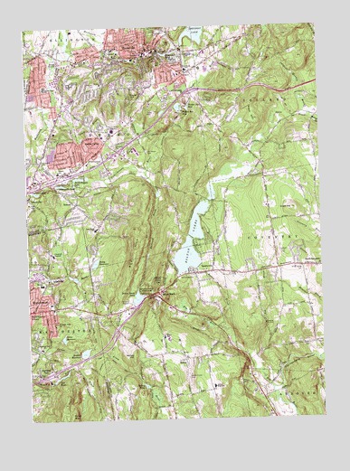
Rockville, CT USGS Topographic Map
Click on map above to begin viewing in our Map Viewer.

This topographic map contains these locations and features:
Feature Name Type Latitude Longitude GNIS ID View Map
Aldon Mill PondReservoirN41.8201°W72.4829°1771393View Map
Aldon Mill Pond DamDamN41.8201°W72.4829°1771392View Map
Ash BrookStreamN41.7701°W72.4065°205128View Map
Bamforth Road CemeteryCemeteryN41.8354°W72.4481°209507View Map
BoltonPopulated PlaceN41.7690°W72.4334°205625View Map
Bolton Center CemeteryCemeteryN41.7634°W72.4324°205626View Map
Bolton Fire DepartmentBuildingN41.7715°W72.4422°2420059View Map
Bolton High SchoolSchoolN41.7604°W72.4212°205627View Map
Bolton LakeReservoirN41.8016°W72.4323°1771176View Map
Bolton LakesReservoirN41.8130°W72.4270°205628View Map
Bolton NotchLocaleN41.7907°W72.4429°205629View Map
Bolton Notch PondLakeN41.7890°W72.4533°205630View Map
Bolton Notch State ParkParkN41.7901°W72.4481°205631View Map
Bolton Pond BrookStreamN41.7773°W72.4162°205632View Map
Bolton Post OfficePost OfficeN41.7909°W72.4421°2783297View Map
Bolton SchoolSchoolN41.7762°W72.4423°205633View Map
Box HillSummitN41.8026°W72.4545°205661View Map
Box Mountain QuarryMineN41.8089°W72.4586°2633485View Map
Buckley Elementary SchoolSchoolN41.7932°W72.4937°205802View Map
Burnap BrookStreamN41.7507°W72.3873°205848View Map
Case PondLakeN41.7643°W72.4857°206054View Map
Case Pond UpperReservoirN41.7622°W72.4890°1771273View Map
Case Pond Upper DamDamN41.7618°W72.4879°1771272View Map
Chapins Meadow BrookStreamN41.8448°W72.3773°206180View Map
Church of ChristChurchN41.7948°W72.4906°1950126View Map
Clarks BrookStreamN41.8304°W72.4562°206308View Map
Crestfield HospitalHospitalN41.8026°W72.4890°206521View Map
Dobsonville PondReservoirN41.8718°W72.4329°1771389View Map
Dobsonville PondLakeN41.8247°W72.4854°206704View Map
Dobsonville Pond DamDamN41.8248°W72.4848°1770597View Map
Elmwood CemeteryCemeteryN41.8370°W72.4620°206947View Map
Faith Baptist ChurchChurchN41.7868°W72.4809°1950233View Map
Fox HillSummitN41.8632°W72.4443°207183View Map
Gages BrookStreamN41.8407°W72.4370°207231View Map
Grant HillSummitN41.8170°W72.3870°207399View Map
Green HillSummitN41.7809°W72.4873°207480View Map
Grove Hill CemeteryCemeteryN41.8641°W72.4366°207543View Map
Heckler FieldAirportN41.8025°W72.3917°213025View Map
Henry ParkParkN41.8601°W72.4445°207789View Map
Highland ParkPopulated PlaceN41.7651°W72.4959°207824View Map
Highland Park SchoolSchoolN41.7729°W72.4945°207825View Map
Hockanum River DamDamN41.8718°W72.4329°1771388View Map
Howard ReservoirReservoirN41.7715°W72.4761°207982View Map
Howard Reservoir DamDamN41.7715°W72.4776°1770220View Map
Lake Street Elementary SchoolSchoolN41.8107°W72.4704°208356View Map
Lower Bolton Lake DamDamN41.7990°W72.4267°1771175View Map
LydallvillePopulated PlaceN41.7954°W72.4904°208640View Map
Manchester Fire Rescue Emergency Medical Services Station 4BuildingN41.7653°W72.4998°2420038View Map
Mount Hope CemeteryCemeteryN41.8180°W72.4989°209081View Map
Northeast Elementary SchoolSchoolN41.8612°W72.4312°209387View Map
Ogden BrookStreamN41.8482°W72.4920°209460View Map
Paper Mill PondLakeN41.8665°W72.4389°209606View Map
Paper Mill Pond DamDamN41.8659°W72.4395°1771390View Map
Porter ReservoirReservoirN41.7761°W72.4850°209947View Map
Porter Reservoir DamDamN41.7762°W72.4859°1770218View Map
QuarryvillePopulated PlaceN41.8645°W72.4212°210048View Map
Quarryville CemeteryCemeteryN41.7959°W72.4304°210049View Map
Railroad BrookStreamN41.8287°W72.4495°210091View Map
Reed HillSummitN41.8454°W72.4023°210155View Map
Risley ReservoirReservoirN41.8002°W72.4707°210202View Map
Risley Reservoir DamDamN41.7984°W72.4720°1770599View Map
RockvillePopulated PlaceN41.8668°W72.4495°210262View Map
Rockville Census Designated PlaceCensusN41.8667°W72.4530°2377857View Map
Rockville General HospitalHospitalN41.8665°W72.4512°2660313View Map
Rockville High SchoolSchoolN41.8565°W72.4806°210263View Map
Saint Bartholomews ChurchChurchN41.7854°W72.4879°1950654View Map
Saint Bernards CemeteryCemeteryN41.8665°W72.4298°210411View Map
Shenipsit Lake DamDamN41.8687°W72.4326°1770595View Map
Silver Street CemeteryCemeteryN41.7973°W72.3829°210866View Map
Skinner Pond Elementary SchoolSchoolN41.8559°W72.4918°210890View Map
Skungamaug RiverStreamN41.7595°W72.3962°212651View Map
South Street CemeteryCemeteryN41.7734°W72.3804°211011View Map
Southwest CemeteryCemeteryN41.8322°W72.4933°211036View Map
Sperry PondLakeN41.7609°W72.4503°211059View Map
Spice BrookStreamN41.8448°W72.3773°211061View Map
Talcott ParkParkN41.8695°W72.4493°211341View Map
Tankerhoosen LakeLakeN41.8269°W72.4775°211353View Map
Tankerhoosen Lake North DamDamN41.8270°W72.4773°1771394View Map
Tolland County Sheriff's OfficeBuildingN41.8660°W72.4471°2754702View Map
Tolland Fire Department Station 340BuildingN41.8449°W72.3867°2420170View Map
Town of BoltonCivilN41.7665°W72.4390°213393View Map
Town of VernonCivilN41.8364°W72.4606°213520View Map
Upper Bolton LakeReservoirN41.8130°W72.4270°1771480View Map
Upper Bolton Lake DamDamN41.8081°W72.4301°1771479View Map
Valley Falls ParkParkN41.8182°W72.4437°211719View Map
VernonPopulated PlaceN41.8187°W72.4795°212582View Map
Vernon CenterPopulated PlaceN41.8370°W72.4720°211726View Map
Vernon Center Middle SchoolSchoolN41.8418°W72.4629°211727View Map
Vernon Fire Marshal's OfficeBuildingN41.8653°W72.4507°2420086View Map
Vernon Middle SchoolSchoolN41.8287°W72.4862°211728View Map
Vernon Police DepartmentBuildingN41.8396°W72.4652°2754718View Map
Vernon Volunteer Fire Department Station 141BuildingN41.8390°W72.4645°2420022View Map
Vernon Volunteer Fire Department Station 241BuildingN41.8230°W72.4838°2420023View Map
Vernon Volunteer Fire Department Station 441BuildingN41.8635°W72.4639°2420030View Map
Vernon Volunteer Fire Department Station 541BuildingN41.8687°W72.4440°2420025View Map
Vernon Volunteer Fire Department Station 641BuildingN41.8403°W72.4649°2420114View Map
Walker Reservoir EastReservoirN41.8494°W72.4307°211773View Map
Walker Reservoir East DamDamN41.8487°W72.4218°1771398View Map
Walker Reservoir WestReservoirN41.8492°W72.4343°211774View Map
WCTF-AM (Vernon)TowerN41.8687°W72.4840°213332View Map
Whites HillSummitN41.7715°W72.4551°212086View Map
Wilson BrookStreamN41.7943°W72.4793°212167View Map

Note: Coordinates in the location and feature list above are referenced to NAD83 datum.


Copyright (C) 2008-2025 Ryan Niemi / Sunset Dynamics ... All Rights Reserved