TopoQuest Logo
Do you find TopoQuest useful?
Help keep TopoQuest running and adding new maps/features by donating!
Bitcoin:  19c7KJd3qBynnjoSw5npx9KScwjBe4ifkT
Litecoin:  LXs6TkuXGGXo1vDsWCkWVdjQX94eUKd6ui
Home View Maps Find Maps Find Places Resources & Links


Stafford Springs, Connecticut Topographic Map

USGS Map Title: Stafford Springs, CT
USGS Map MRC: 41072H3
DRG (GeoTIFF) Download: o41072h3.tif


Neighboring USGS Topographic Map Quads:


  Hampden, MA  
42072A4
 

  Monson, MA  
42072A3


  Ellington, CT  
41072H4
 

  Stafford Springs, CT  
41072H3
 

  Westford, CT  
41072H2
 

  Rockville, CT  
41072G4
 

  Coventry, CT  
41072G3
 

  Spring Hill, CT  
41072G2


Map MRC Location:

N42°
W73°
N42°
W72°
H8 H7 H6 H5 H4 H3 H2 H1
G8 G7 G6 G5 G4 G3 G2 G1
F8 F7 F6 F5 F4 F3 F2 F1
E8 E7 E6 E5 E4 E3 E2 E1
D8 D7 D6 D5 D4 D3 D2 D1
C8 C7 C6 C5 C4 C3 C2 C1
B8 B7 B6 B5 B4 B3 B2 B1
A8 A7 A6 A5 A4 A3 A2 A1
N41°
W73°
N41°
W72°

Stafford Springs, CT USGS 1:24K Topographic Map Preview:
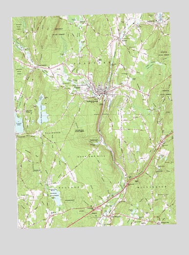
Stafford Springs, CT USGS Topographic Map
Click on map above to begin viewing in our Map Viewer.

This topographic map contains these locations and features:
Feature Name Type Latitude Longitude GNIS ID View Map
Aborn BrookStreamN41.9323°W72.3687°205035View Map
Alden BrookStreamN41.9907°W72.2847°205053View Map
Arnold PondsLakeN41.9420°W72.2682°205120View Map
Baker BrookStreamN41.9520°W72.3017°205203View Map
Bonemill BrookStreamN41.9251°W72.3045°205637View Map
Bradway DamDamN41.9512°W72.3529°1771118View Map
Bradway PondReservoirN41.9751°W72.3362°1771534View Map
Bradway PondLakeN41.9515°W72.3538°205678View Map
Bradway Pond DamDamN41.9521°W72.3514°1771533View Map
Brandy BrookStreamN41.9432°W72.2579°205690View Map
Brooks BrookStreamN41.8990°W72.3504°205752View Map
Buff Cap HillSummitN41.9157°W72.3248°205813View Map
Cedar SwampSwampN41.9682°W72.2676°206103View Map
Cedar SwampSwampN41.9665°W72.2673°206105View Map
Charter BrookStreamN41.8804°W72.3498°206195View Map
Connecticut State Patrol Department Troop CBuildingN41.8832°W72.3232°2754776View Map
Crow HillSummitN41.9934°W72.3445°206540View Map
Crystal LakeReservoirN41.9372°W72.3734°206553View Map
Crystal Lake BrookStreamN41.9687°W72.3604°206554View Map
Crystal Lake DamDamN41.9450°W72.3734°1770851View Map
Dennis PondReservoirN41.9468°W72.2994°206668View Map
Dennis Pond DamDamN41.9491°W72.2982°1770855View Map
Deversky PondReservoirN41.8795°W72.2796°206674View Map
Devils Hopyard SwampSwampN41.9420°W72.3529°206677View Map
Diamond Ledge BrookStreamN41.9695°W72.3531°206683View Map
Edson BrookStreamN41.9657°W72.3331°206902View Map
Ellis BrookStreamN41.9726°W72.3581°206932View Map
Ellis Brook ReservoirReservoirN41.9915°W72.3642°1771115View Map
Ellis DamDamN41.9914°W72.3644°206933View Map
EllithorpePopulated PlaceN41.9951°W72.3140°206934View Map
Ellithorpe DamDamN41.9968°W72.3195°1771120View Map
Ellithorpe ReservoirReservoirN41.9980°W72.3204°1771121View Map
Foster PondLakeN41.9612°W72.2812°207160View Map
Frink BrookStreamN41.9109°W72.2679°207212View Map
Furnace BrookStreamN41.9526°W72.3020°207228View Map
Ginholt PondReservoirN41.9942°W72.3212°207314View Map
Glenville PondReservoirN41.9711°W72.2968°207330View Map
Glenville Pond DamDamN41.9680°W72.2977°1770837View Map
Grapeville BrookStreamN41.8782°W72.3092°207407View Map
Grover BrookStreamN41.8990°W72.3445°207547View Map
Halchek PondReservoirN41.9202°W72.2785°1771498View Map
Halchek Pond DamDamN41.9184°W72.2795°1771497View Map
Hatch BrookStreamN41.9959°W72.2748°207709View Map
Hillside CemeteryCemeteryN41.9947°W72.2847°207848View Map
HydevillePopulated PlaceN41.9932°W72.2762°208054View Map
Hydeville PondReservoirN41.9942°W72.2751°1770850View Map
Hydeville Pond DamDamN41.9934°W72.2753°1770849View Map
Jimmy LedgesBeachN41.9420°W72.2517°208162View Map
Keene BrookStreamN41.9045°W72.2787°208229View Map
Kendall HillSummitN41.9207°W72.3626°208254View Map
Kent Hollow DamDamN41.9804°W72.3663°208272View Map
Labonte BrookStreamN41.8940°W72.3001°208347View Map
Lake View TerracePopulated PlaceN41.9470°W72.3667°208357View Map
McIntyres BrookStreamN41.9501°W72.3706°212875View Map
Memorial HallBuildingN41.9848°W72.2926°1943280View Map
Middle RiverStreamN41.9526°W72.3020°208867View Map
Murry HillSummitN41.9437°W72.3590°209154View Map
Neff HillSummitN41.9243°W72.3448°209202View Map
Nye-Holman State ForestForestN41.9351°W72.3229°209431View Map
Old Stafford Street CemeteryCemeteryN41.9654°W72.2840°209503View Map
OrcuttsPopulated PlaceN41.9768°W72.3217°209525View Map
Orcutts PondReservoirN41.9819°W72.3216°209526View Map
Orcutts Pond DamDamN41.9782°W72.3212°1770833View Map
Parizek PondReservoirN41.8832°W72.2835°209613View Map
Parizek Pond DamDamN41.8821°W72.2849°1771439View Map
Parker MountainSummitN41.9104°W72.2517°209627View Map
Patten BrookStreamN41.9795°W72.3640°209644View Map
Rhode Island MillpondsLakeN41.9601°W72.3204°210170View Map
Rhode Island Ponds DamDamN41.9601°W72.3204°1770845View Map
Riverside PondReservoirN41.9856°W72.2886°210217View Map
Riverside Pond DamDamN41.9854°W72.2901°1770841View Map
Roaring BrookStreamN41.9032°W72.2912°210231View Map
Rockwell HillSummitN41.9493°W72.2706°210264View Map
Ruby BrookStreamN41.9220°W72.2617°210340View Map
Ruby LakeReservoirN41.9145°W72.2601°210341View Map
Saint Edward CemeteryCemeteryN41.9618°W72.3220°210427View Map
School BrookStreamN41.8940°W72.3001°210693View Map
Shenipsit DamDamN41.9769°W72.3340°210803View Map
Shenipsit ReservoirReservoirN41.9773°W72.3331°1771123View Map
Skungamaug CemeteryCemeteryN41.8832°W72.3490°210892View Map
Skungamaug MarshLakeN41.8933°W72.3434°210893View Map
Springs DamDamN41.9518°W72.3179°1770853View Map
Springs PondReservoirN41.9518°W72.3179°1770854View Map
StaffordPopulated PlaceN41.9848°W72.2890°211122View Map
Stafford Ambulance AssociationBuildingN41.9678°W72.3146°2660871View Map
Stafford Fire Department 1 Station 145BuildingN41.9944°W72.2613°2420139View Map
Stafford Fire Department 1 Station 245BuildingN41.9517°W72.3014°2420138View Map
Stafford Police DepartmentBuildingN41.9535°W72.3033°2754739View Map
Stafford SpringsPopulated PlaceN41.9543°W72.3023°211125View Map
Stafford Springs Census Designated PlaceCensusN41.9595°W72.3105°2377866View Map
Stafford Street CemeteryCemeteryN41.9790°W72.2793°211123View Map
StaffordvillePopulated PlaceN41.9940°W72.2587°211126View Map
Staffordville Post OfficePost OfficeN41.9938°W72.2589°2783298View Map
Staffordville Reservoir DamDamN41.9965°W72.2602°1770835View Map
Stoughton BrookStreamN41.9504°W72.2545°211235View Map
Sugar HillSummitN41.8943°W72.3715°211282View Map
Sun Valley LakeReservoirN41.9771°W72.3625°1771486View Map
Sun Valley Lake DamDamN41.9751°W72.3612°1771485View Map
Sweetheart LakeLakeN41.9245°W72.3092°211319View Map
Sweetheart Lake DamDamN41.9242°W72.3080°1771380View Map
Swift Airport (historical)AirportN41.9656°W72.3354°213121View Map
Tolland Fire Department Station 440BuildingN41.9130°W72.3247°2420171View Map
Tolland HillSummitN41.9432°W72.3104°211493View Map
Town of StaffordCivilN41.9875°W72.3123°212349View Map
Town of TollandCivilN41.8786°W72.3648°212667View Map
Town of WillingtonCivilN41.8896°W72.2593°213534View Map
Village HillSummitN41.9415°W72.2898°211740View Map
Warren PondReservoirN41.9629°W72.2988°211823View Map
Warren Pond DamDamN41.9601°W72.2998°1770839View Map
West StaffordPopulated PlaceN41.9707°W72.3551°211995View Map
West Stafford Fire Department Station 44BuildingN41.9686°W72.3439°2420140View Map
West WillingtonPopulated PlaceN41.8812°W72.3020°212007View Map
Whifford HillSummitN41.8915°W72.2590°212064View Map
Whitney DamDamN41.9801°W72.3662°1771112View Map
Whitney ReservoirReservoirN41.9801°W72.3662°1771113View Map
Willington Fire Department 1 Station 113BuildingN41.8914°W72.2905°2420105View Map
Willington HillPopulated PlaceN41.8751°W72.2640°212665View Map

Note: Coordinates in the location and feature list above are referenced to NAD83 datum.


Copyright (C) 2008-2024 Ryan Niemi / Sunset Dynamics ... All Rights Reserved