TopoQuest Logo
Do you find TopoQuest useful?
Help keep TopoQuest running and adding new maps/features by donating!
Bitcoin:  19c7KJd3qBynnjoSw5npx9KScwjBe4ifkT
Litecoin:  LXs6TkuXGGXo1vDsWCkWVdjQX94eUKd6ui
Home View Maps Find Maps Find Places Resources & Links


Elmira, Missouri Topographic Map

USGS Map Title: Elmira, MO
USGS Map MRC: 39094E2
DRG (GeoTIFF) Download: o39094e2.tif


Neighboring USGS Topographic Map Quads:


  Cameron West, MO  
39094F3
 

  Cameron East, MO  
39094F2
 

  Hamilton West, MO  
39094F1
 

  Lathrop, MO  
39094E3
 

  Elmira, MO  
39094E2
 

  Polo, MO  
39094E1
 

  Holt, MO  
39094D3
 

  Lawson, MO  
39094D2
 

  Knoxville, MO  
39094D1


Map MRC Location:

N40°
W95°
N40°
W94°
H8 H7 H6 H5 H4 H3 H2 H1
G8 G7 G6 G5 G4 G3 G2 G1
F8 F7 F6 F5 F4 F3 F2 F1
E8 E7 E6 E5 E4 E3 E2 E1
D8 D7 D6 D5 D4 D3 D2 D1
C8 C7 C6 C5 C4 C3 C2 C1
B8 B7 B6 B5 B4 B3 B2 B1
A8 A7 A6 A5 A4 A3 A2 A1
N39°
W95°
N39°
W94°

Elmira, MO USGS 1:24K Topographic Map Preview:
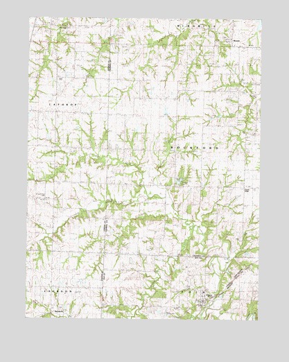
Elmira, MO USGS Topographic Map
Click on map above to begin viewing in our Map Viewer.

This topographic map contains these locations and features:
Feature Name Type Latitude Longitude GNIS ID View Map
Allen CemeteryCemeteryN39.5142°W94.1633°742958View Map
BarnesvillePopulated PlaceN39.5042°W94.2313°740658View Map
Benton School (historical)SchoolN39.5059°W94.1767°713973View Map
Brooking School (historical)SchoolN39.5492°W94.2391°714744View Map
Brushy CreekStreamN39.5392°W94.1596°714900View Map
Burnt ForkStreamN39.5025°W94.1563°715089View Map
Cates CemeteryCemeteryN39.5361°W94.1338°742960View Map
Clay School (historical)SchoolN39.5086°W94.1261°715912View Map
Crooked River CemeteryCemeteryN39.5506°W94.2410°742962View Map
Deer Creek CemeteryCemeteryN39.6211°W94.2294°742963View Map
Deer Creek Union Church (historical)ChurchN39.6207°W94.2301°716806View Map
ElmiraPopulated PlaceN39.5072°W94.1547°717545View Map
Lafayette School (historical)SchoolN39.5919°W94.1790°720735View Map
Log Creek School (historical)SchoolN39.5983°W94.1277°721409View Map
Martins AirportAirportN39.5033°W94.1751°758779View Map
Mayes Homestead AirportAirportN39.5735°W94.1843°758872View Map
MirabilePopulated PlaceN39.6161°W94.1419°730150View Map
Mirabile CemeteryCemeteryN39.6171°W94.1447°2681367View Map
Mirabile Elementary SchoolSchoolN39.6141°W94.1395°747008View Map
Mound School (historical)SchoolN39.5480°W94.1765°722698View Map
Pallas LakeReservoirN39.5276°W94.1317°761269View Map
Pallas Lake DamDamN39.5283°W94.1336°761268View Map
PlainviewPopulated PlaceN39.5950°W94.2347°740180View Map
Plainview School (historical)SchoolN39.5925°W94.2349°724461View Map
Prairie RidgePopulated PlaceN39.5553°W94.1333°738432View Map
Prairie Ridge CemeteryCemeteryN39.5552°W94.1303°2681368View Map
Prairie Ridge School (historical)SchoolN39.5557°W94.1333°724875View Map
Simmons LakeReservoirN39.6245°W94.1259°761668View Map
Sloan CemeteryCemeteryN39.5781°W94.1327°742961View Map
South Prong Crooked RiverStreamN39.5422°W94.1683°738434View Map
Spring BranchStreamN39.5508°W94.1733°738433View Map
Stevenson CreekStreamN39.5508°W94.1852°738435View Map
Timber LakeReservoirN39.5573°W94.1684°758399View Map
Timber Lake DamDamN39.5567°W94.1702°761148View Map
Township of RockfordCivilN39.5700°W94.1519°766369View Map
Village of ElmiraCivilN39.5086°W94.1546°2398814View Map
Zeikle CemeteryCemeteryN39.5336°W94.1355°742959View Map

Note: Coordinates in the location and feature list above are referenced to NAD83 datum.


Copyright (C) 2008-2024 Ryan Niemi / Sunset Dynamics ... All Rights Reserved