TopoQuest Logo
Do you find TopoQuest useful?
Help keep TopoQuest running and adding new maps/features by donating!
Bitcoin:  19c7KJd3qBynnjoSw5npx9KScwjBe4ifkT
Litecoin:  LXs6TkuXGGXo1vDsWCkWVdjQX94eUKd6ui
Home View Maps Find Maps Find Places Resources & Links


Lawson, Missouri Topographic Map

USGS Map Title: Lawson, MO
USGS Map MRC: 39094D2
DRG (GeoTIFF) Download: o39094d2.tif


Neighboring USGS Topographic Map Quads:


  Lathrop, MO  
39094E3
 

  Elmira, MO  
39094E2
 

  Polo, MO  
39094E1
 

  Holt, MO  
39094D3
 

  Lawson, MO  
39094D2
 

  Knoxville, MO  
39094D1
 

  Kearney, MO  
39094C3
 

  Excelsior Springs, MO  
39094C2
 

  Rayville, MO  
39094C1


Map MRC Location:

N40°
W95°
N40°
W94°
H8 H7 H6 H5 H4 H3 H2 H1
G8 G7 G6 G5 G4 G3 G2 G1
F8 F7 F6 F5 F4 F3 F2 F1
E8 E7 E6 E5 E4 E3 E2 E1
D8 D7 D6 D5 D4 D3 D2 D1
C8 C7 C6 C5 C4 C3 C2 C1
B8 B7 B6 B5 B4 B3 B2 B1
A8 A7 A6 A5 A4 A3 A2 A1
N39°
W95°
N39°
W94°

Lawson, MO USGS 1:24K Topographic Map Preview:
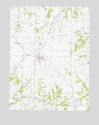
Lawson, MO USGS Topographic Map
Click on map above to begin viewing in our Map Viewer.

This topographic map contains these locations and features:
Feature Name Type Latitude Longitude GNIS ID View Map
Barnesville School (historical)SchoolN39.4931°W94.2388°747032View Map
Bennet School (historical)SchoolN39.4620°W94.1394°747088View Map
Bisbee School (historical)SchoolN39.4836°W94.1374°747086View Map
Butler School (historical)SchoolN39.4695°W94.1822°747087View Map
Canaan Hill ChurchChurchN39.4361°W94.1391°715327View Map
City of LawsonCivilN39.4358°W94.2154°2395650View Map
ClaysvillePopulated PlaceN39.3944°W94.2141°755589View Map
Elmira CampPopulated PlaceN39.4964°W94.1577°717546View Map
Excelsior EstatesPopulated PlaceN39.3903°W94.2077°1699790View Map
Franklin SchoolSchoolN39.4186°W94.2419°718174View Map
Graham School (historical)SchoolN39.4542°W94.1313°747089View Map
Jackson SchoolSchoolN39.3811°W94.1933°720220View Map
LawsonPopulated PlaceN39.4383°W94.2041°720846View Map
Lawson City Reservoir DamDamN39.4567°W94.2019°760428View Map
Lawson Fire and Rescue Protection DistrictBuildingN39.4399°W94.1987°2621032View Map
Lawson High SchoolSchoolN39.4432°W94.1999°2545457View Map
Lawson LakeReservoirN39.4541°W94.2024°760429View Map
Lawson Middle SchoolSchoolN39.4433°W94.1982°2545399View Map
Lawson Police DepartmentBuildingN39.4371°W94.2045°2752484View Map
Lawson Post OfficePost OfficeN39.4389°W94.2040°2782667View Map
Lawson School (historical)SchoolN39.4181°W94.1808°747091View Map
Riggs School (historical)SchoolN39.4625°W94.2386°741439View Map
Salem ChurchChurchN39.3767°W94.2158°725938View Map
Shelton Lake DamDamN39.4483°W94.1986°761708View Map
Southwest Elementary SchoolSchoolN39.4330°W94.2072°2545421View Map
Township of PolkCivilN39.4607°W94.1516°767274View Map
Union School (historical)SchoolN39.4206°W94.1302°747090View Map
VibbardPopulated PlaceN39.3806°W94.1463°740025View Map
Village of Excelsior EstatesCivilN39.3899°W94.2082°2398849View Map
Washington SchoolSchoolN39.3750°W94.2377°728383View Map
Watkins (historical)LocaleN39.4278°W94.1816°740194View Map
Wilderness Camp DamDamN39.4683°W94.1319°761882View Map
Wilderness Camp LakeReservoirN39.4684°W94.1324°761883View Map

Note: Coordinates in the location and feature list above are referenced to NAD83 datum.


Copyright (C) 2008-2024 Ryan Niemi / Sunset Dynamics ... All Rights Reserved