TopoQuest Logo
Do you find TopoQuest useful?
Help keep TopoQuest running and adding new maps/features by donating!
Bitcoin:  19c7KJd3qBynnjoSw5npx9KScwjBe4ifkT
Litecoin:  LXs6TkuXGGXo1vDsWCkWVdjQX94eUKd6ui
Home View Maps Find Maps Find Places Resources & Links


Gresham, Wisconsin Topographic Map

USGS Map Title: Gresham, WI
USGS Map MRC: 44088G7
DRG (GeoTIFF) Download: o44088g7.tif


Neighboring USGS Topographic Map Quads:


  Burney Lake, WI  
44088H8
 

  Neopit, WI  
44088H7
 

  Keshena, WI  
44088H6
 

  Bowler, WI  
44088G8
 

  Gresham, WI  
44088G7
 

  Thornton, WI  
44088G6
 

  Marion, WI  
44088F8
 

  Clintonville North, WI  
44088F7
 

  Embarrass, WI  
44088F6


Map MRC Location:

N45°
W89°
N45°
W88°
H8 H7 H6 H5 H4 H3 H2 H1
G8 G7 G6 G5 G4 G3 G2 G1
F8 F7 F6 F5 F4 F3 F2 F1
E8 E7 E6 E5 E4 E3 E2 E1
D8 D7 D6 D5 D4 D3 D2 D1
C8 C7 C6 C5 C4 C3 C2 C1
B8 B7 B6 B5 B4 B3 B2 B1
A8 A7 A6 A5 A4 A3 A2 A1
N44°
W89°
N44°
W88°

Gresham, WI USGS 1:24K Topographic Map Preview:
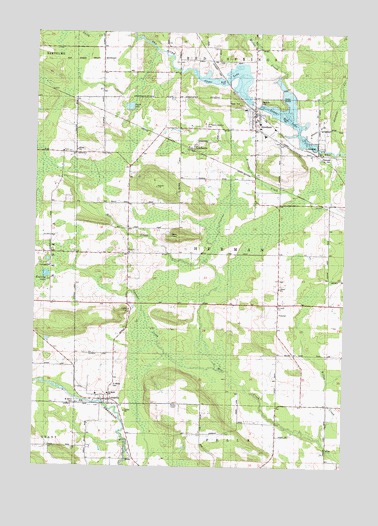
Gresham, WI USGS Topographic Map
Click on map above to begin viewing in our Map Viewer.

This topographic map contains these locations and features:
Feature Name Type Latitude Longitude GNIS ID View Map
Elias ChurchChurchN44.8119°W88.8376°1564508View Map
Elias Lutheran CemeteryCemeteryN44.8116°W88.8357°1876881View Map
Gardner CreekStreamN44.8411°W88.7529°1565405View Map
GreshamPopulated PlaceN44.8530°W88.7882°1581552View Map
Gresham 2WP 1540 DamDamN44.8550°W88.7884°1793072View Map
Gresham Area Fire DepartmentBuildingN44.8535°W88.7868°2696703View Map
Gresham Elementary SchoolSchoolN44.8453°W88.7829°2713215View Map
Gresham High SchoolSchoolN44.8453°W88.7829°2713177View Map
Gresham Pond 147ReservoirN44.8550°W88.7884°1793073View Map
Hermansfort School (historical)SchoolN44.7941°W88.7757°1566321View Map
Hohn School (historical)SchoolN44.8183°W88.8379°1876819View Map
Jung Hemlock-Beech Forest State Natural AreaParkN44.8078°W88.7687°2061600View Map
Kroening LakeLakeN44.8051°W88.8705°1567649View Map
LeopolisPopulated PlaceN44.7680°W88.8448°1567985View Map
Leopolis Census Designated PlaceCensusN44.7659°W88.8446°2585067View Map
Lower Red LakeLakeN44.8507°W88.7726°1577272View Map
LyndhurstPopulated PlaceN44.8419°W88.8126°1568840View Map
Miller CreekStreamN44.8525°W88.7745°1569513View Map
Range Line School (historical)SchoolN44.8397°W88.8593°1876820View Map
Riverside ParkParkN44.8544°W88.7865°1572379View Map
Saint Francis Solanus CemeteryCemeteryN44.8480°W88.8082°1572932View Map
Saint John Lutheran ChurchChurchN44.7966°W88.7770°1573118View Map
Saint Johns CemeteryCemeteryN44.7683°W88.8593°1573073View Map
Saint Johns Hermansfort CemeteryCemeteryN44.7955°W88.7773°1876884View Map
Saint Marys CemeteryCemeteryN44.7736°W88.8437°1573309View Map
Shawano CountyCivilN44.7892°W88.7654°1581117View Map
Smith LakeLakeN44.8535°W88.8377°1574311View Map
Spencer CreekStreamN44.7783°W88.8020°1574526View Map
Town of HermanCivilN44.8108°W88.7979°1583380View Map
Upper Red LakeLakeN44.8607°W88.8003°1577273View Map
Village of GreshamCivilN44.8477°W88.7850°1583326View Map
Willow CreekStreamN44.7574°W88.7588°2784553View Map
Willow Creek School (historical)SchoolN44.7655°W88.7551°1576787View Map

Note: Coordinates in the location and feature list above are referenced to NAD83 datum.


Copyright (C) 2008-2025 Ryan Niemi / Sunset Dynamics ... All Rights Reserved