TopoQuest Logo
Do you find TopoQuest useful?
Help keep TopoQuest running and adding new maps/features by donating!
Bitcoin:  19c7KJd3qBynnjoSw5npx9KScwjBe4ifkT
Litecoin:  LXs6TkuXGGXo1vDsWCkWVdjQX94eUKd6ui
Home View Maps Find Maps Find Places Resources & Links


Escabosa, New Mexico Topographic Map

USGS Map Title: Escabosa, NM
USGS Map MRC: 34106H3
DRG (GeoTIFF) Download: o34106h3.tif


Neighboring USGS Topographic Map Quads:


  Tijeras, NM  
35106A4
 

  Sedillo, NM  
35106A3
 

  Edgewood, NM  
35106A2
 

  Mount Washington, NM  
34106H4
 

  Escabosa, NM  
34106H3
 

  Chilili, NM  
34106H2
 

  Bosque Peak, NM  
34106G4
 

  Tajique, NM  
34106G3
 

  Milbourn Ranch, NM  
34106G2


Map MRC Location:

N35°
W107°
N35°
W106°
H8 H7 H6 H5 H4 H3 H2 H1
G8 G7 G6 G5 G4 G3 G2 G1
F8 F7 F6 F5 F4 F3 F2 F1
E8 E7 E6 E5 E4 E3 E2 E1
D8 D7 D6 D5 D4 D3 D2 D1
C8 C7 C6 C5 C4 C3 C2 C1
B8 B7 B6 B5 B4 B3 B2 B1
A8 A7 A6 A5 A4 A3 A2 A1
N34°
W107°
N34°
W106°

Escabosa, NM USGS 1:24K Topographic Map Preview:
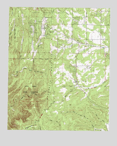
Escabosa, NM USGS Topographic Map
Click on map above to begin viewing in our Map Viewer.

This topographic map contains these locations and features:
Feature Name Type Latitude Longitude GNIS ID View Map
10051 Water WellWellN34.9570°W106.3159°921541View Map
104 Water WellWellN34.9187°W106.2839°921553View Map
105 Water WellWellN34.9301°W106.3061°921556View Map
109 Water WellWellN34.9412°W106.2750°921558View Map
110 Water WellWellN34.9417°W106.2903°921529View Map
114 Water WellWellN34.9800°W106.3000°921525View Map
123 Water WellWellN34.9212°W106.2864°921554View Map
124 Water WellWellN34.9742°W106.3086°921563View Map
182 Water WellWellN34.9639°W106.3475°921561View Map
195 Water WellWellN34.9773°W106.2778°921523View Map
196 Water WellWellN34.9900°W106.2825°921568View Map
204 Water WellWellN34.9850°W106.2836°921566View Map
205 Water WellWellN34.9603°W106.2514°921560View Map
508 Water WellWellN34.9817°W106.3278°921526View Map
71 Water WellWellN34.9862°W106.3270°921567View Map
80 Water WellWellN34.9834°W106.2953°921564View Map
81 Water WellWellN34.9834°W106.2936°921527View Map
82 Water WellWellN34.9842°W106.2950°921565View Map
83 Water WellWellN34.9781°W106.3236°921524View Map
Alley PlaceLocaleN34.9725°W106.2503°903106View Map
Bernalillo County Fire and Rescue Station 11BuildingN34.9787°W106.3212°2657791View Map
Caņon de los AlamitosValleyN34.8767°W106.2659°904527View Map
Caņon de Rajadero de los NegrosValleyN34.8901°W106.2809°904597View Map
Caņon TurrietaValleyN34.9212°W106.2672°904695View Map
Carolino CanyonValleyN34.9378°W106.3445°904783View Map
Carolino Canyon Recreation SiteLocaleN34.9884°W106.3284°937123View Map
Charlies CanyonValleyN34.9198°W106.2897°905040View Map
David CanyonValleyN34.9320°W106.3697°905614View Map
Deadman CampgroundLocaleN34.9992°W106.3317°1986220View Map
Department 11 Water WellWellN34.9789°W106.3217°919121View Map
E-2750 Water WellWellN34.9289°W106.3095°919133View Map
E-2759 Water WellWellN34.9284°W106.3086°919132View Map
E-3176 Water WellWellN34.9128°W106.2792°919130View Map
E-3829 Water WellWellN34.9559°W106.2872°921462View Map
E-3868 Water WellWellN34.9848°W106.2953°921464View Map
E-3928 Water WellWellN34.9537°W106.2747°919134View Map
E-4147 Water WellWellN34.9631°W106.2792°921463View Map
E2290 Water WellWellN34.9237°W106.3086°919131View Map
EscabosaPopulated PlaceN34.9251°W106.2900°918178View Map
Escabosa CemeteryCemeteryN34.9250°W106.2900°931291View Map
Escabosa Post Office (historical)Post OfficeN34.9251°W106.2900°938267View Map
Lujan CanyonValleyN34.9378°W106.3447°908311View Map
MieraPopulated PlaceN34.9650°W106.2914°924512View Map
Oak Flat District Ranger OfficeLocaleN34.9970°W106.3209°913411View Map
Oak Flat Recreation SiteLocaleN34.9987°W106.3186°937058View Map
Ojo de la GoteraSpringN34.9123°W106.3445°932949View Map
Ponderosa PinePopulated PlaceN34.9770°W106.3242°909790View Map
Ponderosa Pine Census Designated PlaceCensusN34.9720°W106.3369°2584184View Map
RG-29443 Water WellWellN34.9562°W106.3170°918894View Map
RG-32850 Water WellWellN34.9795°W106.3170°918701View Map
RG-32865 Water WellWellN34.9570°W106.3434°918896View Map
RG-32865-S Water WellWellN34.9562°W106.3436°918895View Map
RG-33179 Water WellWellN34.9759°W106.3147°918698View Map
RG-35143 Water WellWellN34.9884°W106.3395°918900View Map
RG-35320 Water WellWellN34.9859°W106.3309°918899View Map
RG-36912 Water WellWellN34.9784°W106.3245°918699View Map
RG-41674 Water WellWellN34.9817°W106.3272°918898View Map
RG32865S-2 Water WellWellN34.9698°W106.3450°918897View Map
RG36912 Water WellWellN34.9789°W106.3236°918700View Map
RG38657 Water WellWellN34.9798°W106.3289°918702View Map
S-343 Water WellWellN34.9806°W106.3325°918782View Map
Tranquillo PineLocaleN34.9800°W106.3300°911794View Map
YrisarriPopulated PlaceN34.9664°W106.2914°918412View Map

Note: Coordinates in the location and feature list above are referenced to NAD83 datum.


Copyright (C) 2008-2024 Ryan Niemi / Sunset Dynamics ... All Rights Reserved