TopoQuest Logo
Do you find TopoQuest useful?
Help keep TopoQuest running and adding new maps/features by donating!
Bitcoin:  19c7KJd3qBynnjoSw5npx9KScwjBe4ifkT
Litecoin:  LXs6TkuXGGXo1vDsWCkWVdjQX94eUKd6ui
Home View Maps Find Maps Find Places Resources & Links


Espinosa Ranch, New Mexico Topographic Map

USGS Map Title: Espinosa Ranch, NM
USGS Map MRC: 36107G3
DRG (GeoTIFF) Download: o36107g3.tif


Neighboring USGS Topographic Map Quads:


  Bancos Mesa NW, NM  
36107H4
 

  Bancos Mesa, NM  
36107H3
 

  Carracas Canyon, NM  
36107H2
 

  Gomez Ranch, NM  
36107G4
 

  Espinosa Ranch, NM  
36107G3
 

  Bixler Ranch, NM  
36107G2
 

  Fourmile Canyon, NM  
36107F4
 

  Gobernador, NM  
36107F3
 

  Leandro Canyon, NM  
36107F2


Map MRC Location:

N37°
W108°
N37°
W107°
H8 H7 H6 H5 H4 H3 H2 H1
G8 G7 G6 G5 G4 G3 G2 G1
F8 F7 F6 F5 F4 F3 F2 F1
E8 E7 E6 E5 E4 E3 E2 E1
D8 D7 D6 D5 D4 D3 D2 D1
C8 C7 C6 C5 C4 C3 C2 C1
B8 B7 B6 B5 B4 B3 B2 B1
A8 A7 A6 A5 A4 A3 A2 A1
N36°
W108°
N36°
W107°

Espinosa Ranch, NM USGS 1:24K Topographic Map Preview:
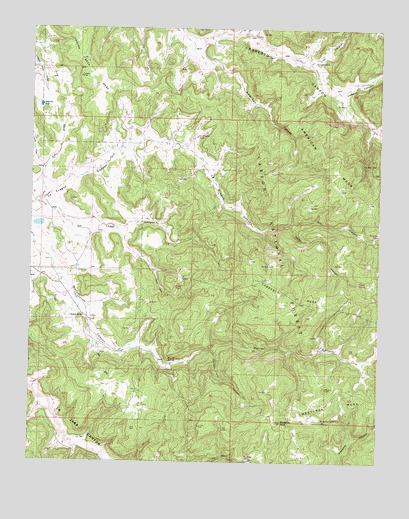
Espinosa Ranch, NM USGS Topographic Map
Click on map above to begin viewing in our Map Viewer.

This topographic map contains these locations and features:
Feature Name Type Latitude Longitude GNIS ID View Map
American CanyonValleyN36.8661°W107.3125°903132View Map
American MesaSummitN36.8375°W107.2700°903137View Map
American TankReservoirN36.8156°W107.2512°936849View Map
Cabrero CanyonValleyN36.8733°W107.2959°904284View Map
Cabresto MesaSummitN36.7978°W107.2825°904288View Map
Cat DrawValleyN36.8256°W107.3723°904834View Map
Cedar CanyonValleyN36.8183°W107.2825°904862View Map
Cedar SpringSpringN36.8019°W107.2553°2678802View Map
Chicken Fry CanyonValleyN36.7822°W107.3112°905086View Map
Espinosa RanchLocaleN36.7917°W107.3564°906195View Map
EspinozaLocaleN36.8083°W107.3506°914328View Map
Jicarilla Ranger DistrictForestN36.8131°W107.2914°2038518View Map
La Baca TankReservoirN36.7510°W107.2979°2678798View Map
La Fragua TankReservoirN36.8436°W107.3167°2678800View Map
Laguna SecaReservoirN36.8526°W107.3724°907801View Map
Laguna Seca MesaSummitN36.8739°W107.3584°907804View Map
Lion CanyonValleyN36.8647°W107.2767°907977View Map
Lion TankReservoirN36.8655°W107.2738°2678801View Map
Lopez CanyonValleyN36.8239°W107.3714°908184View Map
Lopez LakeLakeN36.8184°W107.3728°913453View Map
Manuel SpringSpringN36.7795°W107.3228°908391View Map
Mestenas MesaSummitN36.7711°W107.2692°908661View Map
Mestenas PeakSummitN36.7614°W107.2850°908662View Map
Mesteņas TankReservoirN36.7622°W107.2710°2678797View Map
Oso CanyonValleyN36.8189°W107.2817°909385View Map
PalmerMineN36.8333°W107.3339°916383View Map
Shale TankReservoirN36.8000°W107.3233°2678799View Map
Two Trough SpringSpringN36.7889°W107.2575°913454View Map
Ulibarri CanyonValleyN36.8561°W107.2678°911950View Map

Note: Coordinates in the location and feature list above are referenced to NAD83 datum.


Copyright (C) 2008-2025 Ryan Niemi / Sunset Dynamics ... All Rights Reserved