TopoQuest Logo
Do you find TopoQuest useful?
Help keep TopoQuest running and adding new maps/features by donating!
Bitcoin:  19c7KJd3qBynnjoSw5npx9KScwjBe4ifkT
Litecoin:  LXs6TkuXGGXo1vDsWCkWVdjQX94eUKd6ui
Home View Maps Find Maps Find Places Resources & Links


Gobernador, New Mexico Topographic Map

USGS Map Title: Gobernador, NM
USGS Map MRC: 36107F3
DRG (GeoTIFF) Download: o36107f3.tif


Neighboring USGS Topographic Map Quads:


  Gomez Ranch, NM  
36107G4
 

  Espinosa Ranch, NM  
36107G3
 

  Bixler Ranch, NM  
36107G2
 

  Fourmile Canyon, NM  
36107F4
 

  Gobernador, NM  
36107F3
 

  Leandro Canyon, NM  
36107F2
 

  Santos Peak, NM  
36107E4
 

  Vigas Canyon, NM  
36107E3
 

  Pine Lake, NM  
36107E2


Map MRC Location:

N37°
W108°
N37°
W107°
H8 H7 H6 H5 H4 H3 H2 H1
G8 G7 G6 G5 G4 G3 G2 G1
F8 F7 F6 F5 F4 F3 F2 F1
E8 E7 E6 E5 E4 E3 E2 E1
D8 D7 D6 D5 D4 D3 D2 D1
C8 C7 C6 C5 C4 C3 C2 C1
B8 B7 B6 B5 B4 B3 B2 B1
A8 A7 A6 A5 A4 A3 A2 A1
N36°
W108°
N36°
W107°

Gobernador, NM USGS 1:24K Topographic Map Preview:
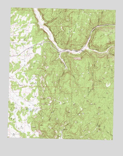
Gobernador, NM USGS Topographic Map
Click on map above to begin viewing in our Map Viewer.

This topographic map contains these locations and features:
Feature Name Type Latitude Longitude GNIS ID View Map
Amarante SpringSpringN36.7086°W107.3084°903127View Map
Arnold Ranch SpringSpringN36.6350°W107.3114°902597View Map
Bubbling SpringSpringN36.7100°W107.2978°911119View Map
Burro SpringSpringN36.6992°W107.3114°902617View Map
Cave SpringSpringN36.6558°W107.2661°914413View Map
Cedar SpringSpringN36.6699°W107.2570°2678790View Map
Cedar Spring CanyonValleyN36.7106°W107.2792°904876View Map
Devils Mesa TankReservoirN36.7264°W107.2594°2678787View Map
Dry Lake CanyonValleyN36.7078°W107.2578°905884View Map
Dry PointCapeN36.7264°W107.3084°905891View Map
Dry Point TankReservoirN36.7278°W107.3056°2678786View Map
Fire CanyonValleyN36.7097°W107.2600°906272View Map
Gobernador (historical)LocaleN36.7120°W107.3517°938815View Map
Gobernador Weather StationLocaleN36.7120°W107.3517°932351View Map
Jog CanyonValleyN36.6933°W107.3087°907387View Map
La Baca CanyonValleyN36.7353°W107.3370°907602View Map
Laguna Seca MesaSummitN36.6583°W107.3192°907803View Map
Lodge SpringSpringN36.6581°W107.2983°2678785View Map
Martinez CanyonValleyN36.6811°W107.2742°908435View Map
Martinez TankReservoirN36.6731°W107.2769°2678789View Map
Mestenas CanyonValleyN36.7347°W107.2709°908660View Map
Muņoz SpringSpringN36.6383°W107.2684°908987View Map
Oso CanyonValleyN36.6258°W107.3123°909383View Map
Pointed TankReservoirN36.6837°W107.2641°2678788View Map
Pueblita CanyonValleyN36.7089°W107.3156°909871View Map
Russell Arnold RanchLocaleN36.6339°W107.3103°910478View Map
Skousen SpringSpringN36.7106°W107.2906°936847View Map
Timez SpringSpringN36.6592°W107.2736°2678784View Map
Trujillo ReservoirReservoirN36.6526°W107.3497°911836View Map
Vaqueros CanyonValleyN36.7145°W107.2837°912077View Map
Vigas MesaSummitN36.6503°W107.2628°912103View Map
Vigas SpringSpringN36.6344°W107.2647°2678783View Map

Note: Coordinates in the location and feature list above are referenced to NAD83 datum.


Copyright (C) 2008-2024 Ryan Niemi / Sunset Dynamics ... All Rights Reserved