TopoQuest Logo
Do you find TopoQuest useful?
Help keep TopoQuest running and adding new maps/features by donating!
Bitcoin:  19c7KJd3qBynnjoSw5npx9KScwjBe4ifkT
Litecoin:  LXs6TkuXGGXo1vDsWCkWVdjQX94eUKd6ui
Home View Maps Find Maps Find Places Resources & Links


Evensville, Tennessee Topographic Map

USGS Map Title: Evensville, TN
USGS Map MRC: 35084E8
DRG (GeoTIFF) Download: o35084e8.tif


Neighboring USGS Topographic Map Quads:


  Melvine, TN  
35085F1
 

  Pennine, TN  
35084F8
 

  Spring City, TN  
35084F7
 

  Morgan Springs, TN  
35085E1
 

  Evensville, TN  
35084E8
 

  Decatur, TN  
35084E7
 

  Graysville, TN  
35085D1
 

  Big Spring, TN  
35084D8
 

  Goodfield, TN  
35084D7


Map MRC Location:

N36°
W85°
N36°
W84°
H8 H7 H6 H5 H4 H3 H2 H1
G8 G7 G6 G5 G4 G3 G2 G1
F8 F7 F6 F5 F4 F3 F2 F1
E8 E7 E6 E5 E4 E3 E2 E1
D8 D7 D6 D5 D4 D3 D2 D1
C8 C7 C6 C5 C4 C3 C2 C1
B8 B7 B6 B5 B4 B3 B2 B1
A8 A7 A6 A5 A4 A3 A2 A1
N35°
W85°
N35°
W84°

Evensville, TN USGS 1:24K Topographic Map Preview:
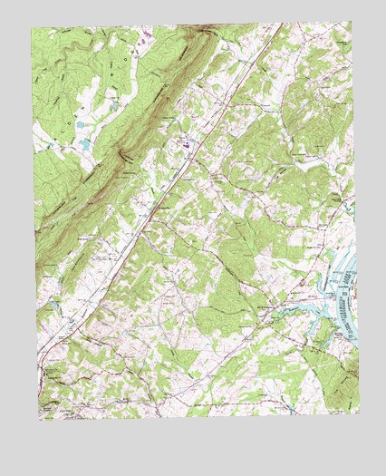
Evensville, TN USGS Topographic Map
Click on map above to begin viewing in our Map Viewer.

This topographic map contains these locations and features:
Feature Name Type Latitude Longitude GNIS ID View Map
Beckett SpringSpringN35.5778°W84.9602°1276738View Map
Bonine CreekStreamN35.6126°W84.9925°1277952View Map
Brown CemeteryCemeteryN35.5362°W84.9472°1278530View Map
Buttram CemeteryCemeteryN35.5184°W84.9961°1279204View Map
Campbell CemeteryCemeteryN35.5340°W84.9041°1279427View Map
Cat HollowValleyN35.5802°W84.8982°1326643View Map
City of Dayton - Rhea County LandfillLocaleN35.5597°W84.9119°2677800View Map
Clear Creek ChurchChurchN35.5598°W84.8891°1305955View Map
Clear Creek GulfValleyN35.6195°W84.9212°1280666View Map
Clear Creek MillLocaleN35.5823°W84.8994°1280668View Map
Clear Creek School (historical)SchoolN35.5606°W84.9019°1320194View Map
Clear Creek SpringsSpringN35.5681°W84.8797°1280671View Map
Collins SpringSpringN35.5951°W84.9448°1281016View Map
Commissioner District 3CivilN35.6100°W84.8947°2464189View Map
Commissioner District 4CivilN35.5564°W84.9752°2464079View Map
ConcordPopulated PlaceN35.5976°W84.9099°1314876View Map
Concord School (historical)SchoolN35.5984°W84.9122°1320195View Map
Cooper CreekStreamN35.6237°W84.9308°1269489View Map
Crow HollowValleyN35.5287°W84.9837°1281741View Map
Dayton Golf and Country ClubLocaleN35.5531°W84.9722°1282227View Map
Detheridge BranchStreamN35.6226°W84.9741°1282372View Map
Dyers CemeteryCemeteryN35.5048°W84.9819°1283266View Map
Evens CemeteryCemeteryN35.5590°W84.9580°1283917View Map
EvensvillePopulated PlaceN35.5645°W84.9547°1283918View Map
Evensville Elementary SchoolSchoolN35.5687°W84.9597°1320208View Map
Evensville MineMineN35.5826°W84.9605°1320209View Map
Evensville Post OfficePost OfficeN35.5797°W84.9392°1651382View Map
Goat Knob School (historical)SchoolN35.5603°W84.8991°1320214View Map
Grassy BranchStreamN35.5159°W84.9272°1285875View Map
Hazel Ridge ShoalsBarN35.5459°W84.8777°1643456View Map
Hazelrigs Ferry (historical)CrossingN35.5248°W84.8763°1643457View Map
Hazelwood CemeteryCemeteryN35.5240°W84.8808°1287266View Map
High Point ChurchChurchN35.6045°W84.8880°1287713View Map
Hill LakeReservoirN35.5368°W84.9930°1306572View Map
Howerton CemeteryCemeteryN35.5765°W84.9416°1288567View Map
Huckleberry PondSwampN35.6172°W84.8760°1288592View Map
Hurst CemeteryCemeteryN35.5712°W84.9099°1288844View Map
Kelly Grove ChurchChurchN35.5009°W84.9850°1290036View Map
Kelly Grove School (historical)SchoolN35.5006°W84.9861°1320223View Map
Lake Hill DamDamN35.5367°W84.9915°1307130View Map
Locke CemeteryCemeteryN35.5328°W84.8966°1291763View Map
Maple Springs ChurchChurchN35.5006°W84.8863°1292638View Map
Monmouth Presbyterian ChurchChurchN35.5342°W84.9061°1320231View Map
Montgomery CemeteryCemeteryN35.5534°W84.8886°1294196View Map
Mynatt CemeteryCemeteryN35.5317°W84.9094°1295190View Map
Newby CemeteryCemeteryN35.6023°W84.9694°1295683View Map
Norman CemeteryCemeteryN35.5456°W84.9924°1295819View Map
Norman ChapelChurchN35.5498°W84.9911°1295823View Map
Norman Chapel School (historical)SchoolN35.5501°W84.9916°1320238View Map
Oak Hill ChurchChurchN35.5437°W84.9461°1296144View Map
Oak Hill School (historical)SchoolN35.5426°W84.9455°1320241View Map
Old WashingtonPopulated PlaceN35.5345°W84.9072°1296394View Map
Paine CemeteryCemeteryN35.5587°W84.9752°1296653View Map
Pierce CemeteryCemeteryN35.5890°W84.9427°1297416View Map
Pleasant Dale ChurchChurchN35.5823°W84.8888°1297786View Map
Pleasant Dale School (historical)SchoolN35.5817°W84.8880°1320248View Map
Polecat BranchStreamN35.6212°W84.9697°1298038View Map
Porter CemeteryCemeteryN35.5278°W84.9649°1298253View Map
Pritchett CemeteryCemeteryN35.5987°W84.8822°1298549View Map
Rhea CountyCivilN35.6087°W84.9244°1639784View Map
Rhea County Ambulance ServiceBuildingN35.5310°W84.9809°2697444View Map
Rhea County Fire DepartmentBuildingN35.5897°W84.9470°2654465View Map
Rhea County Fire Department Station 745 Evensville Fire DistrictBuildingN35.5908°W84.9430°2654899View Map
Rhea County High SchoolSchoolN35.5862°W84.9400°1320255View Map
Rhea Medical CenterHospitalN35.5291°W84.9819°1299271View Map
Robinson LandingLocaleN35.5265°W84.8830°1315821View Map
Rockhouse BranchStreamN35.6148°W84.9869°1299813View Map
Saint Bridget ChurchChurchN35.5134°W84.9952°1300425View Map
Sentinel HeightsPopulated PlaceN35.5026°W84.9988°1301067View Map
Slave CemeteryCemeteryN35.5195°W84.8774°1270494View Map
Smyrna CemeteryCemeteryN35.5776°W84.9294°1320277View Map
Smyrna ChurchChurchN35.5762°W84.9297°1303700View Map
Smyrna Lookout TowerTowerN35.5826°W84.9222°1647753View Map
Smyrna School (historical)SchoolN35.5715°W84.9274°1320278View Map
Sneed CemeteryCemeteryN35.5384°W84.9497°1270768View Map
Stewart BranchStreamN35.5284°W84.9877°1271357View Map
T Industries LakeReservoirN35.5875°W84.9794°1301944View Map
T Industries Lake DamDamN35.5884°W84.9783°1301945View Map
The KnobsSummitN35.5112°W84.8788°1304057View Map
The ShinboneRidgeN35.5501°W84.9819°1304061View Map
Thorny BranchStreamN35.5315°W84.8894°1272575View Map
Valley Grove ChurchChurchN35.5767°W84.9625°1273336View Map
Valley School (historical)SchoolN35.5265°W84.9819°1320285View Map
Vaughn CemeteryCemeteryN35.5853°W84.8905°1273407View Map
Vaughn School (historical)SchoolN35.6034°W84.8883°1320286View Map
Walker CemeteryCemeteryN35.5248°W84.9897°1273589View Map
Walnut Grove ChurchChurchN35.5170°W84.9977°1273721View Map
Walnut Grove School (historical)SchoolN35.5165°W84.9983°1320289View Map
Washington Baptist ChurchChurchN35.5342°W84.9074°1320290View Map
Washington CreekStreamN35.5278°W84.8822°1304397View Map
Washington FerryCrossingN35.5378°W84.8838°1304398View Map
Washington LandingLocaleN35.5376°W84.8833°1320291View Map
Washington SchoolSchoolN35.5392°W84.9005°1304399View Map
Waterhouse CemeteryCemeteryN35.5281°W84.9158°1273896View Map
Webb CemeteryCemeteryN35.5648°W84.9319°1274013View Map
Webb SpringSpringN35.5572°W84.9789°1274041View Map
White Oak ChurchChurchN35.5198°W84.9661°1304524View Map
Yarborough BranchStreamN35.5706°W84.9519°1275231View Map
Yarborough GulfValleyN35.5809°W84.9586°1275232View Map

Note: Coordinates in the location and feature list above are referenced to NAD83 datum.


Copyright (C) 2008-2025 Ryan Niemi / Sunset Dynamics ... All Rights Reserved