TopoQuest Logo
Do you find TopoQuest useful?
Help keep TopoQuest running and adding new maps/features by donating!
Bitcoin:  19c7KJd3qBynnjoSw5npx9KScwjBe4ifkT
Litecoin:  LXs6TkuXGGXo1vDsWCkWVdjQX94eUKd6ui
Home View Maps Find Maps Find Places Resources & Links


Ewell, Alabama Topographic Map

USGS Map Title: Ewell, AL
USGS Map MRC: 31085D5
DRG (GeoTIFF) Download: o31085d5.tif


Neighboring USGS Topographic Map Quads:


  Ariton, AL  
31085E6
 

  Skipperville, AL  
31085E5
 

  Clopton, AL  
31085E4
 

  Ozark, AL  
31085D6
 

  Ewell, AL  
31085D5
 

  Echo, AL  
31085D4
 

  Daleville, AL  
31085C6
 

  Pinckard, AL  
31085C5
 

  Midland City, AL  
31085C4


Map MRC Location:

N32°
W86°
N32°
W85°
H8 H7 H6 H5 H4 H3 H2 H1
G8 G7 G6 G5 G4 G3 G2 G1
F8 F7 F6 F5 F4 F3 F2 F1
E8 E7 E6 E5 E4 E3 E2 E1
D8 D7 D6 D5 D4 D3 D2 D1
C8 C7 C6 C5 C4 C3 C2 C1
B8 B7 B6 B5 B4 B3 B2 B1
A8 A7 A6 A5 A4 A3 A2 A1
N31°
W86°
N31°
W85°

Ewell, AL USGS 1:24K Topographic Map Preview:
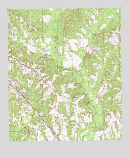
Ewell, AL USGS Topographic Map
Click on map above to begin viewing in our Map Viewer.

This topographic map contains these locations and features:
Feature Name Type Latitude Longitude GNIS ID View Map
Bethel Church (historical)ChurchN31.3904°W85.5913°157651View Map
Bethel United Methodist ChurchChurchN31.4735°W85.5105°155852View Map
Big CreekStreamN31.4168°W85.5383°114263View Map
Blackwell FieldAirportN31.4345°W85.6229°129402View Map
Brown School (historical)SchoolN31.4196°W85.5291°133462View Map
Browns Church (historical)ChurchN31.4199°W85.5299°157652View Map
Browns CrossroadPopulated PlaceN31.4163°W85.5274°149938View Map
Carver Johnson Lake DamDamN31.4668°W85.5949°129844View Map
Cedar CreekStreamN31.4893°W85.5202°115747View Map
Chalkhead Baptist ChurchChurchN31.4085°W85.5522°155020View Map
Chitty BridgeBridgeN31.4752°W85.5302°133470View Map
Choctawhatchee Volunteer Fire DepartmentBuildingN31.4227°W85.5212°2691255View Map
Corinth Free Will Baptist ChurchChurchN31.3960°W85.5030°155859View Map
Dale CountyCivilN31.4318°W85.6110°161548View Map
Dale County Christian SchoolSchoolN31.4204°W85.5713°133475View Map
EwellPopulated PlaceN31.4216°W85.5747°151764View Map
Ewell Assembly of God ChurchChurchN31.4313°W85.5508°155939View Map
Ewell Bible Baptist ChurchChurchN31.4204°W85.5716°155938View Map
Ewell Fire DepartmentBuildingN31.4247°W85.5765°2691085View Map
Ewell Methodist ChurchChurchN31.4227°W85.5785°133486View Map
Freedom ChurchChurchN31.4771°W85.6010°1699898View Map
Friendship ChurchChurchN31.3907°W85.5913°118663View Map
Heart of Dixie Hunting ClubLocaleN31.4910°W85.5916°133495View Map
Hidden Springs AirparkAirportN31.4917°W85.5336°2717149View Map
Holy ChurchChurchN31.4388°W85.5933°120305View Map
Hunt AHP AirportAirportN31.3835°W85.5833°129399View Map
James Crooks LakeReservoirN31.3767°W85.5736°129790View Map
James Crooks Lake DamDamN31.3752°W85.5749°129789View Map
Johnsons PondReservoirN31.4703°W85.5954°151905View Map
Johnstown CemeteryCemeteryN31.4379°W85.5905°157654View Map
Judy CreekStreamN31.4368°W85.5463°155119View Map
Klondike CreekStreamN31.3843°W85.6138°121267View Map
Klondike School (historical)SchoolN31.3977°W85.5855°157655View Map
Klondyke Baptist ChurchChurchN31.3791°W85.6063°155808View Map
Klondyke SpringsSpringN31.3913°W85.6033°133498View Map
Lee CemeteryCemeteryN31.3918°W85.5905°1699903View Map
MabsonPopulated PlaceN31.4682°W85.5630°122134View Map
Mabson United Methodist ChurchChurchN31.4682°W85.5619°155940View Map
Middle CreekStreamN31.4110°W85.5341°122684View Map
Mims Family CemeteryCemeteryN31.4089°W85.5745°1699907View Map
Newman Family CemeteryCemeteryN31.3851°W85.5702°1699912View Map
Newton PondReservoirN31.4355°W85.5195°123933View Map
Ozark Country ClubLocaleN31.4516°W85.6108°164395View Map
Panther CreekStreamN31.4571°W85.5708°163117View Map
Pleasant Grove Primitive Baptist ChurchChurchN31.4352°W85.5883°152971View Map
Rocky Mount Baptist ChurchChurchN31.4796°W85.5999°155914View Map
Rocky Mount School (historical)SchoolN31.4799°W85.5988°133543View Map
Sevenmile CreekStreamN31.4924°W85.5741°153372View Map
Southside Baptist ChurchChurchN31.4168°W85.6124°155922View Map
Spear BranchStreamN31.4043°W85.5297°133555View Map
Spring Hill ChurchChurchN31.3835°W85.6060°127245View Map
Telico BranchStreamN31.4752°W85.5302°133563View Map
Union Grove ChurchChurchN31.3991°W85.5844°128310View Map
Union Hill ChurchChurchN31.4813°W85.5385°133565View Map
Vivian B Adams SchoolSchoolN31.4513°W85.5866°133566View Map
Woodham CemeteryCemeteryN31.3753°W85.5757°129191View Map
Zion ChurchChurchN31.3910°W85.5913°133569View Map

Note: Coordinates in the location and feature list above are referenced to NAD83 datum.


Copyright (C) 2008-2025 Ryan Niemi / Sunset Dynamics ... All Rights Reserved