TopoQuest Logo
Do you find TopoQuest useful?
Help keep TopoQuest running and adding new maps/features by donating!
Bitcoin:  19c7KJd3qBynnjoSw5npx9KScwjBe4ifkT
Litecoin:  LXs6TkuXGGXo1vDsWCkWVdjQX94eUKd6ui
Home View Maps Find Maps Find Places Resources & Links


Fair Haven, Illinois Topographic Map

USGS Map Title: Fair Haven, IL
USGS Map MRC: 41089H8
DRG (GeoTIFF) Download: o41089h8.tif


Neighboring USGS Topographic Map Quads:


  Wacker, IL  
42090A1
 

  Mount Carroll, IL  
42089A8
 

  Lanark, IL  
42089A7
 

  Thomson, IL  
41090H1
 

  Fair Haven, IL  
41089H8
 

  Milledgeville, IL  
41089H7
 

  Union Grove, IL  
41090G1
 

  Morrison, IL  
41089G8
 

  Como, IL  
41089G7


Map MRC Location:

N42°
W90°
N42°
W89°
H8 H7 H6 H5 H4 H3 H2 H1
G8 G7 G6 G5 G4 G3 G2 G1
F8 F7 F6 F5 F4 F3 F2 F1
E8 E7 E6 E5 E4 E3 E2 E1
D8 D7 D6 D5 D4 D3 D2 D1
C8 C7 C6 C5 C4 C3 C2 C1
B8 B7 B6 B5 B4 B3 B2 B1
A8 A7 A6 A5 A4 A3 A2 A1
N41°
W90°
N41°
W89°

Fair Haven, IL USGS 1:24K Topographic Map Preview:
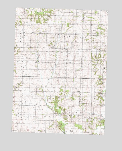
Fair Haven, IL USGS Topographic Map
Click on map above to begin viewing in our Map Viewer.

This topographic map contains these locations and features:
Feature Name Type Latitude Longitude GNIS ID View Map
Center Clyde CemeteryCemeteryN41.8770°W89.9546°1954902View Map
Center Clyde School (historical)SchoolN41.8986°W89.9485°405789View Map
Clyde ChurchChurchN41.9161°W89.9676°406274View Map
Clyde Methodist CemeteryCemeteryN41.8772°W89.9546°406273View Map
Cobb School (historical)SchoolN41.9161°W89.9887°406315View Map
Fair HavenPopulated PlaceN41.9456°W89.9293°408173View Map
Fair Haven Center School (historical)SchoolN41.9747°W89.9182°408174View Map
Fairhaven CemeteryCemeteryN41.9467°W89.9290°1785415View Map
Fox School (historical)SchoolN41.9453°W89.9618°408643View Map
Franklin CornersPopulated PlaceN41.9170°W89.9107°408663View Map
Hartman School (historical)SchoolN41.9759°W89.9571°409890View Map
IdealPopulated PlaceN41.9750°W89.9882°422976View Map
Jackson School (historical)SchoolN41.9753°W89.8807°411009View Map
Jefferson School (historical)SchoolN41.9453°W89.8912°411078View Map
Johnsons Creek Post Office (historical)Post OfficeN41.9600°W89.9885°1785419View Map
North Clyde School (historical)SchoolN41.9156°W89.9496°414581View Map
Schultz QuarryMineN41.9173°W89.8815°1968082View Map
Township of ClydeCivilN41.8880°W89.9200°428824View Map
Township of FairhavenCivilN41.9767°W89.9192°428986View Map
UstickPopulated PlaceN41.8839°W89.9921°423269View Map
White PigeonPopulated PlaceN41.8903°W89.8912°423306View Map
York School (historical)SchoolN41.9459°W89.9979°421585View Map

Note: Coordinates in the location and feature list above are referenced to NAD83 datum.


Copyright (C) 2008-2025 Ryan Niemi / Sunset Dynamics ... All Rights Reserved