TopoQuest Logo
Do you find TopoQuest useful?
Help keep TopoQuest running and adding new maps/features by donating!
Bitcoin:  19c7KJd3qBynnjoSw5npx9KScwjBe4ifkT
Litecoin:  LXs6TkuXGGXo1vDsWCkWVdjQX94eUKd6ui
Home View Maps Find Maps Find Places Resources & Links


Milledgeville, Illinois Topographic Map

USGS Map Title: Milledgeville, IL
USGS Map MRC: 41089H7
DRG (GeoTIFF) Download: o41089h7.tif


Neighboring USGS Topographic Map Quads:


  Mount Carroll, IL  
42089A8
 

  Lanark, IL  
42089A7
 

  Brookville, IL  
42089A6
 

  Fair Haven, IL  
41089H8
 

  Milledgeville, IL  
41089H7
 

  Hazelhurst, IL  
41089H6
 

  Morrison, IL  
41089G8
 

  Como, IL  
41089G7
 

  Sterling, IL  
41089G6


Map MRC Location:

N42°
W90°
N42°
W89°
H8 H7 H6 H5 H4 H3 H2 H1
G8 G7 G6 G5 G4 G3 G2 G1
F8 F7 F6 F5 F4 F3 F2 F1
E8 E7 E6 E5 E4 E3 E2 E1
D8 D7 D6 D5 D4 D3 D2 D1
C8 C7 C6 C5 C4 C3 C2 C1
B8 B7 B6 B5 B4 B3 B2 B1
A8 A7 A6 A5 A4 A3 A2 A1
N41°
W90°
N41°
W89°

Milledgeville, IL USGS 1:24K Topographic Map Preview:
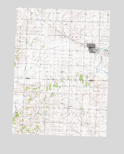
Milledgeville, IL USGS Topographic Map
Click on map above to begin viewing in our Map Viewer.

This topographic map contains these locations and features:
Feature Name Type Latitude Longitude GNIS ID View Map
Bethel CemeteryCemeteryN41.9450°W89.7832°404278View Map
Cemeter Genessee CemeteryCemeteryN41.9025°W89.8412°1954889View Map
Chambers School (historical)SchoolN41.9747°W89.8448°405933View Map
Colcord CemeteryCemeteryN41.8803°W89.8384°405343View Map
ColetaPopulated PlaceN41.9023°W89.8023°406361View Map
Coleta Fire DepartmentBuildingN41.9019°W89.8024°2640627View Map
Dutchtown Brethern CemeteryCemeteryN41.9742°W89.8176°1785411View Map
Dutchtown ChurchChurchN41.9750°W89.8176°407545View Map
Elm School (historical)SchoolN41.9214°W89.8615°407942View Map
Genesee Grove ChurchChurchN41.9028°W89.8423°408939View Map
Hazel Green CemeteryCemeteryN41.9239°W89.8104°1954893View Map
Hazel Green School (historical)SchoolN41.9245°W89.8082°409987View Map
Liberty School (historical)SchoolN41.8792°W89.8332°412034View Map
Little Spring CreekStreamN41.8820°W89.8748°412418View Map
MilledgevillePopulated PlaceN41.9634°W89.7746°413566View Map
Milledgeville Brethren ChurchChurchN41.9645°W89.7748°1968147View Map
Milledgeville City PoliceBuildingN41.9625°W89.7743°2757070View Map
Milledgeville Elementary SchoolSchoolN41.9673°W89.7721°1785424View Map
Milledgeville Farmers ElevatorLocaleN41.9622°W89.7769°2681016View Map
Milledgeville Fire Protection DistrictBuildingN41.9632°W89.7755°2640544View Map
Milledgeville Post OfficePost OfficeN41.9627°W89.7756°1785425View Map
Otter CreekStreamN41.9392°W89.8632°415220View Map
Otter Creek School (historical)SchoolN41.9464°W89.8326°415222View Map
Salem School (historical)SchoolN41.8950°W89.7651°417888View Map
Steuben School (historical)SchoolN41.9236°W89.7682°419109View Map
Township of GeneseeCivilN41.8874°W89.8037°429044View Map
Township of WysoxCivilN41.9766°W89.8021°429963View Map
Trinity Lutheran ChurchChurchN41.9661°W89.7796°1968148View Map
Village of ColetaCivilN41.9026°W89.8002°2398597View Map
Village of MilledgevilleCivilN41.9637°W89.7747°2399354View Map
Walker School (historical)SchoolN41.9886°W89.8118°420416View Map
Wood School (historical)SchoolN41.9459°W89.7976°421412View Map

Note: Coordinates in the location and feature list above are referenced to NAD83 datum.


Copyright (C) 2008-2025 Ryan Niemi / Sunset Dynamics ... All Rights Reserved