TopoQuest Logo
Do you find TopoQuest useful?
Help keep TopoQuest running and adding new maps/features by donating!
Bitcoin:  19c7KJd3qBynnjoSw5npx9KScwjBe4ifkT
Litecoin:  LXs6TkuXGGXo1vDsWCkWVdjQX94eUKd6ui
Home View Maps Find Maps Find Places Resources & Links


Morrison, Illinois Topographic Map

USGS Map Title: Morrison, IL
USGS Map MRC: 41089G8
DRG (GeoTIFF) Download: o41089g8.tif


Neighboring USGS Topographic Map Quads:


  Thomson, IL  
41090H1
 

  Fair Haven, IL  
41089H8
 

  Milledgeville, IL  
41089H7
 

  Union Grove, IL  
41090G1
 

  Morrison, IL  
41089G8
 

  Como, IL  
41089G7
 

  Erie, IL  
41090F1
 

  Prophetstown, IL  
41089F8
 

  Tampico, IL  
41089F7


Map MRC Location:

N42°
W90°
N42°
W89°
H8 H7 H6 H5 H4 H3 H2 H1
G8 G7 G6 G5 G4 G3 G2 G1
F8 F7 F6 F5 F4 F3 F2 F1
E8 E7 E6 E5 E4 E3 E2 E1
D8 D7 D6 D5 D4 D3 D2 D1
C8 C7 C6 C5 C4 C3 C2 C1
B8 B7 B6 B5 B4 B3 B2 B1
A8 A7 A6 A5 A4 A3 A2 A1
N41°
W90°
N41°
W89°

Morrison, IL USGS 1:24K Topographic Map Preview:
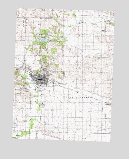
Morrison, IL USGS Topographic Map
Click on map above to begin viewing in our Map Viewer.

This topographic map contains these locations and features:
Feature Name Type Latitude Longitude GNIS ID View Map
Annan Grist MillLocaleN41.8161°W89.9807°1823990View Map
Bethesda Lutheran ChurchChurchN41.8056°W89.9721°1823994View Map
Brick ChurchChurchN41.8653°W89.9879°404840View Map
Church of Saint AnneChurchN41.8103°W89.9648°1823998View Map
City of MorrisonCivilN41.8077°W89.9617°2395409View Map
Delhi School (historical)SchoolN41.7723°W89.9973°407107View Map
Ebenezer Reformed ChurchChurchN41.8048°W89.9657°1824006View Map
Emmanuel Reformed ChurchChurchN41.8067°W89.9662°1824007View Map
First Baptist ChurchChurchN41.8034°W89.9582°1824015View Map
First Presbyterian ChurchChurchN41.8100°W89.9662°1824025View Map
French CreekStreamN41.7953°W89.9723°408741View Map
Grove Hill CemeteryCemeteryN41.8153°W89.9618°1824034View Map
Heaton CemeteryCemeteryN41.8372°W89.9307°410008View Map
Hiddleson School (historical)SchoolN41.8298°W89.9207°410201View Map
Humphrey School (historical)SchoolN41.7725°W89.9007°410683View Map
James School (historical)SchoolN41.8511°W89.9112°411030View Map
Kelly ParkParkN41.8139°W89.9604°1824045View Map
Knox School (historical)SchoolN41.8031°W89.8973°411590View Map
Lake CarltonReservoirN41.8451°W89.9656°1691657View Map
Lake Carlton DamDamN41.8434°W89.9618°1691656View Map
Little Rock CreekStreamN41.8609°W89.9223°412403View Map
MalvernPopulated PlaceN41.8553°W89.8868°412878View Map
Malvern CemeteryCemeteryN41.8622°W89.8809°1954903View Map
McAllister School (historical)SchoolN41.7723°W89.9207°413179View Map
Minnonite CemeteryCemeteryN41.8647°W89.9882°1954906View Map
MorrisonPopulated PlaceN41.8098°W89.9651°413843View Map
Morrison Brethren in Christ ChurchChurchN41.8095°W89.9637°1824062View Map
Morrison Christian Reformed ChurchChurchN41.8061°W89.9718°1824063View Map
Morrison Community HospitalHospitalN41.8089°W89.9578°1824064View Map
Morrison Country ClubLocaleN41.8125°W89.9840°1824065View Map
Morrison Fire DepartmentBuildingN41.8099°W89.9683°2640161View Map
Morrison High SchoolSchoolN41.7995°W89.9701°1824066View Map
Morrison Institute of TechnologySchoolN41.7967°W89.9660°1824067View Map
Morrison Junior High SchoolSchoolN41.8020°W89.9665°1824068View Map
Morrison Police DepartmentBuildingN41.8099°W89.9680°2756722View Map
Morrison Post OfficePost OfficeN41.8102°W89.9689°1824069View Map
Morrison-Rockwood State ParkParkN41.8492°W89.9654°1706187View Map
Mount Pleasant Center School (historical)SchoolN41.8003°W89.9185°414046View Map
Norrish AuditoriumBuildingN41.8106°W89.9657°1824072View Map
Northside SchoolSchoolN41.8128°W89.9640°1824074View Map
Pleasant View Nursing HomeHospitalN41.8123°W89.9526°1824079View Map
Prairie Hill Recycling and Disposal FacilityLocaleN41.7994°W89.8822°2680791View Map
Resthaven Nursing HomeHospitalN41.8045°W89.9573°1824083View Map
Richman School (historical)SchoolN41.7536°W89.9496°416615View Map
Rockwood Field (historical)AirportN41.8523°W89.9560°1824093View Map
Round Grove CemeteryCemeteryN41.7925°W89.8868°416984View Map
Saint Marys Catholic ChurchChurchN41.8095°W89.9651°1824103View Map
Saint Peters Lutheran ChurchChurchN41.8120°W89.9540°1824104View Map
South Clyde School (historical)SchoolN41.8731°W89.9451°418740View Map
Southside SchoolSchoolN41.8059°W89.9662°1824109View Map
Township of Mount PleasantCivilN41.8012°W89.9203°429407View Map
Union Grove CemeteryCemeteryN41.8261°W89.9979°420074View Map
UnionvillePopulated PlaceN41.8192°W89.9826°420148View Map
Upton School (historical)SchoolN41.7723°W89.9501°420179View Map
Waterworks ParkParkN41.8059°W89.9765°1824123View Map
West Clyde School (historical)SchoolN41.8667°W89.9540°420811View Map
Whiteside CountyCivilN41.7563°W89.9141°1785167View Map
Whiteside County CourthouseBuildingN41.8106°W89.9640°1824125View Map
Whiteside County Fair GroundsParkN41.8023°W89.9721°1824126View Map
Whiteside County Sheriff's OfficeBuildingN41.8102°W89.9640°2757136View Map
WZZT-FM (Morrison)TowerN41.8378°W89.9248°428248View Map

Note: Coordinates in the location and feature list above are referenced to NAD83 datum.


Copyright (C) 2008-2025 Ryan Niemi / Sunset Dynamics ... All Rights Reserved