TopoQuest Logo
Do you find TopoQuest useful?
Help keep TopoQuest running and adding new maps/features by donating!
Bitcoin:  19c7KJd3qBynnjoSw5npx9KScwjBe4ifkT
Litecoin:  LXs6TkuXGGXo1vDsWCkWVdjQX94eUKd6ui
Home View Maps Find Maps Find Places Resources & Links


Fairdale, Oregon Topographic Map

USGS Map Title: Fairdale, OR
USGS Map MRC: 45123C3
DRG (GeoTIFF) Download: o45123c3.tif


Neighboring USGS Topographic Map Quads:


  Gobblers Knob, OR  
45123D4
 

  Turner Creek, OR  
45123D3
 

  Gaston, OR  
45123D2
 

  Trask Mountain, OR  
45123C4
 

  Fairdale, OR  
45123C3
 

  Carlton, OR  
45123C2
 

  Stony Mountain, OR  
45123B4
 

  Muddy Valley, OR  
45123B3
 

  McMinnville, OR  
45123B2


Map MRC Location:

N46°
W124°
N46°
W123°
H8 H7 H6 H5 H4 H3 H2 H1
G8 G7 G6 G5 G4 G3 G2 G1
F8 F7 F6 F5 F4 F3 F2 F1
E8 E7 E6 E5 E4 E3 E2 E1
D8 D7 D6 D5 D4 D3 D2 D1
C8 C7 C6 C5 C4 C3 C2 C1
B8 B7 B6 B5 B4 B3 B2 B1
A8 A7 A6 A5 A4 A3 A2 A1
N45°
W124°
N45°
W123°

Fairdale, OR USGS 1:24K Topographic Map Preview:
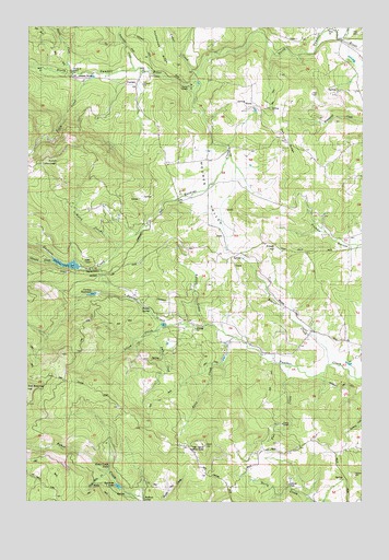
Fairdale, OR USGS Topographic Map
Click on map above to begin viewing in our Map Viewer.

This topographic map contains these locations and features:
Feature Name Type Latitude Longitude GNIS ID View Map
Bailey SpringSpringN45.3007°W123.3307°1161002View Map
Baker Creek FallsFallsN45.2596°W123.3457°1161003View Map
Beaver CreekStreamN45.2862°W123.2634°1117430View Map
Beltview ReservoirReservoirN45.3667°W123.2554°1129872View Map
Bolton CreekStreamN45.3671°W123.3193°1161004View Map
Browns SpringSpringN45.2879°W123.3132°1160999View Map
Camp SmithLocaleN45.2704°W123.2807°1118532View Map
Camp YamhillLocaleN45.3590°W123.3148°1118539View Map
Carlton DivisionCivilN45.3497°W123.2754°1937975View Map
Carlton ReservoirReservoirN45.3046°W123.3516°1118615View Map
Carlton Water Treatment PlantLocaleN45.3035°W123.3372°2660773View Map
Cedar CreekStreamN45.3629°W123.3115°1118745View Map
Cedar Creek (historical)LocaleN45.3637°W123.3123°1699666View Map
Chesterbrook (historical)LocaleN45.3671°W123.3357°1699668View Map
Chesterbrook Post Office (historical)Post OfficeN45.3693°W123.3668°1639184View Map
Dawson SpringSpringN45.3540°W123.2846°1129874View Map
Fairchild CreekStreamN45.3640°W123.3368°1120556View Map
Fairchilds (historical)LocaleN45.3659°W123.3337°1699667View Map
Fairdale (historical)Populated PlaceN45.3598°W123.3354°1120558View Map
Fairdale Mineral SpringSpringN45.3640°W123.3318°1129873View Map
Fairdale Post Office (historical)Post OfficeN45.3598°W123.3354°1165236View Map
Fall CreekStreamN45.2854°W123.2782°1120595View Map
Falls CreekStreamN45.2948°W123.3276°1120615View Map
Flying M AirportAirportN45.3617°W123.3583°1131752View Map
Flying M RanchLocaleN45.3632°W123.3601°1120854View Map
Flying M ReservoirReservoirN45.3619°W123.3522°1161000View Map
Froud HillSummitN45.3176°W123.2837°1136304View Map
Hanna CreekStreamN45.3626°W123.3587°1121561View Map
Haskins CreekStreamN45.3576°W123.3137°1121647View Map
Haskins Creek DamDamN45.3115°W123.3562°1131341View Map
Haskins Creek ReservoirReservoirN45.3123°W123.3614°1121648View Map
High Heaven Lookout TowerTowerN45.2646°W123.3096°1163718View Map
Idlewild CreekStreamN45.3129°W123.3673°1122183View Map
Kane CreekStreamN45.2934°W123.2990°1122627View Map
Kutch CreekStreamN45.3173°W123.3418°1122863View Map
Kutch MountainSummitN45.3390°W123.3646°1136453View Map
Manila Post Office (historical)Post OfficeN45.2637°W123.2890°1164494View Map
McCall SpringSpringN45.2568°W123.2582°1129878View Map
Moores ValleyValleyN45.3454°W123.3071°1124339View Map
Moores Valley CemeteryCemeteryN45.3207°W123.3040°1129876View Map
Mountain House (historical)LocaleN45.3179°W123.3179°1129871View Map
Mountain House Post Office (historical)Post OfficeN45.3179°W123.3179°1165674View Map
Murray CreekStreamN45.2512°W123.2707°1129879View Map
Murray ParkParkN45.2548°W123.2784°1124560View Map
Oak RidgeRidgeN45.3448°W123.2793°1124915View Map
Panther Creek DamDamN45.3515°W123.3062°1133637View Map
Panther Creek ReservoirReservoirN45.3519°W123.3062°1133638View Map
Petch CreekStreamN45.3626°W123.3518°1125313View Map
Pike CemeteryCemeteryN45.3734°W123.2525°1125373View Map
Puddy GulchValleyN45.3179°W123.2532°1158022View Map
Rainbow LakeReservoirN45.2541°W123.3420°1161484View Map
Rainbow LodgeLocaleN45.2501°W123.3329°1125784View Map
Russel CreekStreamN45.2962°W123.3093°1126367View Map
Silver CreekStreamN45.2962°W123.3246°1126960View Map
Slide Mountain CreekStreamN45.2579°W123.3465°1127079View Map
Tillamook GateLocaleN45.3707°W123.3654°1161009View Map
Turek ReservoirReservoirN45.3531°W123.2915°1129875View Map
Turner CreekStreamN45.3712°W123.2584°1128315View Map
Vincent PondReservoirN45.3457°W123.2576°1161001View Map
Von ReservoirReservoirN45.2965°W123.3255°1129877View Map
Vons Airstrip (historical)AirportN45.2921°W123.3021°1131737View Map
Yamhill Encampment Corporation Wastewater Treatment FacilityLocaleN45.3608°W123.3130°2660793View Map

Note: Coordinates in the location and feature list above are referenced to NAD83 datum.


Copyright (C) 2008-2024 Ryan Niemi / Sunset Dynamics ... All Rights Reserved