TopoQuest Logo
Do you find TopoQuest useful?
Help keep TopoQuest running and adding new maps/features by donating!
Bitcoin:  19c7KJd3qBynnjoSw5npx9KScwjBe4ifkT
Litecoin:  LXs6TkuXGGXo1vDsWCkWVdjQX94eUKd6ui
Home View Maps Find Maps Find Places Resources & Links


Muddy Valley, Oregon Topographic Map

USGS Map Title: Muddy Valley, OR
USGS Map MRC: 45123B3
DRG (GeoTIFF) Download: o45123b3.tif


Neighboring USGS Topographic Map Quads:


  Trask Mountain, OR  
45123C4
 

  Fairdale, OR  
45123C3
 

  Carlton, OR  
45123C2
 

  Stony Mountain, OR  
45123B4
 

  Muddy Valley, OR  
45123B3
 

  McMinnville, OR  
45123B2
 

  Sheridan, OR  
45123A4
 

  Ballston, OR  
45123A3
 

  Amity, OR  
45123A2


Map MRC Location:

N46°
W124°
N46°
W123°
H8 H7 H6 H5 H4 H3 H2 H1
G8 G7 G6 G5 G4 G3 G2 G1
F8 F7 F6 F5 F4 F3 F2 F1
E8 E7 E6 E5 E4 E3 E2 E1
D8 D7 D6 D5 D4 D3 D2 D1
C8 C7 C6 C5 C4 C3 C2 C1
B8 B7 B6 B5 B4 B3 B2 B1
A8 A7 A6 A5 A4 A3 A2 A1
N45°
W124°
N45°
W123°

Muddy Valley, OR USGS 1:24K Topographic Map Preview:
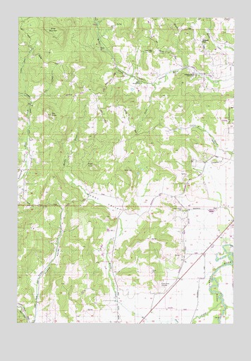
Muddy Valley, OR USGS Topographic Map
Click on map above to begin viewing in our Map Viewer.

This topographic map contains these locations and features:
Feature Name Type Latitude Longitude GNIS ID View Map
Blue Heron ReservoirReservoirN45.1376°W123.2524°1163599View Map
Charles Metsker County ParkParkN45.2271°W123.3126°2058226View Map
Chase Post Office (historical)Post OfficeN45.2262°W123.3137°1165039View Map
Deer CreekStreamN45.1337°W123.2579°1157970View Map
Deer Creek AirportAirportN45.2002°W123.3704°2645960View Map
Devils CreekStreamN45.2476°W123.3321°1119899View Map
Dupee ValleyValleyN45.1262°W123.3654°1120222View Map
Eagle PointSummitN45.1894°W123.3324°1157976View Map
East Fork Muddy CreekStreamN45.1609°W123.3179°1130169View Map
Edward Grenfell County ParkParkN45.2276°W123.2743°1120400View Map
Erratic Rock State ParkParkN45.1401°W123.2932°1157979View Map
Gill CreekStreamN45.2148°W123.3690°1121132View Map
Happy ValleyValleyN45.2262°W123.2540°1121582View Map
Happy Valley CemeteryCemeteryN45.2355°W123.2979°1121584View Map
Happy Valley Community HallBuildingN45.2257°W123.2968°1638831View Map
Haven Hill PondLakeN45.2481°W123.3008°1130166View Map
Huber County ParkParkN45.2234°W123.3065°1122096View Map
Juliette County ParkParkN45.2368°W123.3276°2058227View Map
Little Deer CreekStreamN45.2179°W123.3726°1123180View Map
Masonville Community HallBuildingN45.1729°W123.2559°1638830View Map
Middle Fork Muddy CreekStreamN45.1582°W123.3179°1130168View Map
Mochettaz ReservoirReservoirN45.2205°W123.3103°1130167View Map
Monroe Landing County ParkParkN45.1518°W123.2523°2058228View Map
Muddy CreekStreamN45.1259°W123.2890°1124504View Map
Muddy ValleyValleyN45.1293°W123.3098°1124510View Map
Orchard ViewLocaleN45.2404°W123.2712°1158019View Map
Peter Dinsdale DamDamN45.1382°W123.2512°1131510View Map
Power House County ParkParkN45.2259°W123.3140°2058229View Map
Sander ReservoirReservoirN45.2443°W123.3001°1130183View Map
Slide MountainSummitN45.2447°W123.3533°1158034View Map
Snake CreekStreamN45.2223°W123.2987°1127149View Map
South Yamhill CemeteryCemeteryN45.1713°W123.2803°1127359View Map
The ButteSummitN45.2102°W123.3572°1127955View Map
Vierra SpringsSpringN45.2287°W123.3143°1162626View Map
Yamhill CountyCivilN45.2327°W123.3082°1135866View Map

Note: Coordinates in the location and feature list above are referenced to NAD83 datum.


Copyright (C) 2008-2024 Ryan Niemi / Sunset Dynamics ... All Rights Reserved