TopoQuest Logo
Do you find TopoQuest useful?
Help keep TopoQuest running and adding new maps/features by donating!
Bitcoin:  19c7KJd3qBynnjoSw5npx9KScwjBe4ifkT
Litecoin:  LXs6TkuXGGXo1vDsWCkWVdjQX94eUKd6ui
Home View Maps Find Maps Find Places Resources & Links


Stony Mountain, Oregon Topographic Map

USGS Map Title: Stony Mountain, OR
USGS Map MRC: 45123B4
DRG (GeoTIFF) Download: o45123b4.tif


Neighboring USGS Topographic Map Quads:


  Dovre Peak, OR  
45123C5
 

  Trask Mountain, OR  
45123C4
 

  Fairdale, OR  
45123C3
 

  Springer Mountain, OR  
45123B5
 

  Stony Mountain, OR  
45123B4
 

  Muddy Valley, OR  
45123B3
 

  Grand Ronde, OR  
45123A5
 

  Sheridan, OR  
45123A4
 

  Ballston, OR  
45123A3


Map MRC Location:

N46°
W124°
N46°
W123°
H8 H7 H6 H5 H4 H3 H2 H1
G8 G7 G6 G5 G4 G3 G2 G1
F8 F7 F6 F5 F4 F3 F2 F1
E8 E7 E6 E5 E4 E3 E2 E1
D8 D7 D6 D5 D4 D3 D2 D1
C8 C7 C6 C5 C4 C3 C2 C1
B8 B7 B6 B5 B4 B3 B2 B1
A8 A7 A6 A5 A4 A3 A2 A1
N45°
W124°
N45°
W123°

Stony Mountain, OR USGS 1:24K Topographic Map Preview:
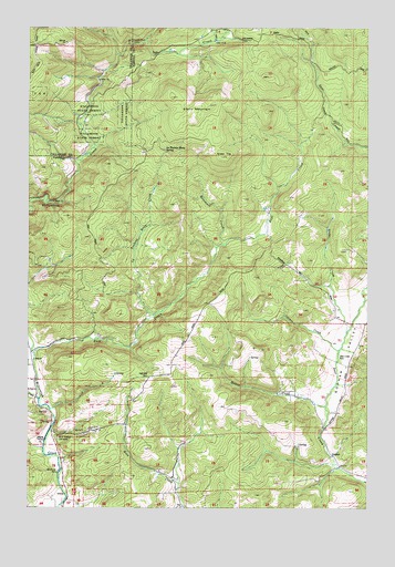
Stony Mountain, OR USGS Topographic Map
Click on map above to begin viewing in our Map Viewer.

This topographic map contains these locations and features:
Feature Name Type Latitude Longitude GNIS ID View Map
Baltimore CreekStreamN45.1932°W123.4298°1117217View Map
Beaver CreekStreamN45.1512°W123.3915°1157953View Map
Blackwell County ParkParkN45.1343°W123.4893°1117796View Map
Buck HollowValleyN45.1448°W123.4926°1118191View Map
Buck Hollow CemeteryCemeteryN45.1429°W123.4901°1158076View Map
Cedar CreekStreamN45.2462°W123.4343°1118744View Map
Coast CreekStreamN45.1532°W123.4971°1139876View Map
Cronin CreekStreamN45.1659°W123.3868°1119557View Map
Deer Creek County ParkParkN45.1640°W123.3871°1119830View Map
East CreekStreamN45.1648°W123.4987°1157977View Map
Gopher (historical)LocaleN45.1387°W123.3901°1158077View Map
Gopher Post Office (historical)Post OfficeN45.1387°W123.3901°1165328View Map
Gopher ValleyValleyN45.1473°W123.3912°1157989View Map
Green TopSummitN45.2162°W123.4301°1121405View Map
Grohe CreekStreamN45.1701°W123.3840°1121452View Map
Highland CemeteryCemeteryN45.1592°W123.4566°1121819View Map
Hussey CemeteryCemeteryN45.1679°W123.3790°1158075View Map
La Toutena Mary CreekStreamN45.1751°W123.4554°1122874View Map
La Toutena Mary SpringSpringN45.2176°W123.4518°1122875View Map
Poverty Hollow AirportAirportN45.1569°W123.3931°2645959View Map
Stony MountainRidgeN45.2317°W123.4485°1127636View Map
Wiley CreekStreamN45.1359°W123.3873°1130170View Map

Note: Coordinates in the location and feature list above are referenced to NAD83 datum.


Copyright (C) 2008-2025 Ryan Niemi / Sunset Dynamics ... All Rights Reserved