TopoQuest Logo
Do you find TopoQuest useful?
Help keep TopoQuest running and adding new maps/features by donating!
Bitcoin:  19c7KJd3qBynnjoSw5npx9KScwjBe4ifkT
Litecoin:  LXs6TkuXGGXo1vDsWCkWVdjQX94eUKd6ui
Home View Maps Find Maps Find Places Resources & Links


Hogan Hollow, Missouri Topographic Map

USGS Map Title: Hogan Hollow, MO
USGS Map MRC: 36090G6
DRG (GeoTIFF) Download: o36090g6.tif


Neighboring USGS Topographic Map Quads:


  Hunter, MO  
36090H7
 

  Ellsinore, MO  
36090H6
 

  Williamsville, MO  
36090H5
 

  Grandin, MO  
36090G7
 

  Hogan Hollow, MO  
36090G6
 

  Stringtown, MO  
36090G5
 

  Doniphan North, MO  
36090F7
 

  Flatwoods, MO  
36090F6
 

  Fairdealing, MO  
36090F5


Map MRC Location:

N37°
W91°
N37°
W90°
H8 H7 H6 H5 H4 H3 H2 H1
G8 G7 G6 G5 G4 G3 G2 G1
F8 F7 F6 F5 F4 F3 F2 F1
E8 E7 E6 E5 E4 E3 E2 E1
D8 D7 D6 D5 D4 D3 D2 D1
C8 C7 C6 C5 C4 C3 C2 C1
B8 B7 B6 B5 B4 B3 B2 B1
A8 A7 A6 A5 A4 A3 A2 A1
N36°
W91°
N36°
W90°

Hogan Hollow, MO USGS 1:24K Topographic Map Preview:
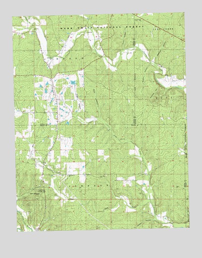
Hogan Hollow, MO USGS Topographic Map
Click on map above to begin viewing in our Map Viewer.

This topographic map contains these locations and features:
Feature Name Type Latitude Longitude GNIS ID View Map
Beaver Dam ChurchChurchN36.7823°W90.7118°749096View Map
Beaver Dam Church CemeteryCemeteryN36.7820°W90.7123°755533View Map
Beaver Lake DamDamN36.8017°W90.6251°765526View Map
BeaverdamPopulated PlaceN36.7531°W90.6310°735232View Map
Beehole BranchStreamN36.8437°W90.6468°735266View Map
Beehole HollowValleyN36.8462°W90.6479°748767View Map
BudapestPopulated PlaceN36.7689°W90.7110°749095View Map
Collins CemeteryCemeteryN36.8020°W90.6734°753638View Map
Double S Ranch AirportAirportN36.8328°W90.7224°753636View Map
Doyle BranchStreamN36.8703°W90.7357°749695View Map
Emmons School (historical)SchoolN36.7609°W90.7404°749839View Map
Grandin Lookout TowerTowerN36.7717°W90.7329°753639View Map
Hogan HollowValleyN36.8176°W90.7043°750361View Map
Hogan Hollow School (historical)SchoolN36.8323°W90.6990°750362View Map
Homestead (historical)Populated PlaceN36.8189°W90.7190°740417View Map
Kearbey CemeteryCemeteryN36.8387°W90.6373°753637View Map
Kearby Chapel (historical)ChurchN36.8392°W90.6376°735265View Map
Lake HoganReservoirN36.8359°W90.7070°765193View Map
Lake Hogan DamDamN36.8351°W90.7068°765192View Map
Lower Tenmile SchoolSchoolN36.8692°W90.7215°750888View Map
Mallard DamReservoirN36.7884°W90.7018°764614View Map
Mallard Lake DamDamN36.7884°W90.7018°764613View Map
Margaret Trainor CemeteryCemeteryN36.8706°W90.6565°753634View Map
Mb Ranch Airport (historical)AirportN36.8362°W90.7223°758702View Map
Murphy HollowValleyN36.7553°W90.6501°751242View Map
New Hope ChurchChurchN36.8673°W90.7346°751295View Map
North Prong Beaverdam CreekStreamN36.7656°W90.6521°751354View Map
Nubbin HollowValleyN36.8451°W90.6523°751363View Map
Pine Valley School (historical)SchoolN36.7895°W90.7287°751629View Map
Pine View School (historical)SchoolN36.7667°W90.6526°735231View Map
Pinhook HillSummitN36.8264°W90.6510°751640View Map
Puls HollowValleyN36.8145°W90.6882°751772View Map
Pump HollowValleyN36.8548°W90.6693°751773View Map
Scott CemeteryCemeteryN36.8648°W90.6959°753635View Map
South Prong Beaverdam CreekStreamN36.7648°W90.6521°737867View Map
State Public Hunting AreaParkN36.7717°W90.7315°753640View Map
Thompson Chapel (historical)ChurchN36.8189°W90.7179°752530View Map

Note: Coordinates in the location and feature list above are referenced to NAD83 datum.


Copyright (C) 2008-2025 Ryan Niemi / Sunset Dynamics ... All Rights Reserved