TopoQuest Logo
Do you find TopoQuest useful?
Help keep TopoQuest running and adding new maps/features by donating!
Bitcoin:  19c7KJd3qBynnjoSw5npx9KScwjBe4ifkT
Litecoin:  LXs6TkuXGGXo1vDsWCkWVdjQX94eUKd6ui
Home View Maps Find Maps Find Places Resources & Links


Fairhope, Pennsylvania Topographic Map

USGS Map Title: Fairhope, PA
USGS Map MRC: 39078G7
DRG (GeoTIFF) Download: o39078g7.tif


Neighboring USGS Topographic Map Quads:


  Berlin, PA  
39078H8
 

  New Baltimore, PA  
39078H7
 

  Buffalo Mills, PA  
39078H6
 

  Wittenberg, PA  
39078G8
 

  Fairhope, PA  
39078G7
 

  Hyndman, PA  
39078G6
 

  Frostburg, MD  
39078F8
 

  Cumberland, MD  
39078F7
 

  Evitts Creek, MD  
39078F6


Map MRC Location:

N40°
W79°
N40°
W78°
H8 H7 H6 H5 H4 H3 H2 H1
G8 G7 G6 G5 G4 G3 G2 G1
F8 F7 F6 F5 F4 F3 F2 F1
E8 E7 E6 E5 E4 E3 E2 E1
D8 D7 D6 D5 D4 D3 D2 D1
C8 C7 C6 C5 C4 C3 C2 C1
B8 B7 B6 B5 B4 B3 B2 B1
A8 A7 A6 A5 A4 A3 A2 A1
N39°
W79°
N39°
W78°

Fairhope, PA USGS 1:24K Topographic Map Preview:
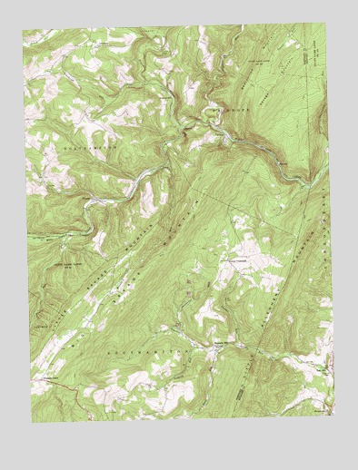
Fairhope, PA USGS Topographic Map
Click on map above to begin viewing in our Map Viewer.

This topographic map contains these locations and features:
Feature Name Type Latitude Longitude GNIS ID View Map
Bearwallow MountainSummitN39.8651°W78.7759°1168980View Map
Becks Cut Station (historical)BuildingN39.8318°W78.8170°1197086View Map
Big Savage MountainSummitN39.7945°W78.8297°1169585View Map
Bittners MillPopulated PlaceN39.8498°W78.8175°1203105View Map
Bradigum SchoolSchoolN39.8626°W78.8581°1197094View Map
Brush CreekStreamN39.8431°W78.8100°1192200View Map
Comps CrossroadsPopulated PlaceN39.8001°W78.7922°1203315View Map
Crossroads SchoolSchoolN39.7509°W78.7514°1197092View Map
FairhopePopulated PlaceN39.8401°W78.7920°1174441View Map
Fairhope Post OfficePost OfficeN39.8417°W78.7932°2780074View Map
Falls Cut TunnelTunnelN39.8417°W78.8089°1174605View Map
Fitchner Covered BridgeBridgeN39.7634°W78.7661°1954950View Map
FoleyPopulated PlaceN39.8295°W78.8181°1203601View Map
Foley Station (historical)BuildingN39.8301°W78.8214°1197089View Map
GlencoePopulated PlaceN39.8212°W78.8456°1175713View Map
HoblitzellPopulated PlaceN39.8348°W78.7506°1197095View Map
JohnsburgPopulated PlaceN39.8695°W78.8434°1203898View Map
Kennells MillPopulated PlaceN39.7715°W78.7986°1203930View Map
Korns School (historical)SchoolN39.7606°W78.8242°1206406View Map
Laurel RunStreamN39.8090°W78.8592°1178998View Map
Laurel RunStreamN39.8084°W78.8603°585366View Map
Leapley RunStreamN39.7726°W78.8050°1179089View Map
Little Allegheny MountainSummitN39.7584°W78.7859°1179455View Map
Mountain RunStreamN39.8315°W78.8156°1181957View Map
Mountain SchoolSchoolN39.7801°W78.8522°1197093View Map
Palo AltoPopulated PlaceN39.7637°W78.7500°1183232View Map
Palo Alto United Methodist Church CemeteryCemeteryN39.7660°W78.7500°2776134View Map
Philson SchoolSchoolN39.8109°W78.8742°1197091View Map
Pleasant UnionPopulated PlaceN39.7637°W78.8700°1204421View Map
Poorbaugh RunStreamN39.8576°W78.8231°1184245View Map
Powder RunStreamN39.7726°W78.7892°1184358View Map
Roddys StationLocaleN39.8101°W78.8589°1197087View Map
Rush RunStreamN39.7718°W78.7986°1185644View Map
Shaffers RunStreamN39.8437°W78.7975°1193323View Map
Shoemaker RunStreamN39.7784°W78.8128°1193352View Map
Southampton MillsLocaleN39.8243°W78.8309°1206858View Map
Southampton SchoolSchoolN39.8212°W78.8331°1197090View Map
StringtownPopulated PlaceN39.7506°W78.7520°1205089View Map
Township of FairhopeCivilN39.8497°W78.7878°1217048View Map
Township of SouthamptonCivilN39.7665°W78.8296°1217063View Map
Union Gospel MissionChurchN39.7718°W78.7978°1193582View Map
Welch StationLocaleN39.8359°W78.7764°1197088View Map
WilliamsPopulated PlaceN39.8306°W78.7706°1204952View Map

Note: Coordinates in the location and feature list above are referenced to NAD83 datum.


Copyright (C) 2008-2024 Ryan Niemi / Sunset Dynamics ... All Rights Reserved