TopoQuest Logo
Do you find TopoQuest useful?
Help keep TopoQuest running and adding new maps/features by donating!
Bitcoin:  19c7KJd3qBynnjoSw5npx9KScwjBe4ifkT
Litecoin:  LXs6TkuXGGXo1vDsWCkWVdjQX94eUKd6ui
Home View Maps Find Maps Find Places Resources & Links


Wittenberg, Pennsylvania Topographic Map

USGS Map Title: Wittenberg, PA
USGS Map MRC: 39078G8
DRG (GeoTIFF) Download: o39078g8.tif


Neighboring USGS Topographic Map Quads:


  Murdock, PA  
39079H1
 

  Berlin, PA  
39078H8
 

  New Baltimore, PA  
39078H7
 

  Meyersdale, PA  
39079G1
 

  Wittenberg, PA  
39078G8
 

  Fairhope, PA  
39078G7
 

  Avilton, MD  
39079F1
 

  Frostburg, MD  
39078F8
 

  Cumberland, MD  
39078F7


Map MRC Location:

N40°
W79°
N40°
W78°
H8 H7 H6 H5 H4 H3 H2 H1
G8 G7 G6 G5 G4 G3 G2 G1
F8 F7 F6 F5 F4 F3 F2 F1
E8 E7 E6 E5 E4 E3 E2 E1
D8 D7 D6 D5 D4 D3 D2 D1
C8 C7 C6 C5 C4 C3 C2 C1
B8 B7 B6 B5 B4 B3 B2 B1
A8 A7 A6 A5 A4 A3 A2 A1
N39°
W79°
N39°
W78°

Wittenberg, PA USGS 1:24K Topographic Map Preview:
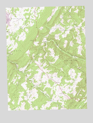
Wittenberg, PA USGS Topographic Map
Click on map above to begin viewing in our Map Viewer.

This topographic map contains these locations and features:
Feature Name Type Latitude Longitude GNIS ID View Map
Bear RunStreamN39.8437°W78.9895°1168913View Map
Berkleys MillPopulated PlaceN39.8454°W78.9997°1192123View Map
Borough of CallimontCivilN39.8012°W78.9216°2086600View Map
Bowman SchoolSchoolN39.8404°W78.9314°1197079View Map
Brush Creek SchoolSchoolN39.8698°W78.9003°1197083View Map
CallimontPopulated PlaceN39.7981°W78.9164°1195887View Map
Geiger SchoolSchoolN39.7829°W78.8928°1205938View Map
Glade CityPopulated PlaceN39.8187°W78.9947°1175651View Map
Greenville ChurchChurchN39.7512°W78.9909°1176174View Map
Hays MillPopulated PlaceN39.8509°W78.9731°1176699View Map
Hays Mill Lookout TowerTowerN39.8345°W78.9578°1213225View Map
Hostetter ChurchChurchN39.7679°W78.9675°1177493View Map
Hostetter SchoolSchoolN39.7712°W78.9697°1197078View Map
KeystonePopulated PlaceN39.8065°W78.9856°1178432View Map
Lebanon CemeteryCemeteryN39.8515°W78.8914°1179095View Map
Lebanon ChurchChurchN39.8506°W78.8872°1179098View Map
MancePopulated PlaceN39.8317°W78.9367°1204091View Map
Maple Valley ParkParkN39.8442°W78.9972°1180372View Map
Miller RunStreamN39.7948°W78.9720°1192942View Map
Mount Carmel ChurchChurchN39.7695°W78.9120°1181669View Map
Mount Olivet ChurchChurchN39.8526°W78.8903°1181781View Map
PhilsonPopulated PlaceN39.8140°W78.8900°1197077View Map
Pine Grove SchoolSchoolN39.7554°W78.9172°1197081View Map
Roadside ParkParkN39.8698°W78.9536°1185161View Map
Saint Johns ChurchChurchN39.7743°W78.9120°1186089View Map
Sand PatchPopulated PlaceN39.7981°W78.9728°1186914View Map
Siebert LakeLakeN39.7812°W78.9840°1197084View Map
SlabtownPopulated PlaceN39.8029°W78.9836°1202109View Map
State Game Lands Number 82ParkN39.8073°W78.8989°1190994View Map
Stumn RunStreamN39.8012°W78.9845°1188899View Map
Township of LarimerCivilN39.7883°W78.9259°1217052View Map
Township of NorthamptonCivilN39.8430°W78.8771°1217057View Map
Waggaman SchoolSchoolN39.8317°W78.8817°1197082View Map
Ware RunStreamN39.8676°W78.8992°1190590View Map
Warrens MillPopulated PlaceN39.7795°W78.9570°1190601View Map
White Oak ChurchChurchN39.7695°W78.9114°1191296View Map
Witt SchoolSchoolN39.8167°W78.9397°1197080View Map
WittenbergPopulated PlaceN39.7823°W78.9222°1191640View Map
Wittenberg Post Office (historical)Post OfficeN39.7823°W78.9222°1214447View Map

Note: Coordinates in the location and feature list above are referenced to NAD83 datum.


Copyright (C) 2008-2025 Ryan Niemi / Sunset Dynamics ... All Rights Reserved