TopoQuest Logo
Do you find TopoQuest useful?
Help keep TopoQuest running and adding new maps/features by donating!
Bitcoin:  19c7KJd3qBynnjoSw5npx9KScwjBe4ifkT
Litecoin:  LXs6TkuXGGXo1vDsWCkWVdjQX94eUKd6ui
Home View Maps Find Maps Find Places Resources & Links


Fairmont, North Carolina Topographic Map

USGS Map Title: Fairmont, NC
USGS Map MRC: 34079D1
DRG (GeoTIFF) Download: o34079d1.tif


Neighboring USGS Topographic Map Quads:


  McDonald, NC  
34079E2
 

  Southwest Lumberton, NC  
34079E1
 

  Southeast Lumberton, NC  
34078E8
 

  Gaddysville, NC  
34079D2
 

  Fairmont, NC  
34079D1
 

  Evergreen, NC  
34078D8
 

  Lake View, SC  
34079C2
 

  Fair Bluff, NC  
34079C1
 

  Cerro Gordo, NC  
34078C8


Map MRC Location:

N35°
W80°
N35°
W79°
H8 H7 H6 H5 H4 H3 H2 H1
G8 G7 G6 G5 G4 G3 G2 G1
F8 F7 F6 F5 F4 F3 F2 F1
E8 E7 E6 E5 E4 E3 E2 E1
D8 D7 D6 D5 D4 D3 D2 D1
C8 C7 C6 C5 C4 C3 C2 C1
B8 B7 B6 B5 B4 B3 B2 B1
A8 A7 A6 A5 A4 A3 A2 A1
N34°
W80°
N34°
W79°

Fairmont, NC USGS 1:24K Topographic Map Preview:
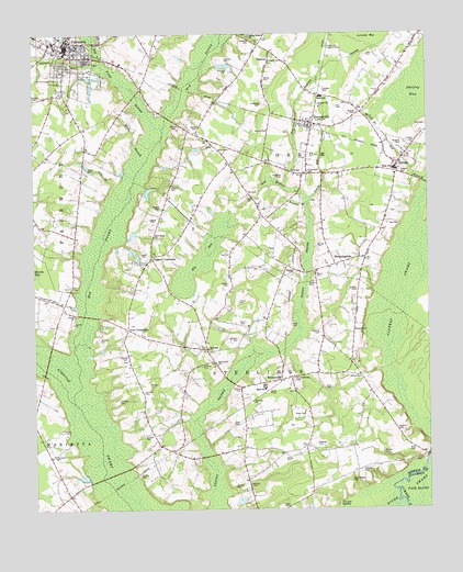
Fairmont, NC USGS Topographic Map
Click on map above to begin viewing in our Map Viewer.

This topographic map contains these locations and features:
Feature Name Type Latitude Longitude GNIS ID View Map
Antioch ChurchChurchN34.4813°W79.0334°980210View Map
Atkinson CemeteryCemeteryN34.4932°W79.0634°980353View Map
Atkinson CemeteryCemeteryN34.4982°W79.0556°980354View Map
Barfield CemeteryCemeteryN34.4060°W79.0898°980549View Map
Barfield CemeteryCemeteryN34.4154°W79.0948°980550View Map
Barfield CemeteryCemeteryN34.4202°W79.1039°980551View Map
Barnes CemeteryCemeteryN34.3813°W79.0617°980565View Map
Barnes CemeteryCemeteryN34.4446°W79.0350°980566View Map
Barnes CemeteryCemeteryN34.4740°W79.0517°980567View Map
BarnesvillePopulated PlaceN34.4088°W79.0467°980574View Map
Barnesville CemeteryCemeteryN34.4143°W79.0673°980575View Map
Bass CemeteryCemeteryN34.4071°W79.0325°980601View Map
Bass-Walters CemeteryCemeteryN34.3832°W79.0242°980607View Map
Bay BranchSwampN34.4613°W79.0492°980649View Map
Bethea CemeteryCemeteryN34.4129°W79.0717°981096View Map
Bethesda ChurchChurchN34.4179°W79.0700°981186View Map
Big BaySwampN34.4421°W79.0714°981307View Map
Big BranchStreamN34.4616°W79.0006°981321View Map
Big Indian SwampStreamN34.4604°W79.0453°981404View Map
BloomingdalePopulated PlaceN34.4407°W79.0203°1006134View Map
Branch CemeteryCemeteryN34.4785°W79.0228°981821View Map
Britt CemeteryCemeteryN34.3910°W79.0050°981918View Map
Britt CemeteryCemeteryN34.4754°W79.0020°981920View Map
Bryant BranchStreamN34.4557°W79.0386°982074View Map
Bullock CemeteryCemeteryN34.4757°W79.0734°982232View Map
Bullock CemeteryCemeteryN34.4832°W79.1239°982234View Map
Byrd CemeteriesCemeteryN34.4693°W79.0631°982363View Map
Byrd CemeteryCemeteryN34.4638°W79.0414°982365View Map
Davis CemeteryCemeteryN34.4243°W79.0578°983986View Map
Edwards CemeteryCemeteryN34.3929°W79.0353°984654View Map
FairmontPopulated PlaceN34.4968°W79.1142°1020194View Map
Fairmont Department of Public Safety Fire DivisionBuildingN34.4943°W79.1133°2638058View Map
Fairmont High SchoolSchoolN34.4735°W79.1026°1006780View Map
Fairmont Middle SchoolSchoolN34.4979°W79.1178°1006781View Map
Fairmont Police DepartmentBuildingN34.4944°W79.1138°2131004View Map
Fairmont Post OfficePost OfficeN34.4976°W79.1128°2774265View Map
Fairmont Rescue SquadBuildingN34.4943°W79.1133°2720398View Map
Fairmont Rural Fire DepartmentBuildingN34.4961°W79.1107°2639438View Map
First Presbyterian ChurchChurchN34.4976°W79.1215°2505835View Map
Flowers SwampSwampN34.4346°W79.0078°985242View Map
Floyd CemeteryCemeteryN34.3979°W79.0614°985244View Map
Floyd CemeteryCemeteryN34.4568°W79.0545°985245View Map
Gin BranchStreamN34.4591°W79.0995°985706View Map
Graham CemeteryCemeteryN34.4857°W79.0323°985909View Map
Hardin CemeteryCemeteryN34.4299°W79.0600°986392View Map
Hardin CemeteryCemeteryN34.4346°W79.0634°986393View Map
Haynes CemeteryCemeteryN34.3854°W79.0211°986550View Map
Hedgpeth CemeteryCemeteryN34.4627°W79.0456°986593View Map
Hedgpeth CemeteryCemeteryN34.4821°W79.0525°986594View Map
Hedgpeth CemeteryCemeteryN34.4929°W79.0475°986595View Map
Herring CemeteryCemeteryN34.3896°W79.1184°986652View Map
Herring CemeteryCemeteryN34.4215°W79.0345°986653View Map
Hog SwampSwampN34.4907°W79.0720°986894View Map
Horne CemeteryCemeteryN34.4368°W79.0353°987066View Map
Inman CemeteryCemeteryN34.4643°W79.1073°987384View Map
Ivey CemeteryCemeteryN34.4799°W79.0214°987442View Map
Ivey CemeteryCemeteryN34.4810°W79.0281°987443View Map
Ivey CemeteryCemeteryN34.4943°W79.0170°987444View Map
Ivey CrossroadsPopulated PlaceN34.4224°W79.0950°987445View Map
Jenkins CemeteryCemeteryN34.3940°W79.0903°987549View Map
Jesse Flowers and Eliza Purvis Hedgpeth CemeteryCemeteryN34.4629°W79.0077°985239View Map
Johnson CemeteryCemeteryN34.4038°W79.0981°987655View Map
Johnson CemeteryCemeteryN34.4199°W79.0606°987656View Map
Kirkfield CemeteryCemeteryN34.4902°W79.0623°988020View Map
Lawson CemeteryCemeteryN34.4708°W79.0043°988225View Map
Lee CemeteryCemeteryN34.4427°W79.0625°988290View Map
Leggett CemeteryCemeteryN34.4424°W79.0886°988331View Map
Leggett CemeteryCemeteryN34.4515°W79.0861°988332View Map
Leggett CemeteryCemeteryN34.4546°W79.0842°988333View Map
Leggett CrossroadsPopulated PlaceN34.4416°W79.0873°988334View Map
Leggett LakeReservoirN34.4585°W79.0884°998092View Map
Leggett Lake DamDamN34.4585°W79.0898°998091View Map
Lewis CemeteryCemeteryN34.4596°W79.0809°988379View Map
Little Indian SwampStreamN34.4563°W79.0375°988673View Map
McColl BranchStreamN34.4766°W79.0134°989540View Map
McKee AirportAirportN34.4996°W79.1049°2679171View Map
Miry BranchStreamN34.4660°W79.0895°990074View Map
Mynatt FieldAirportN34.3783°W79.0763°2679216View Map
New Hope ChurchChurchN34.4468°W79.0864°990990View Map
Nobles CemeteryCemeteryN34.4102°W79.0214°991166View Map
Noblin CemeteryCemeteryN34.4063°W79.0595°991169View Map
Nye CemeteryCemeteryN34.4496°W79.0092°991335View Map
Nye CemeteryCemeteryN34.4579°W79.0559°991336View Map
OaktonPopulated PlaceN34.4954°W79.0489°991485View Map
Oakton Baptist ChurchChurchN34.4924°W79.0496°2506199View Map
Ohovah ChurchChurchN34.4038°W79.0553°991524View Map
OrrumPopulated PlaceN34.4660°W79.0092°1021756View Map
Orrum High SchoolSchoolN34.4646°W79.0103°1006782View Map
Orrum Post OfficePost OfficeN34.4663°W79.0080°2773784View Map
Orrum Township Volunteer Fire DepartmentBuildingN34.4763°W79.0369°2638082View Map
Page CemeteryCemeteryN34.3760°W79.0453°991782View Map
Parklane PlazaLocaleN34.4088°W79.0461°1007681View Map
Pitman Mill BranchStreamN34.4924°W79.1031°992424View Map
Pitman-Barnes CemeteryCemeteryN34.4096°W79.0420°992426View Map
ProctorvillePopulated PlaceN34.4766°W79.0364°992835View Map
Proctorville CemeteryCemeteryN34.4638°W79.0378°992836View Map
Proctorville Elementary SchoolSchoolN34.4835°W79.0331°1006783View Map
Proctorville Lookout TowerTowerN34.4960°W79.0314°1023684View Map
Proctorville Post OfficePost OfficeN34.4763°W79.0372°2774234View Map
Red Hill BranchStreamN34.4963°W79.0664°993110View Map
Red Hill CemeteryCemeteryN34.4765°W79.0792°993111View Map
Rhodes CemeteryCemeteryN34.4377°W79.0420°993264View Map
Robeson County Group Home II FairmontBuildingN34.4901°W79.1141°2505754View Map
Sealey CemeteryCemeteryN34.3840°W79.0914°994458View Map
Sealey CemeteryCemeteryN34.3888°W79.0450°994459View Map
Sealey CemeteryCemeteryN34.3902°W79.0148°994460View Map
Sealey CemeteryCemeteryN34.4879°W79.0509°994461View Map
Shelley BaySwampN34.4860°W79.0009°994646View Map
South Robeson Medical ClinicHospitalN34.4852°W79.1134°2505781View Map
South Robeson Rescue UnitBuildingN34.4880°W79.1122°2720644View Map
Spring Branch ChurchChurchN34.4999°W79.0556°995327View Map
Sterlings Township Volunteer Fire DepartmentBuildingN34.4077°W79.0515°2638192View Map
Town of FairmontCivilN34.4946°W79.1135°2406479View Map
Town of OrrumCivilN34.4667°W79.0089°2407055View Map
Town of ProctorvilleCivilN34.4752°W79.0370°2407163View Map
Township of FairmontCivilN34.4795°W79.1246°1027106View Map
Township of OrrumCivilN34.4589°W79.0121°1027112View Map
Township of SterlingsCivilN34.3851°W79.0591°1027125View Map
Walters CemeteryCemeteryN34.3963°W79.0100°996752View Map
Walters CemeteryCemeteryN34.4074°W79.0881°996753View Map
Walters CemeteryCemeteryN34.4221°W79.0214°996754View Map
Walters CemeteryCemeteryN34.4329°W79.0225°996755View Map
Walters CemeteryCemeteryN34.4340°W79.0359°996756View Map
Ward CemeteryCemeteryN34.4235°W79.0431°996771View Map
Warwick CemeteryCemeteryN34.4707°W79.0098°996817View Map
Williams CemeteryCemeteryN34.3810°W79.0567°997363View Map

Note: Coordinates in the location and feature list above are referenced to NAD83 datum.


Copyright (C) 2008-2024 Ryan Niemi / Sunset Dynamics ... All Rights Reserved