TopoQuest Logo
Do you find TopoQuest useful?
Help keep TopoQuest running and adding new maps/features by donating!
Bitcoin:  19c7KJd3qBynnjoSw5npx9KScwjBe4ifkT
Litecoin:  LXs6TkuXGGXo1vDsWCkWVdjQX94eUKd6ui
Home View Maps Find Maps Find Places Resources & Links


Celeste, Texas Topographic Map

USGS Map Title: Celeste, TX
USGS Map MRC: 33096C2
DRG (GeoTIFF) Download: o33096c2.tif


Neighboring USGS Topographic Map Quads:


  Trenton, TX  
33096D3
 

  Leonard, TX  
33096D2
 

  Gober, TX  
33096D1
 

  Pike, TX  
33096C3
 

  Celeste, TX  
33096C2
 

  Wolfe City, TX  
33096C1
 

  Farmersville, TX  
33096B3
 

  Greenville NW, TX  
33096B2
 

  Greenville NE, TX  
33096B1


Map MRC Location:

N34°
W97°
N34°
W96°
H8 H7 H6 H5 H4 H3 H2 H1
G8 G7 G6 G5 G4 G3 G2 G1
F8 F7 F6 F5 F4 F3 F2 F1
E8 E7 E6 E5 E4 E3 E2 E1
D8 D7 D6 D5 D4 D3 D2 D1
C8 C7 C6 C5 C4 C3 C2 C1
B8 B7 B6 B5 B4 B3 B2 B1
A8 A7 A6 A5 A4 A3 A2 A1
N33°
W97°
N33°
W96°

Celeste, TX USGS 1:24K Topographic Map Preview:
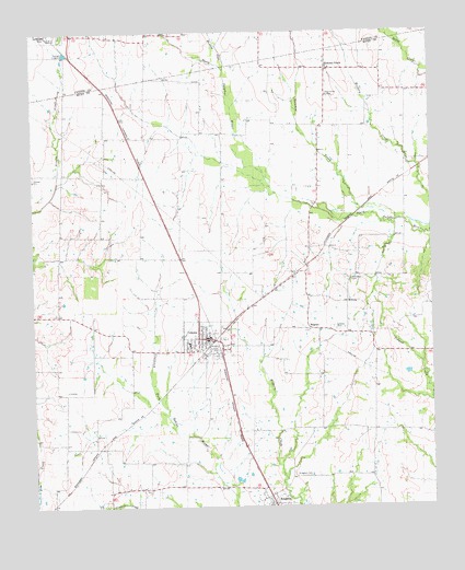
Celeste, TX USGS Topographic Map
Click on map above to begin viewing in our Map Viewer.

This topographic map contains these locations and features:
Feature Name Type Latitude Longitude GNIS ID View Map
CelestePopulated PlaceN33.2943°W96.1947°1354174View Map
Celeste CemeteryCemeteryN33.2973°W96.1558°1354175View Map
Celeste City HallBuildingN33.2941°W96.1954°2753764View Map
Celeste DivisionCivilN33.2810°W96.2126°1938610View Map
Celeste Elementary SchoolSchoolN33.2931°W96.2014°2006278View Map
Celeste Junior High SchoolSchoolN33.2924°W96.1992°2006280View Map
Celeste Police DepartmentBuildingN33.2940°W96.1954°2751245View Map
Celeste Post OfficePost OfficeN33.2941°W96.1947°2731968View Map
Celeste Volunteer Fire DepartmentBuildingN33.2934°W96.1955°2655431View Map
Chambers Airport (historical)AirportN33.3232°W96.2322°1386359View Map
City of CelesteCivilN33.2902°W96.1945°2409420View Map
Hickory CreekPopulated PlaceN33.3654°W96.1569°1379925View Map
HogeyePopulated PlaceN33.2971°W96.1633°1379941View Map
KingstonPopulated PlaceN33.2529°W96.1766°1374385View Map
Kingston CemeteryCemeteryN33.2587°W96.1689°1360683View Map
MidwayPopulated PlaceN33.3034°W96.1516°1380192View Map
Mustang CreekStreamN33.3654°W96.1883°1363546View Map
Nicholson CemeteryCemeteryN33.3096°W96.1503°1363879View Map
Rainbow CreekStreamN33.3251°W96.1353°1365970View Map
Soil Conservation Service Site 59 DamDamN33.3518°W96.2419°1855196View Map
Soil Conservation Service Site 59 ReservoirReservoirN33.3518°W96.2419°1855197View Map
Soil Conservation Service Site 64a DamDamN33.2951°W96.2486°1863034View Map
Soil Conservation Service Site 64a ReservoirReservoirN33.2951°W96.2486°1863035View Map
Soil Conservation Service Site 65 DamDamN33.2668°W96.2486°1863030View Map
Soil Conservation Service Site 65 ReservoirReservoirN33.2668°W96.2486°1863031View Map

Note: Coordinates in the location and feature list above are referenced to NAD83 datum.


Copyright (C) 2008-2024 Ryan Niemi / Sunset Dynamics ... All Rights Reserved