TopoQuest Logo
Do you find TopoQuest useful?
Help keep TopoQuest running and adding new maps/features by donating!
Bitcoin:  19c7KJd3qBynnjoSw5npx9KScwjBe4ifkT
Litecoin:  LXs6TkuXGGXo1vDsWCkWVdjQX94eUKd6ui
Home View Maps Find Maps Find Places Resources & Links


Arnott, Wisconsin Topographic Map

USGS Map Title: Arnott, WI
USGS Map MRC: 44089D4
DRG (GeoTIFF) Download: o44089d4.tif


Neighboring USGS Topographic Map Quads:


  Stevens Point, WI  
44089E5
 

  Polonia, WI  
44089E4
 

  New Hope, WI  
44089E3
 

  Whiting, WI  
44089D5
 

  Arnott, WI  
44089D4
 

  Amherst, WI  
44089D3
 

  Bancroft, WI  
44089C5
 

  Almond, WI  
44089C4
 

  Blaine, WI  
44089C3


Map MRC Location:

N45°
W90°
N45°
W89°
H8 H7 H6 H5 H4 H3 H2 H1
G8 G7 G6 G5 G4 G3 G2 G1
F8 F7 F6 F5 F4 F3 F2 F1
E8 E7 E6 E5 E4 E3 E2 E1
D8 D7 D6 D5 D4 D3 D2 D1
C8 C7 C6 C5 C4 C3 C2 C1
B8 B7 B6 B5 B4 B3 B2 B1
A8 A7 A6 A5 A4 A3 A2 A1
N44°
W90°
N44°
W89°

Arnott, WI USGS 1:24K Topographic Map Preview:
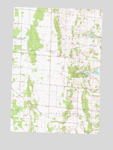
Arnott, WI USGS Topographic Map
Click on map above to begin viewing in our Map Viewer.

This topographic map contains these locations and features:
Feature Name Type Latitude Longitude GNIS ID View Map
Adams LakeLakeN44.4367°W89.3813°1560685View Map
ArnottPopulated PlaceN44.4572°W89.4468°1560954View Map
Arnott School (historical)SchoolN44.4664°W89.4471°1851440View Map
Bear LakeLakeN44.4353°W89.3942°1561379View Map
Buena Vista ChurchChurchN44.4014°W89.4471°1562355View Map
FancherPopulated PlaceN44.4630°W89.3857°1564852View Map
Lombard CemeteryCemeteryN44.4222°W89.4259°1568502View Map
Morrill CemeteryCemeteryN44.4411°W89.4879°1569748View Map
Morrill School (historical)SchoolN44.4397°W89.4882°1851522View Map
Pleasant Valley School (historical)SchoolN44.3761°W89.3923°1851536View Map
Prairie School (historical)SchoolN44.4372°W89.4465°1851541View Map
Saint Mary of Mount Carmel ChurchChurchN44.4716°W89.3751°1573261View Map
Somers Gravel PitMineN44.4450°W89.4264°2634492View Map
Standing Rock ParkParkN44.4378°W89.3982°1574786View Map
Stockton Fire DepartmentBuildingN44.4952°W89.4239°2697788View Map
Thomas LakeLakeN44.4736°W89.3903°1575371View Map
Town Hall School (historical)SchoolN44.4947°W89.4259°1851588View Map
Town of StocktonCivilN44.4891°W89.4229°1584230View Map

Note: Coordinates in the location and feature list above are referenced to NAD83 datum.


Copyright (C) 2008-2025 Ryan Niemi / Sunset Dynamics ... All Rights Reserved