TopoQuest Logo
Do you find TopoQuest useful?
Help keep TopoQuest running and adding new maps/features by donating!
Bitcoin:  19c7KJd3qBynnjoSw5npx9KScwjBe4ifkT
Litecoin:  LXs6TkuXGGXo1vDsWCkWVdjQX94eUKd6ui
Home View Maps Find Maps Find Places Resources & Links


New Hope, Wisconsin Topographic Map

USGS Map Title: New Hope, WI
USGS Map MRC: 44089E3
DRG (GeoTIFF) Download: o44089e3.tif


Neighboring USGS Topographic Map Quads:


  Rosholt NW, WI  
44089F4
 

  Rosholt, WI  
44089F3
 

  Tigerton NW, WI  
44089F2
 

  Polonia, WI  
44089E4
 

  New Hope, WI  
44089E3
 

  Iola, WI  
44089E2
 

  Arnott, WI  
44089D4
 

  Amherst, WI  
44089D3
 

  Scandinavia, WI  
44089D2


Map MRC Location:

N45°
W90°
N45°
W89°
H8 H7 H6 H5 H4 H3 H2 H1
G8 G7 G6 G5 G4 G3 G2 G1
F8 F7 F6 F5 F4 F3 F2 F1
E8 E7 E6 E5 E4 E3 E2 E1
D8 D7 D6 D5 D4 D3 D2 D1
C8 C7 C6 C5 C4 C3 C2 C1
B8 B7 B6 B5 B4 B3 B2 B1
A8 A7 A6 A5 A4 A3 A2 A1
N44°
W90°
N44°
W89°

New Hope, WI USGS 1:24K Topographic Map Preview:
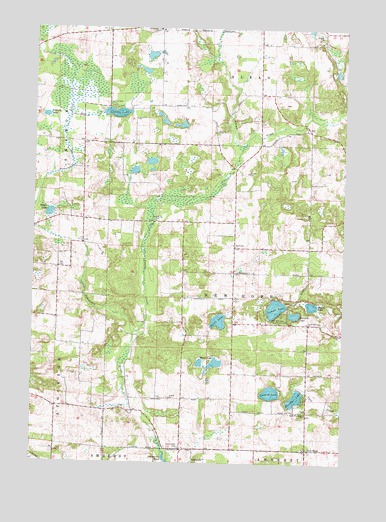
New Hope, WI USGS Topographic Map
Click on map above to begin viewing in our Map Viewer.

This topographic map contains these locations and features:
Feature Name Type Latitude Longitude GNIS ID View Map
Chick-A-Gami Bay Scout CampLocaleN44.5425°W89.2754°1563008View Map
Collins LakeLakeN44.6005°W89.3421°1563269View Map
Collins ParkParkN44.6025°W89.3434°1563271View Map
GarfieldPopulated PlaceN44.5619°W89.2943°1577608View Map
Hamilton School (historical)SchoolN44.5919°W89.3343°1851483View Map
Hintz LakeLakeN44.5409°W89.3000°1566486View Map
Kranski LakeLakeN44.5998°W89.3706°1567638View Map
Malloy School (historical)SchoolN44.5697°W89.3093°1851512View Map
Minister LakeLakeN44.5428°W89.2695°1569557View Map
Nelsonville CemeteryCemeteryN44.5047°W89.3154°1570169View Map
New HopePopulated PlaceN44.5036°W89.2637°1570222View Map
New Hope Pines State Natural AreaParkN44.5747°W89.2734°2061072View Map
North New Hope ChurchChurchN44.5397°W89.2634°1570471View Map
Oakland School (historical)SchoolN44.5422°W89.3701°1851528View Map
Onland LakeLakeN44.5204°W89.2786°1570840View Map
Pallen LakeLakeN44.5717°W89.3686°1570996View Map
Poncho CreekStreamN44.5369°W89.3348°1571748View Map
Reton LakeLakeN44.5286°W89.3016°1572221View Map
Rinehart LakeLakeN44.5188°W89.2686°1572325View Map
Rinehart School (historical)SchoolN44.5150°W89.2626°1851546View Map
Saint Adalbert SchoolSchoolN44.6248°W89.3253°1572812View Map
Skunk LakeLakeN44.5455°W89.2627°1574253View Map
South New Hope ChurchChurchN44.5141°W89.2643°1574472View Map
Sunset LakeLakeN44.5447°W89.2772°1575112View Map
Tomorrow River School (historical)SchoolN44.5703°W89.3657°1851586View Map
Town of New HopeCivilN44.5478°W89.2842°1583811View Map

Note: Coordinates in the location and feature list above are referenced to NAD83 datum.


Copyright (C) 2008-2025 Ryan Niemi / Sunset Dynamics ... All Rights Reserved