TopoQuest Logo
Do you find TopoQuest useful?
Help keep TopoQuest running and adding new maps/features by donating!
Bitcoin:  19c7KJd3qBynnjoSw5npx9KScwjBe4ifkT
Litecoin:  LXs6TkuXGGXo1vDsWCkWVdjQX94eUKd6ui
Home View Maps Find Maps Find Places Resources & Links


Blaine, Wisconsin Topographic Map

USGS Map Title: Blaine, WI
USGS Map MRC: 44089C3
DRG (GeoTIFF) Download: o44089c3.tif


Neighboring USGS Topographic Map Quads:


  Arnott, WI  
44089D4
 

  Amherst, WI  
44089D3
 

  Scandinavia, WI  
44089D2
 

  Almond, WI  
44089C4
 

  Blaine, WI  
44089C3
 

  King, WI  
44089C2
 

  Plainfield, WI  
44089B4
 

  Wautoma NE, WI  
44089B3
 

  Wild Rose, WI  
44089B2


Map MRC Location:

N45°
W90°
N45°
W89°
H8 H7 H6 H5 H4 H3 H2 H1
G8 G7 G6 G5 G4 G3 G2 G1
F8 F7 F6 F5 F4 F3 F2 F1
E8 E7 E6 E5 E4 E3 E2 E1
D8 D7 D6 D5 D4 D3 D2 D1
C8 C7 C6 C5 C4 C3 C2 C1
B8 B7 B6 B5 B4 B3 B2 B1
A8 A7 A6 A5 A4 A3 A2 A1
N44°
W90°
N44°
W89°

Blaine, WI USGS 1:24K Topographic Map Preview:
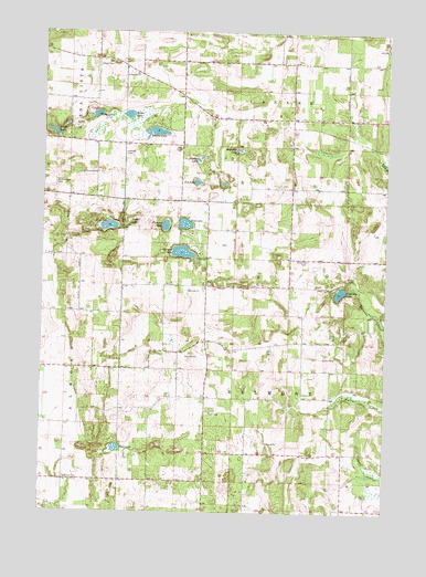
Blaine, WI USGS Topographic Map
Click on map above to begin viewing in our Map Viewer.

This topographic map contains these locations and features:
Feature Name Type Latitude Longitude GNIS ID View Map
BlainePopulated PlaceN44.3091°W89.3157°1561908View Map
Boelter LakeLakeN44.3490°W89.3343°1561998View Map
Buena Vista CemeteryCemeteryN44.3355°W89.3704°1562354View Map
East LakeLakeN44.2666°W89.3474°1564342View Map
Elmwood CemeteryCemeteryN44.3158°W89.2787°1564583View Map
Fountain LakeLakeN44.3074°W89.2667°1565177View Map
Fountain Lake DamDamN44.3083°W89.2651°1793535View Map
Hillside CemeteryCemeteryN44.3433°W89.3451°1566461View Map
Huntleys LakeLakeN44.3445°W89.3044°1566820View Map
Jim LakeLakeN44.3360°W89.3191°1567179View Map
Lincoln School (historical)SchoolN44.2869°W89.3257°1851505View Map
Madley School (historical)SchoolN44.3633°W89.3243°1851510View Map
Peters LakeLakeN44.3533°W89.3440°1571260View Map
Pickerel LakeLakeN44.3177°W89.3242°1571316View Map
Pickerel Lake State Natural AreaParkN44.3153°W89.3234°2061073View Map
Pierces LakeLakeN44.3419°W89.3189°1571356View Map
Pine LakeLakeN44.3252°W89.3235°1571488View Map
Pleasant LakeLakeN44.3247°W89.3304°1571611View Map
Poplar LakeLakeN44.3256°W89.3432°1571773View Map
Riley LakeLakeN44.3534°W89.3559°1572317View Map
Saint Patricks ChurchChurchN44.3641°W89.3415°1573414View Map
Silver LakeLakeN44.3488°W89.3713°1574136View Map
Sunnyview School (historical)SchoolN44.3161°W89.2854°1851583View Map
Town of BelmontCivilN44.2873°W89.2853°1582790View Map
Town of LanarkCivilN44.3742°W89.2848°1583523View Map
Wolf LakeLakeN44.3244°W89.3510°1576935View Map

Note: Coordinates in the location and feature list above are referenced to NAD83 datum.


Copyright (C) 2008-2024 Ryan Niemi / Sunset Dynamics ... All Rights Reserved