TopoQuest Logo
Do you find TopoQuest useful?
Help keep TopoQuest running and adding new maps/features by donating!
Bitcoin:  19c7KJd3qBynnjoSw5npx9KScwjBe4ifkT
Litecoin:  LXs6TkuXGGXo1vDsWCkWVdjQX94eUKd6ui
Home View Maps Find Maps Find Places Resources & Links


Faught Ridge, Arizona Topographic Map

USGS Map Title: Faught Ridge, AZ
USGS Map MRC: 34110A1
DRG (GeoTIFF) Download: o34110a1.tif


Neighboring USGS Topographic Map Quads:


  Red Top Mountain, AZ  
34110B2
 

  Show Low South, AZ  
34110B1
 

  Lakeside, AZ  
34109B8
 

  Long Tom Canyon, AZ  
34110A2
 

  Faught Ridge, AZ  
34110A1
 

  Indian Pine, AZ  
34109A8
 

  Cedar Creek, AZ  
33110H2
 

  Round Top Mountain, AZ  
33110H1
 

  Alchesay Flat, AZ  
33109H8


Map MRC Location:

N35°
W111°
N35°
W110°
H8 H7 H6 H5 H4 H3 H2 H1
G8 G7 G6 G5 G4 G3 G2 G1
F8 F7 F6 F5 F4 F3 F2 F1
E8 E7 E6 E5 E4 E3 E2 E1
D8 D7 D6 D5 D4 D3 D2 D1
C8 C7 C6 C5 C4 C3 C2 C1
B8 B7 B6 B5 B4 B3 B2 B1
A8 A7 A6 A5 A4 A3 A2 A1
N34°
W111°
N34°
W110°

Faught Ridge, AZ USGS 1:24K Topographic Map Preview:
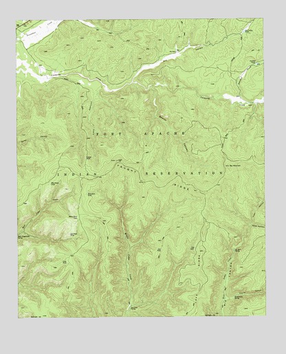
Faught Ridge, AZ USGS Topographic Map
Click on map above to begin viewing in our Map Viewer.

This topographic map contains these locations and features:
Feature Name Type Latitude Longitude GNIS ID View Map
Beaver CanyonValleyN34.0967°W110.0584°1161View Map
Big MountainSummitN34.0631°W110.0190°1331View Map
Cattail RushSpringN34.0673°W110.0909°2573View Map
Dry LakeLakeN34.0287°W110.0364°4144View Map
Dry ValleyValleyN34.0989°W110.0676°28646View Map
Dry Valley TankReservoirN34.1196°W110.0107°4168View Map
East Burn TankReservoirN34.0522°W110.0902°4270View Map
Faught RidgeRidgeN34.0578°W110.0562°4556View Map
Faught Ridge LookoutLocaleN34.0653°W110.0757°23356View Map
First HollowValleyN34.0392°W110.0073°29010View Map
Fourth HollowValleyN34.0081°W110.0215°29153View Map
Heavy Burn TankReservoirN34.0422°W110.0954°5688View Map
Lake RidgeRidgeN34.0192°W110.0346°6846View Map
Lake TankReservoirN34.0235°W110.1006°6848View Map
Log Road TankReservoirN34.0349°W110.0995°7271View Map
Lucy CanyonValleyN34.0975°W110.0823°7535View Map
Petrified CreekStreamN34.0900°W110.0132°32839View Map
Petrified TankReservoirN34.1059°W110.0042°9359View Map
Rattlesnake SpringSpringN34.0083°W110.0166°9981View Map
Salt TankReservoirN34.0281°W110.0532°10772View Map
Salt Trap SpringSpringN34.0038°W110.0691°10774View Map
Third HollowValleyN34.0387°W110.0079°35252View Map
Twentyfour-Dart SpringSpringN34.0276°W110.0163°12920View Map
West Burn TankReservoirN34.0563°W110.1089°13484View Map
West RanchLocaleN34.1109°W110.0454°13525View Map

Note: Coordinates in the location and feature list above are referenced to NAD83 datum.


Copyright (C) 2008-2025 Ryan Niemi / Sunset Dynamics ... All Rights Reserved