TopoQuest Logo
Do you find TopoQuest useful?
Help keep TopoQuest running and adding new maps/features by donating!
Bitcoin:  19c7KJd3qBynnjoSw5npx9KScwjBe4ifkT
Litecoin:  LXs6TkuXGGXo1vDsWCkWVdjQX94eUKd6ui
Home View Maps Find Maps Find Places Resources & Links


Ferron, Utah Topographic Map

USGS Map Title: Ferron, UT
USGS Map MRC: 39111A2
DRG (GeoTIFF) Download: o39111a2.tif


Neighboring USGS Topographic Map Quads:


  Ferron Canyon, UT  
39111B3
 

  The Cap, UT  
39111B2
 

  Castle Dale, UT  
39111B1
 

  Flagstaff Peak, UT  
39111A3
 

  Ferron, UT  
39111A2
 

  Molen, UT  
39111A1
 

  Emery West, UT  
38111H3
 

  Emery East, UT  
38111H2
 

  Short Canyon, UT  
38111H1


Map MRC Location:

N40°
W112°
N40°
W111°
H8 H7 H6 H5 H4 H3 H2 H1
G8 G7 G6 G5 G4 G3 G2 G1
F8 F7 F6 F5 F4 F3 F2 F1
E8 E7 E6 E5 E4 E3 E2 E1
D8 D7 D6 D5 D4 D3 D2 D1
C8 C7 C6 C5 C4 C3 C2 C1
B8 B7 B6 B5 B4 B3 B2 B1
A8 A7 A6 A5 A4 A3 A2 A1
N39°
W112°
N39°
W111°

Ferron, UT USGS 1:24K Topographic Map Preview:
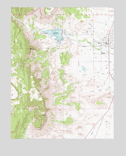
Ferron, UT USGS Topographic Map
Click on map above to begin viewing in our Map Viewer.

This topographic map contains these locations and features:
Feature Name Type Latitude Longitude GNIS ID View Map
Biddlecome HollowValleyN39.1139°W111.2393°1438627View Map
Bills ForkStreamN39.0239°W111.2282°1438769View Map
Blue DugwayTrailN39.0411°W111.1293°1438929View Map
Blue TrailTrailN39.0994°W111.2388°1438962View Map
Blue Trail CreekStreamN39.1102°W111.2379°1448154View Map
Cattle Country Mobile Home CampgroundLocaleN39.0791°W111.1318°1448237View Map
City of FerronCivilN39.0913°W111.1337°2410501View Map
Diversion HollowValleyN39.1002°W111.1782°1450333View Map
Diversion Hollow Debris Basin ReservoirReservoirN39.0993°W111.1788°1447756View Map
Dry WashValleyN39.0972°W111.1796°1440696View Map
Dry Wash TrailTrailN39.0780°W111.2207°1448357View Map
Emery County Ambulance - FerronBuildingN39.0888°W111.1305°2768447View Map
Emery County HomeBuildingN39.0908°W111.1424°1448376View Map
FerronPopulated PlaceN39.0936°W111.1332°1441026View Map
Ferron Debris Basin Number Five DamDamN39.1083°W111.1541°1447759View Map
Ferron Debris Basin Number Four DamDamN39.0983°W111.1774°1447757View Map
Ferron Debris Basin Number One DamDamN39.0466°W111.1407°1447747View Map
Ferron Debris Basin Number Three DamDamN39.0683°W111.1624°1447751View Map
Ferron Debris Basin Number Two DamDamN39.0500°W111.1441°1447749View Map
Ferron District Ranger StationLocaleN39.0850°W111.1327°1451243View Map
Ferron Elementary SchoolSchoolN39.0912°W111.1349°1448968View Map
Ferron Fire DepartmentBuildingN39.0888°W111.1304°2627177View Map
Ferron MillPopulated PlaceN39.0997°W111.1843°1441030View Map
Ferron Post OfficePost OfficeN39.0909°W111.1339°2769057View Map
First Baptist ChurchChurchN39.0897°W111.1349°1449256View Map
Herring FlatFlatN39.0641°W111.1613°1441722View Map
Hole TrailTrailN39.0203°W111.2310°1450392View Map
Indian HollowValleyN39.1036°W111.1507°1450400View Map
Indian Hollow Debris Basin ReservoirReservoirN39.1092°W111.1555°1447758View Map
King DitchCanalN39.0758°W111.1454°1450410View Map
Little Nelson MountainSummitN39.0836°W111.2282°1442751View Map
Mill Site CampgroundLocaleN39.0919°W111.1966°1448663View Map
Millsite DamDamN39.0966°W111.1857°1447755View Map
Millsite Golf CourseLocaleN39.1005°W111.1857°1454983View Map
Millsite ReservoirReservoirN39.0993°W111.1973°1447754View Map
Millsite State ParkParkN39.0916°W111.1927°1455398View Map
Nelson MountainSummitN39.0441°W111.2229°1443792View Map
Peterson RanchLocaleN39.1014°W111.2116°1444311View Map
San Rafael Junior High SchoolSchoolN39.0813°W111.1400°1448967View Map
South DitchCanalN39.0616°W111.1541°1450506View Map
Straight Hollow North Debris Basin ReservoirReservoirN39.0493°W111.1451°1447748View Map
Straight Hollow South Debris Basin ReservoirReservoirN39.0460°W111.1424°1447746View Map
The Church of Jesus Christ of Latter Day SaintsChurchN39.0811°W111.1413°1449450View Map
The Church of Jesus Christ of Latter Day SaintsChurchN39.0930°W111.1327°1449451View Map
The HoleValleyN39.0136°W111.2341°1446461View Map
The HoleAreaN39.0258°W111.2385°1451261View Map
Youngs PeakSummitN39.0225°W111.2132°1447576View Map
Zwahlen WashValleyN39.0539°W111.1654°1450562View Map
Zwahlen Wash Debris Basin ReservoirReservoirN39.0663°W111.1621°1447750View Map

Note: Coordinates in the location and feature list above are referenced to NAD83 datum.


Copyright (C) 2008-2025 Ryan Niemi / Sunset Dynamics ... All Rights Reserved