TopoQuest Logo
Do you find TopoQuest useful?
Help keep TopoQuest running and adding new maps/features by donating!
Bitcoin:  19c7KJd3qBynnjoSw5npx9KScwjBe4ifkT
Litecoin:  LXs6TkuXGGXo1vDsWCkWVdjQX94eUKd6ui
Home View Maps Find Maps Find Places Resources & Links


Molen, Utah Topographic Map

USGS Map Title: Molen, UT
USGS Map MRC: 39111A1
DRG (GeoTIFF) Download: o39111a1.tif


Neighboring USGS Topographic Map Quads:


  The Cap, UT  
39111B2
 

  Castle Dale, UT  
39111B1
 

  Hadden Holes, UT  
39110B8
 

  Ferron, UT  
39111A2
 

  Molen, UT  
39111A1
 

  Horn Silver Gulch, UT  
39110A8
 

  Emery East, UT  
38111H2
 

  Short Canyon, UT  
38111H1
 

  Sid And Charley, UT  
38110H8


Map MRC Location:

N40°
W112°
N40°
W111°
H8 H7 H6 H5 H4 H3 H2 H1
G8 G7 G6 G5 G4 G3 G2 G1
F8 F7 F6 F5 F4 F3 F2 F1
E8 E7 E6 E5 E4 E3 E2 E1
D8 D7 D6 D5 D4 D3 D2 D1
C8 C7 C6 C5 C4 C3 C2 C1
B8 B7 B6 B5 B4 B3 B2 B1
A8 A7 A6 A5 A4 A3 A2 A1
N39°
W112°
N39°
W111°

Molen, UT USGS 1:24K Topographic Map Preview:
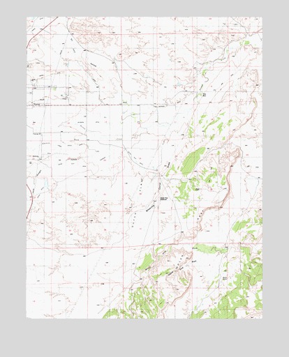
Molen, UT USGS Topographic Map
Click on map above to begin viewing in our Map Viewer.

This topographic map contains these locations and features:
Feature Name Type Latitude Longitude GNIS ID View Map
Bench DitchCanalN39.1016°W111.0902°1448127View Map
Blue DougwaySlopeN39.0489°W111.1227°1455187View Map
Dutch FlatFlatN39.0480°W111.0666°1435471View Map
Dutch Flat DitchCanalN39.0647°W111.0993°1450342View Map
Dutch Flat ReservoirReservoirN39.0500°W111.0550°1435472View Map
Eli HollowValleyN39.0989°W111.0813°1435504View Map
Ferron City CemeteryCemeteryN39.0936°W111.1232°1435525View Map
Fugate DitchCanalN39.1052°W111.0954°1435567View Map
Kings CrownSummitN39.0536°W111.0335°1435824View Map
Larson RanchLocaleN39.0933°W111.0391°1429483View Map
MolenPopulated PlaceN39.0883°W111.0735°1437640View Map
Molen CemeteryCemeteryN39.0889°W111.0553°1435976View Map
Molen DitchCanalN39.0897°W111.1238°1450433View Map
Molen TanksReservoirN39.0150°W111.0225°1430404View Map
Nelson RanchLocaleN39.0614°W111.1154°1430683View Map
Paradise RanchLocaleN39.1144°W111.0029°1431092View Map
Peterson DitchCanalN39.0836°W111.0718°1436114View Map
Shearing Corral DrawValleyN39.0741°W111.0429°1436340View Map
Straight HollowValleyN39.0689°W111.0746°1450519View Map
The BoxBendN39.0928°W111.0324°1435186View Map
Yellow Seep WashValleyN39.0272°W111.0316°1436672View Map
Zwahlen DitchCanalN39.0664°W111.1243°1450561View Map

Note: Coordinates in the location and feature list above are referenced to NAD83 datum.


Copyright (C) 2008-2025 Ryan Niemi / Sunset Dynamics ... All Rights Reserved