TopoQuest Logo
Do you find TopoQuest useful?
Help keep TopoQuest running and adding new maps/features by donating!
Bitcoin:  19c7KJd3qBynnjoSw5npx9KScwjBe4ifkT
Litecoin:  LXs6TkuXGGXo1vDsWCkWVdjQX94eUKd6ui
Home View Maps Find Maps Find Places Resources & Links


Pine Grove, California Topographic Map

USGS Map Title: Pine Grove, CA
USGS Map MRC: 38120D6
DRG (GeoTIFF) Download: o38120d6.tif


Neighboring USGS Topographic Map Quads:


  Fiddletown, CA  
38120E7
 

  Aukum, CA  
38120E6
 

  Omo Ranch, CA  
38120E5
 

  Amador City, CA  
38120D7
 

  Pine Grove, CA  
38120D6
 

  West Point, CA  
38120D5
 

  Jackson, CA  
38120C7
 

  Mokelumne Hill, CA  
38120C6
 

  Rail Road Flat, CA  
38120C5


Map MRC Location:

N39°
W121°
N39°
W120°
H8 H7 H6 H5 H4 H3 H2 H1
G8 G7 G6 G5 G4 G3 G2 G1
F8 F7 F6 F5 F4 F3 F2 F1
E8 E7 E6 E5 E4 E3 E2 E1
D8 D7 D6 D5 D4 D3 D2 D1
C8 C7 C6 C5 C4 C3 C2 C1
B8 B7 B6 B5 B4 B3 B2 B1
A8 A7 A6 A5 A4 A3 A2 A1
N38°
W121°
N38°
W120°

Pine Grove, CA USGS 1:24K Topographic Map Preview:
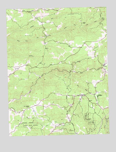
Pine Grove, CA USGS Topographic Map
Click on map above to begin viewing in our Map Viewer.

This topographic map contains these locations and features:
Feature Name Type Latitude Longitude GNIS ID View Map
Amador CanalCanalN38.3874°W120.6985°254556View Map
Amador CountyCivilN38.4464°W120.6511°1675841View Map
Amador Fire Protection District Station 114BuildingN38.4131°W120.6589°2624598View Map
Amador Fire Protection District Station 115BuildingN38.4146°W120.6816°2624620View Map
American Legion Ambulance Station 4BuildingN38.4130°W120.6588°2662262View Map
Armory HallBuildingN38.4430°W120.6313°1733384View Map
California Department of Forestry and Fire Protection Pine Grove Fire Station 80BuildingN38.4144°W120.6635°2624703View Map
California Youth AuthorityLocaleN38.4119°W120.6394°220408View Map
Chaw'se Regional Indian MuseumBuildingN38.4249°W120.6427°1733388View Map
ClintonPopulated PlaceN38.3760°W120.6683°1658290View Map
Clinton PeakSummitN38.3796°W120.6755°221228View Map
Clute BuildingBuildingN38.4419°W120.6313°1733389View Map
Department of Forestry and Fire Protection Pine Grove ConservationBuildingN38.4111°W120.6394°2624153View Map
Else CreekStreamN38.4338°W120.6724°1733392View Map
Fort Ann MineMineN38.4882°W120.6313°223694View Map
Grass Valley CreekStreamN38.4357°W120.6735°260795View Map
Helbing RanchLocaleN38.4846°W120.6555°225121View Map
Indian Grinding Rock State Historic ParkParkN38.4249°W120.6427°1733387View Map
Irishtown (historical)Populated PlaceN38.3888°W120.6747°1733395View Map
Jackson RancheriaCivilN38.3849°W120.7226°226085View Map
Lockwood Fire Protection District Station 152BuildingN38.4613°W120.6583°2624673View Map
Mount ZionSummitN38.3899°W120.6519°238322View Map
Mount Zion State ForestForestN38.3924°W120.6533°229176View Map
New York Ranch SchoolSchoolN38.4035°W120.7255°229508View Map
North TrailTrailN38.4277°W120.6427°1733403View Map
Oneto RanchLocaleN38.4407°W120.7380°230050View Map
Pine AcresPopulated PlaceN38.3960°W120.6435°1733404View Map
Pine GrovePopulated PlaceN38.4130°W120.6588°1659391View Map
Pine Grove Census Designated PlaceCensusN38.4074°W120.6606°2583114View Map
Pine Grove Community ChurchChurchN38.4124°W120.6585°1733405View Map
Pine Grove Forestry CampLocaleN38.4132°W120.6399°1733407View Map
Pine Grove ParkParkN38.4130°W120.6585°1733408View Map
Pine Grove Post OfficePost OfficeN38.4117°W120.6537°1733409View Map
Pine Grove Stem Magnet Elementary SchoolSchoolN38.4130°W120.6536°1733406View Map
Pine Grove Town HallBuildingN38.4132°W120.6588°1733410View Map
RancheriaLocaleN38.4607°W120.7030°231210View Map
Saint Bernards Catholic ChurchChurchN38.4446°W120.6305°1733414View Map
Soldiers Memorial ParkParkN38.4424°W120.6316°1733418View Map
South Branch Sutter CreekStreamN38.4405°W120.6316°267410View Map
South Nature TrailTrailN38.4210°W120.6497°1733419View Map
U'macha'tam'ma Environmental CampsitesLocaleN38.4274°W120.6394°1733429View Map
VolcanoPopulated PlaceN38.4430°W120.6308°237127View Map
Volcano Catholic CemeteryCemeteryN38.4462°W120.6294°1733386View Map
Volcano Census Designated PlaceCensusN38.4456°W120.6305°2583178View Map
Volcano Jail HouseBuildingN38.4430°W120.6316°1733430View Map
Volcano Post OfficePost OfficeN38.4423°W120.6305°1733431View Map
Volcano Protestant CemeteryCemeteryN38.4452°W120.6288°1733412View Map
Volcano School (historical)SchoolN38.4427°W120.6297°1733432View Map
Zion California Department of Forestry StationLocaleN38.4141°W120.6638°1733433View Map

Note: Coordinates in the location and feature list above are referenced to NAD83 datum.


Copyright (C) 2008-2025 Ryan Niemi / Sunset Dynamics ... All Rights Reserved