TopoQuest Logo
Do you find TopoQuest useful?
Help keep TopoQuest running and adding new maps/features by donating!
Bitcoin:  19c7KJd3qBynnjoSw5npx9KScwjBe4ifkT
Litecoin:  LXs6TkuXGGXo1vDsWCkWVdjQX94eUKd6ui
Home View Maps Find Maps Find Places Resources & Links


Cloudcroft, New Mexico Topographic Map

USGS Map Title: Cloudcroft, NM
USGS Map MRC: 32105H6
DRG (GeoTIFF) Download: o32105h6.tif


Neighboring USGS Topographic Map Quads:


  Domingo Peak, NM  
33105A7
 

  Firman Canyon, NM  
33105A6
 

  Elk-Silver, NM  
33105A5
 

  High Rolls, NM  
32105H7
 

  Cloudcroft, NM  
32105H6
 

  Harvey Ranch, NM  
32105H5
 

  Sacramento Peak, NM  
32105G7
 

  Bluff Springs, NM  
32105G6
 

  Sacramento, NM  
32105G5


Map MRC Location:

N33°
W106°
N33°
W105°
H8 H7 H6 H5 H4 H3 H2 H1
G8 G7 G6 G5 G4 G3 G2 G1
F8 F7 F6 F5 F4 F3 F2 F1
E8 E7 E6 E5 E4 E3 E2 E1
D8 D7 D6 D5 D4 D3 D2 D1
C8 C7 C6 C5 C4 C3 C2 C1
B8 B7 B6 B5 B4 B3 B2 B1
A8 A7 A6 A5 A4 A3 A2 A1
N32°
W106°
N32°
W105°

Cloudcroft, NM USGS 1:24K Topographic Map Preview:
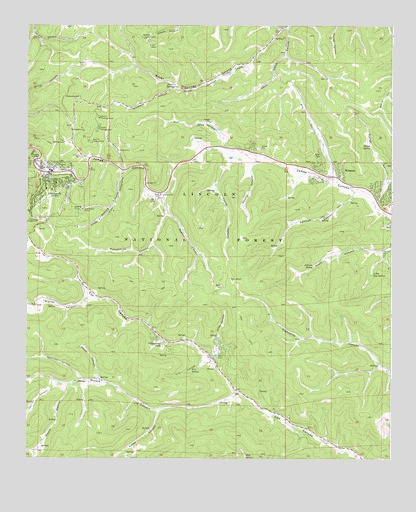
Cloudcroft, NM USGS Topographic Map
Click on map above to begin viewing in our Map Viewer.

This topographic map contains these locations and features:
Feature Name Type Latitude Longitude GNIS ID View Map
Apache CampgroundLocaleN32.9668°W105.7289°903213View Map
Apache CanyonValleyN32.9579°W105.7169°903214View Map
Aspen CampgroundLocaleN32.9423°W105.7411°1987526View Map
Bass CemeteryCemeteryN32.9054°W105.6833°903601View Map
Bird SpringSpringN32.8754°W105.6755°1987524View Map
Black Bear CampgroundLocaleN32.9401°W105.7400°1987527View Map
Bradford CanyonValleyN32.9820°W105.6994°904054View Map
Cascade Ski TrailTrailN32.9506°W105.7047°930571View Map
Chippeway ParkPopulated PlaceN32.9095°W105.7053°905117View Map
Church of ChristChurchN32.9573°W105.7425°920416View Map
Cloud Climbing Railroad Historical MarkerParkN32.9573°W105.7425°931704View Map
Cloud Nine Ski TrailTrailN32.9506°W105.7047°930577View Map
CloudcroftPopulated PlaceN32.9573°W105.7425°905216View Map
Cloudcroft C335MineN32.9620°W105.7097°916991View Map
Cloudcroft Christian CenterChurchN32.9573°W105.7425°920418View Map
Cloudcroft Elementary SchoolSchoolN32.9580°W105.7410°934149View Map
Cloudcroft High SchoolSchoolN32.9580°W105.7415°934151View Map
Cloudcroft Intermediate Life SupportBuildingN32.9579°W105.7353°2657605View Map
Cloudcroft Lodge Historic SiteBuildingN32.9573°W105.7425°933786View Map
Cloudcroft Middle SchoolSchoolN32.9581°W105.7423°934150View Map
Cloudcroft Municipal SchoolSchoolN32.9573°W105.7425°935651View Map
Cloudcroft Police DepartmentBuildingN32.9582°W105.7449°2722591View Map
Cloudcroft Post OfficePost OfficeN32.9583°W105.7442°937977View Map
Cloudcroft Recreation AreaLocaleN32.9709°W105.7305°1987528View Map
Cloudcroft Volunteer Fire Department Station 1BuildingN32.9579°W105.7352°2657684View Map
Cloudcroft Volunteer Fire Department Station 2BuildingN32.9607°W105.7476°2658066View Map
Cloudcroft Weather StationLocaleN32.9573°W105.7425°931864View Map
Coyote Ski TrailTrailN32.9506°W105.7047°930550View Map
Cross Tie Ski TrailTrailN32.9506°W105.7047°930549View Map
Dale Resler CampLocaleN32.9470°W105.7311°905582View Map
Deerhead CampgroundLocaleN32.9437°W105.7464°905711View Map
Dry CanyonValleyN32.9551°W105.6442°905868View Map
El Oso Ski TrailTrailN32.9506°W105.7047°930575View Map
Fir CampgroundLocaleN32.9695°W105.7305°906269View Map
First Baptist ChurchChurchN32.9573°W105.7425°920118View Map
Fite CanyonValleyN32.9031°W105.6858°906285View Map
Fite SpringSpringN32.9008°W105.6936°906286View Map
Forks TankReservoirN32.9854°W105.6483°913226View Map
Franks Plunge Ski TrailTrailN32.9506°W105.7047°930576View Map
Goodsell CanyonValleyN32.8976°W105.7300°906648View Map
Grainery TankReservoirN32.9797°W105.6272°913222View Map
James Canyon Volunteer Fire Department Station 1 HeadquartersBuildingN32.9561°W105.6455°2657838View Map
Johnson SpringSpringN32.9308°W105.6521°907413View Map
Jones CanyonValleyN32.9037°W105.6867°907424View Map
Kerr CanyonValleyN32.8968°W105.7389°902903View Map
Little Apache CanyonValleyN32.9590°W105.7186°907982View Map
Little Hay SpringSpringN32.9284°W105.6315°908021View Map
Little Lift Ski TrailTrailN32.9506°W105.7047°930544View Map
Lucas CanyonValleyN32.8893°W105.7041°908298View Map
Lumber Jack Ski TrailTrailN32.9506°W105.7047°930568View Map
Mexican Canyon Railroad Trestle Historic SiteBridgeN32.9573°W105.7425°934387View Map
Narrow Gauge Ski TrailTrailN32.9506°W105.7047°930553View Map
Orr CanyonValleyN32.9645°W105.6814°909362View Map
Painter CanyonValleyN32.9626°W105.6700°909439View Map
Pancho Villa Ski TrailTrailN32.9506°W105.7047°930545View Map
Peake CanyonValleyN32.8979°W105.7261°909525View Map
Penny Whistle Ski TrailTrailN32.9506°W105.7047°930574View Map
Pierce CanyonValleyN32.9215°W105.7264°909635View Map
Pine CampgroundLocaleN32.9662°W105.7372°893276View Map
Potato TankReservoirN32.9801°W105.6748°913225View Map
Pumphouse CanyonValleyN32.9515°W105.7039°909894View Map
Pumphouse Ski TrailTrailN32.9506°W105.7047°930578View Map
Quick Silver Ski TrailTrailN32.9506°W105.7047°930572View Map
Rawlins CanyonValleyN32.9468°W105.7022°910031View Map
Rebeccas Revenge Ski TrailTrailN32.9506°W105.7047°930547View Map
Red Dog Ski TrailTrailN32.9506°W105.7047°930551View Map
Roadrunner Ski TrailTrailN32.9506°W105.7047°930569View Map
Russia CanyonValleyN32.8937°W105.6778°910479View Map
Sacramento Mountains Historical Society MuseumBuildingN32.9573°W105.7425°929508View Map
Saddle CampgroundLocaleN32.9704°W105.7255°910509View Map
Short Ski TrailTrailN32.9506°W105.7047°930543View Map
Silver CampgroundLocaleN32.9734°W105.7253°911061View Map
Silver Snowplay AreaLocaleN32.9762°W105.7272°913375View Map
Silver Spoon Ski TrailTrailN32.9506°W105.7047°930546View Map
Silver SpringSpringN32.9827°W105.6999°911076View Map
Ski Clouderoft Ski AreaLocaleN32.9493°W105.7061°936808View Map
Sleepy Grass CampgroundLocaleN32.9490°W105.7194°911136View Map
Slough CanyonValleyN32.9481°W105.6308°911141View Map
Slough SpringSpringN32.9652°W105.6326°911144View Map
Snow Canyon Ski TrailTrailN32.9506°W105.7047°930567View Map
SpringvilleLocaleN32.9573°W105.7425°935945View Map
Spud Patch CanyonValleyN32.9990°W105.6608°911354View Map
Sullivan CanyonValleyN32.9529°W105.6367°911471View Map
The Cloud Climber Ski TrailTrailN32.9506°W105.7047°930579View Map
The Couplings Ski TrailTrailN32.9506°W105.7047°930548View Map
The Springs Ski TrailTrailN32.9506°W105.7047°930552View Map
Thumper Ski TrailTrailN32.9506°W105.7047°930570View Map
Trestle Ski TrailTrailN32.9506°W105.7047°930554View Map
Turkey Pen CanyonValleyN32.9993°W105.6636°911885View Map
Twin Forks Census Designated PlaceCensusN32.9463°W105.6374°2584228View Map
Upper Cox Canyon Volunteer Fire DepartmentBuildingN32.9095°W105.7037°2657940View Map
Village of CloudcroftCivilN32.9532°W105.7327°2413541View Map
Wayne CanyonValleyN32.8973°W105.7339°897555View Map
Whistle Ski TrailTrailN32.9506°W105.7047°930573View Map
WimsattPopulated PlaceN32.9581°W105.6425°912443View Map
Wofford Electronic SiteLocaleN32.9937°W105.7086°913224View Map
Wofford Lookout TowerTowerN32.9965°W105.7105°929095View Map
Young CanyonValleyN32.9643°W105.6761°912531View Map
Zenith ParkParkN32.9579°W105.7389°912544View Map

Note: Coordinates in the location and feature list above are referenced to NAD83 datum.


Copyright (C) 2008-2024 Ryan Niemi / Sunset Dynamics ... All Rights Reserved