TopoQuest Logo
Do you find TopoQuest useful?
Help keep TopoQuest running and adding new maps/features by donating!
Bitcoin:  19c7KJd3qBynnjoSw5npx9KScwjBe4ifkT
Litecoin:  LXs6TkuXGGXo1vDsWCkWVdjQX94eUKd6ui
Home View Maps Find Maps Find Places Resources & Links


Harvey Ranch, New Mexico Topographic Map

USGS Map Title: Harvey Ranch, NM
USGS Map MRC: 32105H5
DRG (GeoTIFF) Download: o32105h5.tif


Neighboring USGS Topographic Map Quads:


  Firman Canyon, NM  
33105A6
 

  Elk-Silver, NM  
33105A5
 

  Turkey Peak, NM  
33105A4
 

  Cloudcroft, NM  
32105H6
 

  Harvey Ranch, NM  
32105H5
 

  Mayhill, NM  
32105H4
 

  Bluff Springs, NM  
32105G6
 

  Sacramento, NM  
32105G5
 

  Woodson Canyon, NM  
32105G4


Map MRC Location:

N33°
W106°
N33°
W105°
H8 H7 H6 H5 H4 H3 H2 H1
G8 G7 G6 G5 G4 G3 G2 G1
F8 F7 F6 F5 F4 F3 F2 F1
E8 E7 E6 E5 E4 E3 E2 E1
D8 D7 D6 D5 D4 D3 D2 D1
C8 C7 C6 C5 C4 C3 C2 C1
B8 B7 B6 B5 B4 B3 B2 B1
A8 A7 A6 A5 A4 A3 A2 A1
N32°
W106°
N32°
W105°

Harvey Ranch, NM USGS 1:24K Topographic Map Preview:
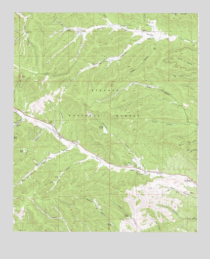
Harvey Ranch, NM USGS Topographic Map
Click on map above to begin viewing in our Map Viewer.

This topographic map contains these locations and features:
Feature Name Type Latitude Longitude GNIS ID View Map
Baird Canyon TankReservoirN32.9818°W105.6141°912773View Map
Beard CanyonValleyN32.9879°W105.6178°903691View Map
Bell CanyonValleyN32.9854°W105.5353°903726View Map
Bell TankReservoirN32.9588°W105.5946°912775View Map
Board Tree CanyonValleyN32.9904°W105.5289°903973View Map
Chimney SpringSpringN32.9379°W105.5987°909597View Map
Christadelphian ChurchChurchN32.9929°W105.5497°905131View Map
Church CampLocaleN32.9118°W105.5400°1987530View Map
Claim TankReservoirN32.9483°W105.5141°912777View Map
Coleman RanchLocaleN32.9132°W105.6080°906860View Map
Cotton CanyonValleyN32.9334°W105.6022°905393View Map
Cotton SpringSpringN32.9207°W105.6180°905394View Map
Deer Canyon TankReservoirN32.8864°W105.5110°912781View Map
Deer SpringSpringN32.8827°W105.5015°912782View Map
Dollins SpringSpringN32.8848°W105.5468°905811View Map
Dollins TankReservoirN32.8975°W105.5465°912766View Map
Eightmile CanyonValleyN32.9223°W105.5855°906024View Map
Grainery TankReservoirN32.9754°W105.6186°924220View Map
Graveyard TankReservoirN32.8912°W105.5282°912771View Map
Hansen CanyonValleyN32.9923°W105.5572°906832View Map
HortonvillePopulated PlaceN32.9115°W105.5358°1987529View Map
Hyatt CanyonValleyN32.9390°W105.6194°907174View Map
Hyatt SpringSpringN32.9285°W105.6249°907175View Map
James Canyon CampgroundLocaleN32.9045°W105.5047°907305View Map
James Canyon Volunteer Fire Department Station 2BuildingN32.9342°W105.5989°2658059View Map
James Ridge LookoutTowerN32.9648°W105.6053°928964View Map
Lake TankReservoirN32.9622°W105.6036°912772View Map
Latham CanyonValleyN32.9370°W105.5036°907888View Map
Latham TankReservoirN32.9387°W105.5347°912768View Map
Lower 3 Mile TankReservoirN32.9121°W105.5143°912778View Map
Lower Dew TankReservoirN32.9397°W105.5924°1987531View Map
Lower Wet Burnt TankReservoirN32.9643°W105.5115°912769View Map
Mars TankReservoirN32.9015°W105.5073°912779View Map
Mayhill Volunteer Fire Department Substation 2BuildingN32.9110°W105.5377°2657964View Map
McNatt SpringSpringN32.9347°W105.5642°908543View Map
Mickison SpringSpringN32.8793°W105.5584°908676View Map
Middle TankReservoirN32.9232°W105.5305°912770View Map
Myers SpringSpringN32.8984°W105.5125°897526View Map
Nickols TankReservoirN32.9959°W105.6173°912774View Map
Nickols WellWellN32.9884°W105.6169°909084View Map
Pew CanyonValleyN32.9306°W105.5958°909596View Map
Pew SpringSpringN32.9426°W105.6044°897554View Map
Poison Spring CanyonValleyN32.9912°W105.5900°902915View Map
Sixteen Springs Canyon CemeteryCemeteryN32.9899°W105.5777°911107View Map
Sixteen Springs Canyon Volunteer Fire DepartmentBuildingN32.9917°W105.5496°2658161View Map
Three L CanyonValleyN32.9170°W105.5730°911675View Map
Threemile CanyonValleyN32.9084°W105.5361°911686View Map
Upper TankReservoirN32.9251°W105.5370°912767View Map
Walker CanyonValleyN32.9851°W105.5278°912135View Map
Wet Burnt TankReservoirN32.9744°W105.5153°912776View Map

Note: Coordinates in the location and feature list above are referenced to NAD83 datum.


Copyright (C) 2008-2025 Ryan Niemi / Sunset Dynamics ... All Rights Reserved