TopoQuest Logo
Do you find TopoQuest useful?
Help keep TopoQuest running and adding new maps/features by donating!
Bitcoin:  19c7KJd3qBynnjoSw5npx9KScwjBe4ifkT
Litecoin:  LXs6TkuXGGXo1vDsWCkWVdjQX94eUKd6ui
Home View Maps Find Maps Find Places Resources & Links


Fishers Peak, Colorado Topographic Map

USGS Map Title: Fishers Peak, CO
USGS Map MRC: 37104A4
DRG (GeoTIFF) Download: o37104a4.tif


Neighboring USGS Topographic Map Quads:


  Trinidad West, CO  
37104B5
 

  Trinidad East, CO  
37104B4
 

  Mooney Hills, CO  
37104B3
 

  Starkville, CO  
37104A5
 

  Fishers Peak, CO  
37104A4
 

  Barela, CO  
37104A3
 

  Tin Pan Canyon, NM  
36104H5
 

  Raton, NM  
36104H4
 

  Yankee, NM  
36104H3


Map MRC Location:

N38°
W105°
N38°
W104°
H8 H7 H6 H5 H4 H3 H2 H1
G8 G7 G6 G5 G4 G3 G2 G1
F8 F7 F6 F5 F4 F3 F2 F1
E8 E7 E6 E5 E4 E3 E2 E1
D8 D7 D6 D5 D4 D3 D2 D1
C8 C7 C6 C5 C4 C3 C2 C1
B8 B7 B6 B5 B4 B3 B2 B1
A8 A7 A6 A5 A4 A3 A2 A1
N37°
W105°
N37°
W104°

Fishers Peak, CO USGS 1:24K Topographic Map Preview:
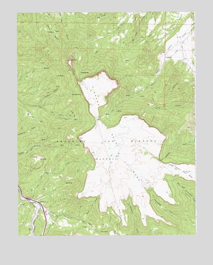
Fishers Peak, CO USGS Topographic Map
Click on map above to begin viewing in our Map Viewer.

This topographic map contains these locations and features:
Feature Name Type Latitude Longitude GNIS ID View Map
BaldySummitN37.0431°W104.4828°194867View Map
Bell SpringSpringN37.0897°W104.4719°194860View Map
Bell TankReservoirN37.0939°W104.4817°194859View Map
Big FlatFlatN37.0684°W104.4914°194866View Map
Brush CreekStreamN37.0075°W104.4528°194872View Map
Cassidays SpringSpringN37.0792°W104.4617°194864View Map
Coblett CanyonValleyN37.0730°W104.4848°194861View Map
First SpringSpringN37.1142°W104.4786°194857View Map
Fishers PeakSummitN37.0984°W104.4628°194858View Map
Fishers Peak MesaSummitN37.0817°W104.4497°194868View Map
Grey Creek MineMineN37.1225°W104.4422°1735224View Map
Joe CreekStreamN37.0203°W104.4930°194869View Map
Lake Dorothy DamDamN37.0034°W104.3755°199150View Map
Lake Dorothy ReservoirReservoirN37.0034°W104.3755°199151View Map
Little Fishers Peak MesaSummitN37.0397°W104.3928°203740View Map
Marion FlatFlatN37.0681°W104.4605°194865View Map
McBride CreekStreamN37.0175°W104.4878°194871View Map
Miguel Gurule DitchCanalN37.1104°W104.3864°2723554View Map
Pearl SpringSpringN37.0025°W104.4419°194873View Map
Sager SpringSpringN37.0297°W104.4664°194870View Map
San MiguelPopulated PlaceN37.0995°W104.3955°194863View Map
Second SpringSpringN37.0914°W104.4553°194862View Map

Note: Coordinates in the location and feature list above are referenced to NAD83 datum.


Copyright (C) 2008-2025 Ryan Niemi / Sunset Dynamics ... All Rights Reserved