TopoQuest Logo
Do you find TopoQuest useful?
Help keep TopoQuest running and adding new maps/features by donating!
Bitcoin:  19c7KJd3qBynnjoSw5npx9KScwjBe4ifkT
Litecoin:  LXs6TkuXGGXo1vDsWCkWVdjQX94eUKd6ui
Home View Maps Find Maps Find Places Resources & Links


Fitzwater Point, Oregon Topographic Map

USGS Map Title: Fitzwater Point, OR
USGS Map MRC: 42120A5
DRG (GeoTIFF) Download: o42120a5.tif


Neighboring USGS Topographic Map Quads:


  Drews Reservoir, OR  
42120B6
 

  Drews Gap, OR  
42120B5
 

  Lakeview Airport, OR  
42120B4
 

  Dog Lake, OR  
42120A6
 

  Fitzwater Point, OR  
42120A5
 

  West Side, OR  
42120A4
 

  Beaver Mountain, CA  
41120H6
 

  Pease Flat, CA  
41120H5
 

  West of Willow Ranch, CA  
41120H4


Map MRC Location:

N43°
W121°
N43°
W120°
H8 H7 H6 H5 H4 H3 H2 H1
G8 G7 G6 G5 G4 G3 G2 G1
F8 F7 F6 F5 F4 F3 F2 F1
E8 E7 E6 E5 E4 E3 E2 E1
D8 D7 D6 D5 D4 D3 D2 D1
C8 C7 C6 C5 C4 C3 C2 C1
B8 B7 B6 B5 B4 B3 B2 B1
A8 A7 A6 A5 A4 A3 A2 A1
N42°
W121°
N42°
W120°

Fitzwater Point, OR USGS 1:24K Topographic Map Preview:
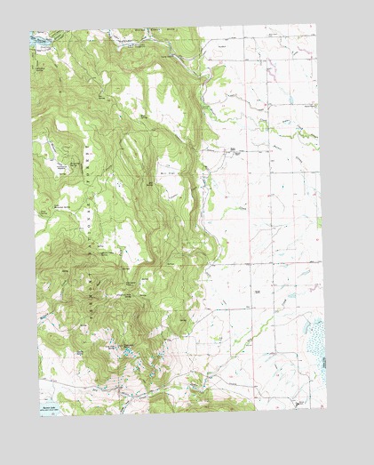
Fitzwater Point, OR USGS Topographic Map
Click on map above to begin viewing in our Map Viewer.

This topographic map contains these locations and features:
Feature Name Type Latitude Longitude GNIS ID View Map
Ashcraft FlumeCanalN42.0988°W120.5527°1137317View Map
Ashcraft RanchLocaleN42.0966°W120.5238°1155818View Map
Becraft RanchLocaleN42.0838°W120.5383°1160990View Map
Bee SpringSpringN42.1034°W120.5971°1137876View Map
Behm RanchLocaleN42.1210°W120.5386°1638708View Map
Briggs RanchLocaleN42.0382°W120.5316°1138628View Map
County SpringSpringN42.0203°W120.6094°1140254View Map
Drews Creek Recreation SiteLocaleN42.1193°W120.5814°1141242View Map
Drews DamDamN42.1219°W120.6177°1153919View Map
Drews Reservoir Boat RampLocaleN42.1201°W120.6194°2700277View Map
Drews Reservoir County ParkParkN42.1193°W120.6191°1160991View Map
East CanalCanalN42.1110°W120.5255°1141513View Map
East Fork McCoin CreekStreamN42.0374°W120.6155°1141582View Map
Fish CreekStreamN42.1210°W120.5741°1142147View Map
Fitzwater PassGapN42.0413°W120.5877°1142188View Map
Fitzwater Pass SpringSpringN42.0379°W120.5842°1142189View Map
Fitzwater PointRidgeN42.0221°W120.5897°1142190View Map
Friday RanchLocaleN42.0843°W120.5400°1160989View Map
Goose Lake Timber CampLocaleN42.0016°W120.5141°1638709View Map
Horseshoe MeadowFlatN42.0802°W120.6158°1143811View Map
Horseshoe SpringSpringN42.0821°W120.6091°1143817View Map
Juniper Post Office (historical)Post OfficeN42.0985°W120.5080°1165465View Map
Lakeview Water Users HeadquartersLocaleN42.1152°W120.5261°1155817View Map
Little Horseshoe SpringSpringN42.0680°W120.6179°1145182View Map
Lone Pine SpringSpringN42.0217°W120.5922°1145360View Map
Mill FlatFlatN42.0763°W120.5683°1146252View Map
Mill SpringSpringN42.0744°W120.5741°1146256View Map
Miners Cabin SpringSpringN42.0521°W120.5980°1146321View Map
Mud SpringSpringN42.0963°W120.5792°1146587View Map
Renner DamDamN42.0044°W120.6192°1155646View Map
Renner RanchLocaleN42.0979°W120.5022°1148377View Map
Renner ReservoirReservoirN42.1002°W120.5128°1153759View Map
Sibley DrawValleyN42.0049°W120.5861°1149463View Map
South CanalCanalN42.0399°W120.5500°1149908View Map
Stover ReservoirReservoirN42.0927°W120.5139°1153760View Map
Theora Post Office (historical)Post OfficeN42.1135°W120.5138°1164719View Map
Trail SpringSpringN42.0659°W120.6238°1151380View Map
Venator CreekStreamN42.0732°W120.5480°1151747View Map
West Side CemeteryCemeteryN42.1210°W120.5227°1152143View Map
Whiskey CreekStreamN42.1193°W120.6233°1152182View Map
Whiskey SpringSpringN42.1123°W120.6236°1152195View Map

Note: Coordinates in the location and feature list above are referenced to NAD83 datum.


Copyright (C) 2008-2024 Ryan Niemi / Sunset Dynamics ... All Rights Reserved