TopoQuest Logo
Do you find TopoQuest useful?
Help keep TopoQuest running and adding new maps/features by donating!
Bitcoin:  19c7KJd3qBynnjoSw5npx9KScwjBe4ifkT
Litecoin:  LXs6TkuXGGXo1vDsWCkWVdjQX94eUKd6ui
Home View Maps Find Maps Find Places Resources & Links


Lakeview Airport, Oregon Topographic Map

USGS Map Title: Lakeview Airport, OR
USGS Map MRC: 42120B4
DRG (GeoTIFF) Download: o42120b4.tif


Neighboring USGS Topographic Map Quads:


  Cox Flat, OR  
42120C5
 

  Big Baldy, OR  
42120C4
 

  Crooked Creek Valley, OR  
42120C3
 

  Drews Gap, OR  
42120B5
 

  Lakeview Airport, OR  
42120B4
 

  Lakeview, OR  
42120B3
 

  Fitzwater Point, OR  
42120A5
 

  West Side, OR  
42120A4
 

  Crane Creek, OR  
42120A3


Map MRC Location:

N43°
W121°
N43°
W120°
H8 H7 H6 H5 H4 H3 H2 H1
G8 G7 G6 G5 G4 G3 G2 G1
F8 F7 F6 F5 F4 F3 F2 F1
E8 E7 E6 E5 E4 E3 E2 E1
D8 D7 D6 D5 D4 D3 D2 D1
C8 C7 C6 C5 C4 C3 C2 C1
B8 B7 B6 B5 B4 B3 B2 B1
A8 A7 A6 A5 A4 A3 A2 A1
N42°
W121°
N42°
W120°

Lakeview Airport, OR USGS 1:24K Topographic Map Preview:
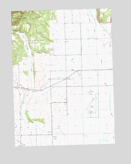
Lakeview Airport, OR USGS Topographic Map
Click on map above to begin viewing in our Map Viewer.

This topographic map contains these locations and features:
Feature Name Type Latitude Longitude GNIS ID View Map
Baldwin DitchCanalN42.1929°W120.4747°1153747View Map
Bullard CreekStreamN42.1341°W120.3755°1138930View Map
Camp CreekStreamN42.2335°W120.3955°1139219View Map
Cottonwood Post Office (historical)Post OfficeN42.1402°W120.4733°1165093View Map
East Branch Thomas CreekStreamN42.1438°W120.3752°1141507View Map
Farleighs ReservoirReservoirN42.1538°W120.4337°1153750View Map
Farr AirportAirportN42.1273°W120.4838°2646019View Map
Five CornersPopulated PlaceN42.1863°W120.4341°1142210View Map
Goose SwaleValleyN42.1838°W120.3872°1153748View Map
Gray LateralCanalN42.1782°W120.4344°1153749View Map
Lake County AirportAirportN42.1554°W120.4052°1154010View Map
Lakeview DragstripLocaleN42.1598°W120.4026°2699537View Map
Leehmann RanchLocaleN42.1940°W120.4244°1144918View Map
Mark Clark Golf CourseLocaleN42.1896°W120.4175°1163737View Map
Muddy CreekStreamN42.1468°W120.4808°1146612View Map
New IdahoLocaleN42.2227°W120.4344°1153752View Map
New Idaho School (historical)SchoolN42.2203°W120.4331°1136983View Map
Reed RanchLocaleN42.1329°W120.4519°1148356View Map
Roberts RanchLocaleN42.1260°W120.4938°1136979View Map
Thomas Creek Rural Fire DepartmentBuildingN42.1870°W120.4343°2576690View Map
Vernon School (historical)SchoolN42.1672°W120.4350°1151753View Map
Warner CreekStreamN42.2090°W120.3780°1151908View Map
Warner Creek Correctional FacilityBuildingN42.2447°W120.3793°2722756View Map

Note: Coordinates in the location and feature list above are referenced to NAD83 datum.


Copyright (C) 2008-2025 Ryan Niemi / Sunset Dynamics ... All Rights Reserved