TopoQuest Logo
Do you find TopoQuest useful?
Help keep TopoQuest running and adding new maps/features by donating!
Bitcoin:  19c7KJd3qBynnjoSw5npx9KScwjBe4ifkT
Litecoin:  LXs6TkuXGGXo1vDsWCkWVdjQX94eUKd6ui
Home View Maps Find Maps Find Places Resources & Links


Flagstaff Butte, Oregon Topographic Map

USGS Map Title: Flagstaff Butte, OR
USGS Map MRC: 45117A5
DRG (GeoTIFF) Download: o45117a5.tif


Neighboring USGS Topographic Map Quads:


  Little Catherine Creek, OR  
45117B6
 

  China Cap, OR  
45117B5
 

  Steamboat Lake, OR  
45117B4
 

  Medical Springs, OR  
45117A6
 

  Flagstaff Butte, OR  
45117A5
 

  Bennet Peak, OR  
45117A4
 

  Keating NW, OR  
44117H6
 

  Sawtooth Ridge, OR  
44117H5
 

  Balm Creek Reservoir, OR  
44117H4


Map MRC Location:

N46°
W118°
N46°
W117°
H8 H7 H6 H5 H4 H3 H2 H1
G8 G7 G6 G5 G4 G3 G2 G1
F8 F7 F6 F5 F4 F3 F2 F1
E8 E7 E6 E5 E4 E3 E2 E1
D8 D7 D6 D5 D4 D3 D2 D1
C8 C7 C6 C5 C4 C3 C2 C1
B8 B7 B6 B5 B4 B3 B2 B1
A8 A7 A6 A5 A4 A3 A2 A1
N45°
W118°
N45°
W117°

Flagstaff Butte, OR USGS 1:24K Topographic Map Preview:
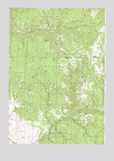
Flagstaff Butte, OR USGS Topographic Map
Click on map above to begin viewing in our Map Viewer.

This topographic map contains these locations and features:
Feature Name Type Latitude Longitude GNIS ID View Map
Alder CreekStreamN45.0071°W117.5769°1116828View Map
Angel PointSummitN45.0615°W117.5316°1116947View Map
Argenti SpringSpringN45.0707°W117.5997°1131541View Map
Bald HillSummitN45.0693°W117.6247°1136025View Map
Bazine SpringSpringN45.0290°W117.6083°1131542View Map
Big HillSummitN45.0210°W117.5977°1136067View Map
Bottle CreekStreamN45.1004°W117.6099°1117959View Map
Burn CreekStreamN45.0107°W117.5713°1118335View Map
Burn Creek MineMineN45.0100°W117.5481°2697291View Map
Camp CreekStreamN45.1021°W117.6008°1118504View Map
Cold SpringSpringN45.0670°W117.5782°1119112View Map
Collins CreekStreamN45.1054°W117.5430°1119151View Map
Conundrum CreekStreamN45.0235°W117.5499°1158176View Map
Corral CreekStreamN45.1038°W117.5727°1119294View Map
Fairview PointSummitN45.0277°W117.5210°1136278View Map
Flagstaff ButteSummitN45.0796°W117.5172°1120817View Map
Four Point RidgeRidgeN45.0482°W117.5310°1120917View Map
Gobel DrawValleyN45.0504°W117.5994°1121182View Map
Gravel FlatFlatN45.0274°W117.5483°1121332View Map
Happy CanyonValleyN45.0310°W117.5172°1121577View Map
Happy SpringSpringN45.0522°W117.5242°1131539View Map
Huckleberry SpringSpringN45.0946°W117.5787°1122100View Map
Lick CreekStreamN45.0171°W117.5683°1123071View Map
Marlin SpringSpringN45.0494°W117.5998°1123775View Map
Mud SpringSpringN45.0616°W117.5922°1124491View Map
Pawnee GulchValleyN45.0260°W117.5785°1125244View Map
Pole CreekStreamN45.1071°W117.5605°1147845View Map
Prong CreekStreamN45.1024°W117.5699°1125678View Map
Sand Pass CreekStreamN45.1079°W117.5519°1149040View Map
South Catherine DitchCanalN45.0954°W117.5130°1127237View Map
Sufferin Smith SpringSpringN45.0217°W117.5408°1127687View Map
Taylor GreenFlatN45.0790°W117.5385°1127903View Map
The Black PinesSummitN45.0739°W117.5953°1158575View Map
Trout CreekCanalN45.0810°W117.5094°1128236View Map
Trout CreekStreamN45.0746°W117.5010°1128244View Map
Universal SpringSpringN45.0636°W117.5041°1131540View Map
Velvet CreekStreamN45.0307°W117.5010°1128520View Map

Note: Coordinates in the location and feature list above are referenced to NAD83 datum.


Copyright (C) 2008-2025 Ryan Niemi / Sunset Dynamics ... All Rights Reserved