TopoQuest Logo
Do you find TopoQuest useful?
Help keep TopoQuest running and adding new maps/features by donating!
Bitcoin:  19c7KJd3qBynnjoSw5npx9KScwjBe4ifkT
Litecoin:  LXs6TkuXGGXo1vDsWCkWVdjQX94eUKd6ui
Home View Maps Find Maps Find Places Resources & Links


Bennet Peak, Oregon Topographic Map

USGS Map Title: Bennet Peak, OR
USGS Map MRC: 45117A4
DRG (GeoTIFF) Download: o45117a4.tif


Neighboring USGS Topographic Map Quads:


  China Cap, OR  
45117B5
 

  Steamboat Lake, OR  
45117B4
 

  Eagle Cap, OR  
45117B3
 

  Flagstaff Butte, OR  
45117A5
 

  Bennet Peak, OR  
45117A4
 

  Krag Peak, OR  
45117A3
 

  Sawtooth Ridge, OR  
44117H5
 

  Balm Creek Reservoir, OR  
44117H4
 

  Sparta Butte, OR  
44117H3


Map MRC Location:

N46°
W118°
N46°
W117°
H8 H7 H6 H5 H4 H3 H2 H1
G8 G7 G6 G5 G4 G3 G2 G1
F8 F7 F6 F5 F4 F3 F2 F1
E8 E7 E6 E5 E4 E3 E2 E1
D8 D7 D6 D5 D4 D3 D2 D1
C8 C7 C6 C5 C4 C3 C2 C1
B8 B7 B6 B5 B4 B3 B2 B1
A8 A7 A6 A5 A4 A3 A2 A1
N45°
W118°
N45°
W117°

Bennet Peak, OR USGS 1:24K Topographic Map Preview:
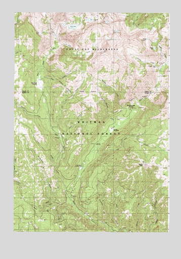
Bennet Peak, OR USGS Topographic Map
Click on map above to begin viewing in our Map Viewer.

This topographic map contains these locations and features:
Feature Name Type Latitude Longitude GNIS ID View Map
Arrow LakeLakeN45.1100°W117.3931°1117053View Map
Basin CreekStreamN45.0168°W117.4649°1117294View Map
Basin MineMineN45.0118°W117.4710°1117297View Map
Bench CanyonValleyN45.0957°W117.3774°1117512View Map
Bennett PeakSummitN45.0383°W117.3956°1117524View Map
Boulder CreekStreamN45.0665°W117.4060°1117974View Map
Boulder Park Recreation SiteLocaleN45.0710°W117.4035°1131987View Map
Boulder Park Resort (historical)LocaleN45.0710°W117.4035°1117982View Map
Copper CreekStreamN45.0907°W117.3827°1119270View Map
Copper Creek FallsFallsN45.0944°W117.3860°1119271View Map
Cougar MeadowsFlatN45.0590°W117.4194°1119379View Map
Cow CreekStreamN45.0382°W117.4644°1119423View Map
Dixie CreekStreamN45.0004°W117.4146°1119967View Map
Eagleton Post Office (historical)Post OfficeN45.0235°W117.4594°1165190View Map
East Fork West Eagle CreekStreamN45.0929°W117.4774°1120330View Map
Echo LakeLakeN45.1168°W117.4533°1120380View Map
Echo Lake DamDamN45.1167°W117.4578°1131375View Map
Excelsior GulchValleyN45.0004°W117.4194°1141939View Map
Fake CreekStreamN45.0865°W117.4802°1120581View Map
Fake Creek TrailTrailN45.0779°W117.4271°1120582View Map
Flat Rock Forest CampLocaleN45.1099°W117.4666°1120829View Map
Forks Forest CampLocaleN45.0213°W117.4549°1120887View Map
Glendenning CreekStreamN45.0154°W117.4519°1121160View Map
Groover SpringSpringN45.0068°W117.4464°1130909View Map
Grove CreekStreamN45.0493°W117.4610°1121470View Map
Heart LakeLakeN45.1048°W117.3875°1121723View Map
Jenkins SpringSpringN45.0457°W117.3927°1131037View Map
Jim CreekStreamN45.0543°W117.4644°1122427View Map
Little Boulder CreekStreamN45.0585°W117.4210°1123138View Map
Lookout SpringSpringN45.0415°W117.4024°1130991View Map
Mammouth SpringSpringN45.0360°W117.3873°1130989View Map
Mud SpringSpringN45.0360°W117.4094°1130992View Map
Olive LakeLakeN45.1132°W117.4794°1124982View Map
Phillips DitchCanalN45.0332°W117.4680°1125346View Map
Silver SpringSpringN45.0243°W117.3775°1130990View Map
Skookum CreekStreamN45.0040°W117.4266°1127033View Map
Steiger SpringSpringN45.0166°W117.4885°1130908View Map
Tamarack Recreation SiteLocaleN45.0199°W117.4538°1167274View Map
Thistle CreekStreamN45.0096°W117.4427°1161610View Map
Trail Creek TrailTrailN45.1229°W117.4230°1128191View Map
Traverse LakeLakeN45.1208°W117.4392°1128213View Map
Traverse Lake DamDamN45.1208°W117.4426°1131376View Map
Two Color CreekStreamN45.0449°W117.4358°1151607View Map
Two Color Guard StationLocaleN45.0496°W117.4346°1128377View Map
Two Color Horse CampLocaleN45.0374°W117.4455°1952997View Map
Two Color Recreation SiteLocaleN45.0374°W117.4455°1167039View Map
West Eagle CreekStreamN45.0193°W117.4541°1128826View Map
West Eagle Horse CampLocaleN45.0818°W117.4802°1131986View Map
West Eagle MeadowFlatN45.0840°W117.4794°1128827View Map
West Eagle TrailTrailN45.0643°W117.4705°1128828View Map

Note: Coordinates in the location and feature list above are referenced to NAD83 datum.


Copyright (C) 2008-2024 Ryan Niemi / Sunset Dynamics ... All Rights Reserved