TopoQuest Logo
Do you find TopoQuest useful?
Help keep TopoQuest running and adding new maps/features by donating!
Bitcoin:  19c7KJd3qBynnjoSw5npx9KScwjBe4ifkT
Litecoin:  LXs6TkuXGGXo1vDsWCkWVdjQX94eUKd6ui
Home View Maps Find Maps Find Places Resources & Links


Balm Creek Reservoir, Oregon Topographic Map

USGS Map Title: Balm Creek Reservoir, OR
USGS Map MRC: 44117H4
DRG (GeoTIFF) Download: o44117h4.tif


Neighboring USGS Topographic Map Quads:


  Flagstaff Butte, OR  
45117A5
 

  Bennet Peak, OR  
45117A4
 

  Krag Peak, OR  
45117A3
 

  Sawtooth Ridge, OR  
44117H5
 

  Balm Creek Reservoir, OR  
44117H4
 

  Sparta Butte, OR  
44117H3
 

  Keating, OR  
44117G5
 

  Glasgow Butte, OR  
44117G4
 

  Sparta, OR  
44117G3


Map MRC Location:

N45°
W118°
N45°
W117°
H8 H7 H6 H5 H4 H3 H2 H1
G8 G7 G6 G5 G4 G3 G2 G1
F8 F7 F6 F5 F4 F3 F2 F1
E8 E7 E6 E5 E4 E3 E2 E1
D8 D7 D6 D5 D4 D3 D2 D1
C8 C7 C6 C5 C4 C3 C2 C1
B8 B7 B6 B5 B4 B3 B2 B1
A8 A7 A6 A5 A4 A3 A2 A1
N44°
W118°
N44°
W117°

Balm Creek Reservoir, OR USGS 1:24K Topographic Map Preview:
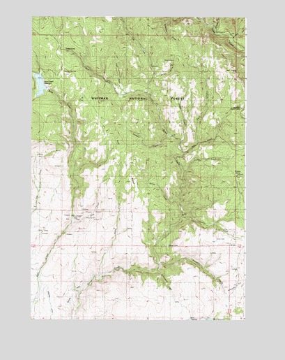
Balm Creek Reservoir, OR USGS Topographic Map
Click on map above to begin viewing in our Map Viewer.

This topographic map contains these locations and features:
Feature Name Type Latitude Longitude GNIS ID View Map
Arthur Post Office (historical)Post OfficeN44.9138°W117.4774°1164859View Map
Balm Creek DamDamN44.9700°W117.4912°1155517View Map
Balm Creek ReservoirReservoirN44.9718°W117.4952°1137487View Map
Balm Creek Reservoir Boat LaunchLocaleN44.9706°W117.4915°2700164View Map
Balm Creek Reservoir Recreation SiteLocaleN44.9704°W117.4905°1156474View Map
Balm Creek ShaftMineN44.9168°W117.4766°1137488View Map
Bennett CreekStreamN44.9986°W117.4006°1137922View Map
Bradley CreekStreamN44.9915°W117.3874°1138559View Map
Cottonwood CreekStreamN44.8952°W117.4288°1140173View Map
Cougar CreekStreamN44.9485°W117.4155°1140212View Map
Daddy Lode MineMineN44.9418°W117.4157°1140585View Map
Dark CanyonValleyN44.9479°W117.4049°1140626View Map
East Fork Goose CreekStreamN44.9693°W117.4344°1152812View Map
Forshey CreekStreamN44.9179°W117.4133°1142312View Map
Forshey MeadowFlatN44.9093°W117.3757°1142313View Map
Goose LakeLakeN44.9053°W117.4205°1142855View Map
Goslin CorralLocaleN44.9865°W117.4799°1142876View Map
Larkspur CreekStreamN44.9507°W117.4221°1144832View Map
Ledge CreekStreamN44.9360°W117.4135°1144906View Map
Lily White Guard StationBuildingN44.9625°W117.3779°1145017View Map
Lost GulchValleyN44.9674°W117.4469°1145538View Map
O'Brien CreekStreamN44.9952°W117.3966°1147102View Map
Phillips DitchCanalN44.8865°W117.4752°1147638View Map
Poorman MineMineN44.9190°W117.4635°1147888View Map
Rattlesnake CreekStreamN44.8860°W117.3871°1152810View Map
Red GulchValleyN44.9438°W117.4135°1148298View Map
Red KnobSummitN44.9777°W117.3882°1155480View Map
Red RidgeRidgeN44.9368°W117.4435°1148328View Map
Sanger GulchValleyN44.9740°W117.4313°1149064View Map
Sanger MineMineN44.9790°W117.4177°1149065View Map
Sanger Post Office (historical)Post OfficeN44.9785°W117.4180°1165917View Map
Saw Mill Gulch DamDamN44.8752°W117.3980°1153913View Map
Sawmill CreekStreamN44.8974°W117.4280°1149091View Map
Sheep CreekStreamN44.8913°W117.4610°1149323View Map
Slide CreekStreamN44.9132°W117.4794°1149704View Map
Sucker CreekStreamN44.9229°W117.4155°1150518View Map
Surprise SpringSpringN44.9353°W117.3799°1150701View Map
Surprise Springs Rural Fire and RescueBuildingN44.9250°W117.3759°2577157View Map
Union SpringSpringN44.9774°W117.4815°1151655View Map
West Fork Goose CreekStreamN44.9510°W117.4216°1152077View Map

Note: Coordinates in the location and feature list above are referenced to NAD83 datum.


Copyright (C) 2008-2025 Ryan Niemi / Sunset Dynamics ... All Rights Reserved