TopoQuest Logo
Do you find TopoQuest useful?
Help keep TopoQuest running and adding new maps/features by donating!
Bitcoin:  19c7KJd3qBynnjoSw5npx9KScwjBe4ifkT
Litecoin:  LXs6TkuXGGXo1vDsWCkWVdjQX94eUKd6ui
Home View Maps Find Maps Find Places Resources & Links


Flanagan North, Illinois Topographic Map

USGS Map Title: Flanagan North, IL
USGS Map MRC: 40088H7
DRG (GeoTIFF) Download: o40088h7.tif


Neighboring USGS Topographic Map Quads:


  Long Point, IL  
41088A8
 

  Streator South, IL  
41088A7
 

  Blackstone, IL  
41088A6
 

  Dana, IL  
40088H8
 

  Flanagan North, IL  
40088H7
 

  Northwest Pontiac, IL  
40088H6
 

  Flanagan SW, IL  
40088G8
 

  Flanagan South, IL  
40088G7
 

  Southwest Pontiac, IL  
40088G6


Map MRC Location:

N41°
W89°
N41°
W88°
H8 H7 H6 H5 H4 H3 H2 H1
G8 G7 G6 G5 G4 G3 G2 G1
F8 F7 F6 F5 F4 F3 F2 F1
E8 E7 E6 E5 E4 E3 E2 E1
D8 D7 D6 D5 D4 D3 D2 D1
C8 C7 C6 C5 C4 C3 C2 C1
B8 B7 B6 B5 B4 B3 B2 B1
A8 A7 A6 A5 A4 A3 A2 A1
N40°
W89°
N40°
W88°

Flanagan North, IL USGS 1:24K Topographic Map Preview:
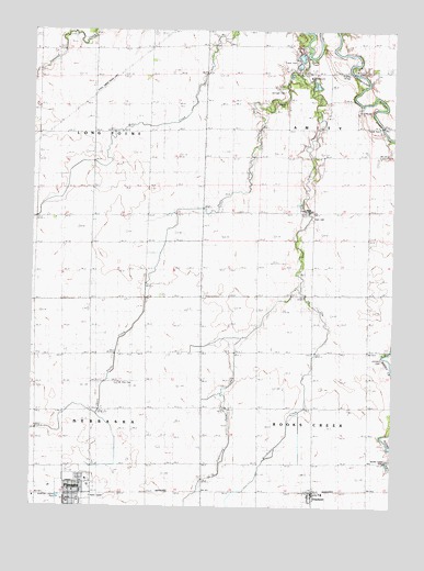
Flanagan North, IL USGS Topographic Map
Click on map above to begin viewing in our Map Viewer.

This topographic map contains these locations and features:
Feature Name Type Latitude Longitude GNIS ID View Map
Adams RLA Number 1 AirportAirportN40.9326°W88.7541°427702View Map
American Legion ParkParkN40.8775°W88.8651°1719379View Map
Artesian ParkParkN40.8759°W88.8584°1737539View Map
Bradley BridgeBridgeN40.9900°W88.7653°424667View Map
Earp CemeteryCemeteryN40.9511°W88.7780°407591View Map
FlanaganPopulated PlaceN40.8781°W88.8612°408428View Map
Flanagan - Graymont Emergency Ambulance ServiceBuildingN40.8780°W88.8547°2673820View Map
Flanagan Graymont Fire Protection DistrictBuildingN40.8780°W88.8547°2682506View Map
Flanagan Post OfficePost OfficeN40.8765°W88.8615°2788360View Map
Flanagan United Methodist ChurchChurchN40.8792°W88.8601°1737597View Map
GraymontPopulated PlaceN40.8778°W88.7770°409354View Map
Graymont Elementary SchoolSchoolN40.8786°W88.7740°1737606View Map
Graymont Post OfficePost OfficeN40.8784°W88.7773°2788630View Map
Johnson CemeteryCemeteryN40.9138°W88.7537°411160View Map
Morehouse CreekStreamN40.9320°W88.7823°413809View Map
Morris CemeteryCemeteryN40.9814°W88.7876°413839View Map
Mount Zion CemeteryCemeteryN40.9074°W88.8453°414116View Map
Nigh Chapel CemeteryCemeteryN40.9527°W88.7810°1737634View Map
Nigh Chapel United Methodist ChurchChurchN40.9525°W88.7806°414520View Map
Scattering Point CreekStreamN40.9884°W88.7828°418066View Map
Scattering Point School (historical)SchoolN40.9528°W88.7809°1737678View Map
Short Point CreekStreamN40.9936°W88.7801°418469View Map
Springer CemeteryCemeteryN40.9841°W88.7881°418999View Map
Township of AmityCivilN40.9747°W88.7582°428588View Map
Township of Long PointCivilN40.9728°W88.8734°429279View Map
Township of NebraskaCivilN40.8852°W88.8733°429423View Map
Township of Rooks CreekCivilN40.8871°W88.7581°429668View Map
Village of FlanaganCivilN40.8769°W88.8599°2398882View Map
Walden Farm CemeteryCemeteryN40.8873°W88.7517°1719423View Map

Note: Coordinates in the location and feature list above are referenced to NAD83 datum.


Copyright (C) 2008-2025 Ryan Niemi / Sunset Dynamics ... All Rights Reserved